Download
3D Flyover
Add to list
More
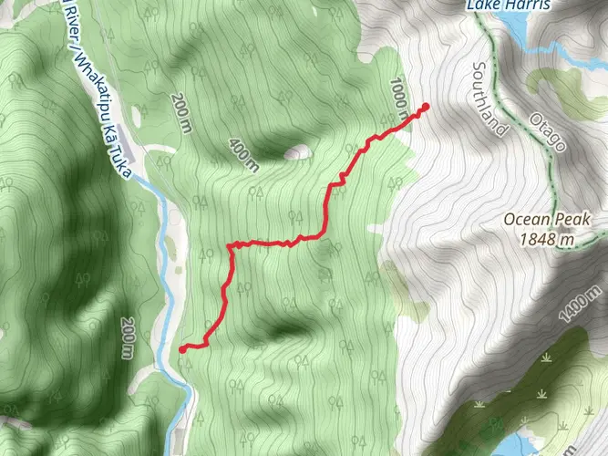
31.4 km
~2 days
1408 m
Multi-Day
“Embark on the Routeburn Track for a mesmerizing trek through New Zealand's majestic Southern Alps.”
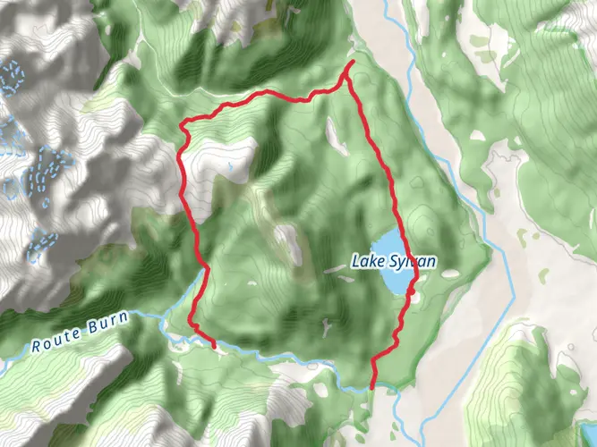
Nestled in the heart of New Zealand's South Island, the Routeburn Track is a world-renowned hiking trail that offers an immersive experience through the Southern Alps. Spanning approximately 31 kilometers (19 miles) and with an elevation gain of around 1400 meters (4593 feet), this point-to-point trek is a journey through pristine landscapes, encompassing lush forests, alpine meadows, and crystal-clear lakes.
Getting to the Trailhead
The Routeburn Track can be accessed from either end: The Divide, close to Te Anau, or the Routeburn Shelter, near Glenorchy. For those starting at The Divide, public transport options are available from Te Anau, which is well-connected by bus services from Queenstown and other major towns. If you're driving, take the Milford Road (SH94) to The Divide car park, which is the lower end of the track. Alternatively, starting from the Routeburn Shelter requires a drive along a scenic route from Queenstown to Glenorchy and then to the trailhead. Parking is available, and shuttle services also operate to and from Queenstown.
Navigating the Routeburn Track
The Routeburn Track is well-marked and maintained, making navigation straightforward. However, it's always wise to carry a detailed map or use a navigation app like HiiKER to track your progress and ensure you stay on the correct path.
Key Landmarks and Natural Features
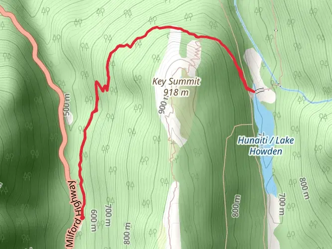
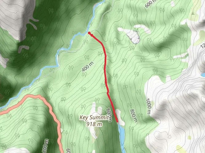
As you embark on the Routeburn Track, you'll traverse a variety of landscapes. The trail begins by winding through dense beech forests, where the sounds of native birds such as the kea and the bellbird fill the air. After approximately 6 kilometers (3.7 miles), hikers reach the first major landmark, Key Summit, which offers panoramic views of the surrounding Fiordland National Park.
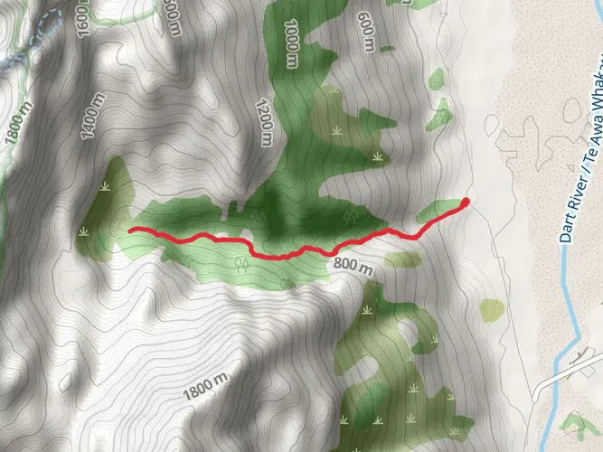
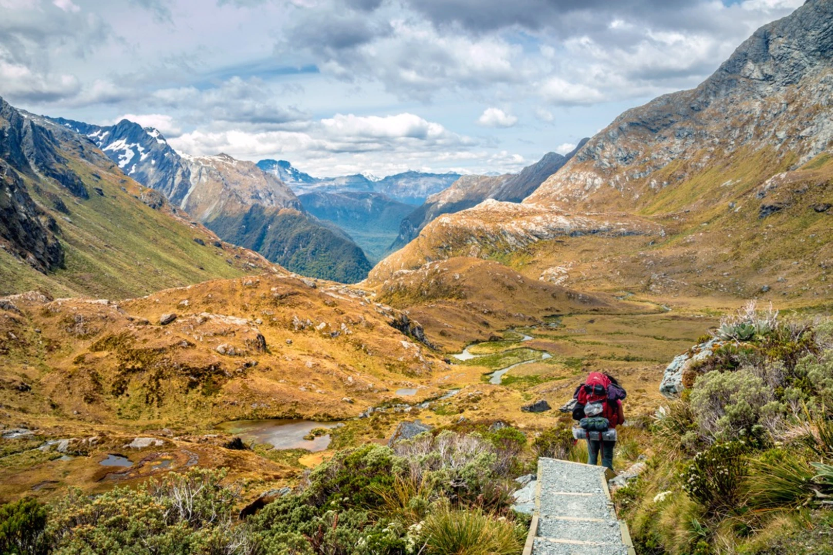
Continuing on, the trail ascends towards the Harris Saddle, the highest point of the track at around 1255 meters (4117 feet). This section is approximately 12 kilometers (7.5 miles) from the start and provides breathtaking vistas of the Hollyford Valley and the Darran Mountains. The nearby Harris Lake is a serene spot, perfect for a rest and photo opportunities.
Descending from the saddle, the trail leads to the Routeburn Falls Hut, another 2 kilometers (1.2 miles) ahead, which overlooks the impressive Routeburn Falls. This area is rich in history, with the trail itself being a traditional route used by Māori for gathering pounamu (greenstone).
The final stretch of the Routeburn Track descends into the Routeburn Valley, where the landscape softens, and the forest canopy provides shelter. The trail follows the Routeburn River, leading to the end of the track at the Routeburn Shelter.
Flora and Fauna
Throughout the hike, you'll encounter a diverse range of flora, including alpine herbs, tussocks, and the towering red beech trees. The area is also home to an array of wildlife; keep an eye out for the cheeky kea, the world's only alpine parrot, and the more elusive yellow-crowned parakeet.
Weather and Safety
The Routeburn Track can be hiked year-round, but the best conditions are typically from late October to late April. Weather in the mountains can change rapidly, so it's essential to be prepared for all conditions and check the forecast before setting out. Ensure you have adequate clothing, food, and equipment for the trek.
Accommodation and Permits
There are several huts and campsites along the Routeburn Track, which require bookings in advance, especially during the peak season. A permit is also required to hike the track, which can be obtained from the Department of Conservation.
Conclusion
The Routeburn Track is a journey through some of New Zealand's most spectacular wilderness. Whether you're a seasoned hiker or a nature enthusiast, this trail promises an unforgettable adventure through the heart of the Southern Alps.

What to expect?
Activity types
Comments and Reviews
User comments, reviews and discussions about the Routeburn Track, New Zealand.
4.87
average rating out of 5
15 rating(s)