Download
3D Flyover
Add to list
More
36.5 km
~7 hrs 28 min
102 m
Multi-Day
“Embark on the scenic and historic Henry Hudson Trail, a moderate hike through New Jersey's diverse landscapes and storied past.”
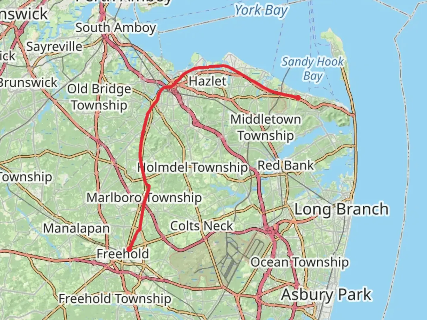
Spanning approximately 37 kilometers (about 23 miles) with a modest elevation gain of around 100 meters (328 feet), the Henry Hudson Trail offers a unique blend of scenic views, historical significance, and a chance to experience the natural beauty of Monmouth County, New Jersey. This point-to-point trail is considered to have a medium difficulty rating, making it accessible to hikers with a moderate level of experience.
Getting to the Trailhead
The trailhead is conveniently located near Monmouth County, New Jersey. For those arriving by car, parking is available at the Popamora Point section in Highlands, which serves as the northern terminus of the trail. To reach the start of the trail using public transportation, hikers can take NJ Transit buses that service the area, alighting at a stop close to the trailhead.
Navigating the Trail
As you embark on your journey along the Henry Hudson Trail, it's advisable to use the HiiKER app for navigation. The app provides detailed maps and trail information that can help you stay on course and be aware of any trail junctions or points of interest along the way.
Historical Significance
The trail follows the path of the former Central Railroad of New Jersey's shore line, offering a glimpse into the region's past. As you hike, imagine the steam locomotives that once chugged along this route, carrying vacationers to the Jersey Shore in the late 1800s and early 1900s.
Landmarks and Nature
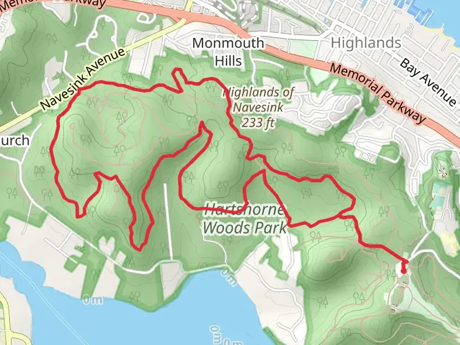
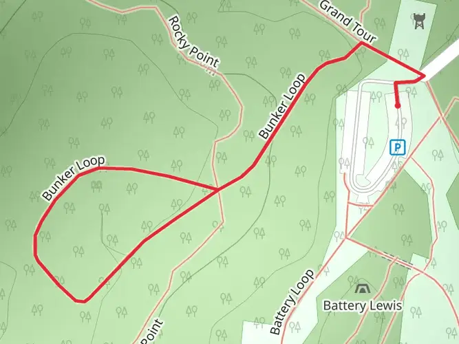
The trail is well-known for its diverse landscapes, including coastal wetlands, wooded areas, and open fields. Approximately 5 kilometers (3 miles) into the hike, you'll encounter the Marlboro Psychiatric Hospital grounds, which are steeped in history and now reclaimed by nature.
Further along, around the 15-kilometer (9-mile) mark, the trail passes through Big Brook Park, where you might spot white-tailed deer, wild turkeys, and various bird species. The park is also a popular spot for fossil hunting, as the area was once submerged under a prehistoric sea.
Wildlife and Flora
The Henry Hudson Trail is a haven for wildlife enthusiasts. The trail's proximity to both woodland and wetland environments means that hikers can observe a variety of animals in their natural habitats. Keep an eye out for migratory birds, especially during the spring and fall.
The trail is also lined with a mix of native plants and trees, including oak, hickory, and the occasional pine. During the spring, the trail is adorned with wildflowers, adding a splash of color to the greenery.
Trail Amenities
Benches and picnic areas are scattered along the trail, providing spots to rest and enjoy a meal. Restrooms are available at certain points, but it's wise to check their locations beforehand.
Safety and Etiquette
While the trail is shared with cyclists and joggers, it's important to stay alert and practice good trail etiquette. Keep to the right, pass on the left, and always signal your intentions to others on the trail.
Remember to carry enough water, especially during the warmer months, and dress in layers to accommodate changing weather conditions. As always, leave no trace and pack out all trash to preserve the beauty of the trail for future visitors.

Frequently asked questions
How long is the Henry Hudson Trail and how much climbing does the full route have?
The Henry Hudson Trail is 36.51 km, or about 22.7 miles, end to end. It is a relatively flat rail-trail with only about 102 m, or 335 feet, of total elevation gain, which is why it is generally considered an easy long-distance walk or ride in Monmouth County.
Where can you park for the Henry Hudson Trail in Monmouth County?
Two of the best-known access points for the Henry Hudson Trail are Popamora Point at 369 Shore Drive in Highlands and the Henry Hudson Trail Activity Center at 945 State Highway 36 in Leonardo. The northern section also begins near the Aberdeen-Keyport border at Lloyd Road and Clark Street, giving several practical places to start shorter out-and-back walks.
Is the Henry Hudson Trail paved and suitable for easy walking or strollers?
The Henry Hudson Trail is a paved former railroad corridor that is about 10 feet wide for much of its route. Its gentle grade and low total elevation gain make it one of the easier long trails in Monmouth County for walking, jogging, biking, and other low-impact outings, though the full 36.51 km length is still a substantial day or multi-day effort.
Are dogs allowed on the Henry Hudson Trail?
Dogs are allowed on the Henry Hudson Trail, but they need to be kept leashed in Monmouth County parks. The trail is specifically listed by the county as a place to hike with a leashed dog, including both the Aberdeen to Atlantic Highlands section and the Freehold to Marlboro section.
What towns and landmarks does the Henry Hudson Trail pass through?
The Henry Hudson Trail links a wide stretch of Monmouth County, with sections running between Highlands, Atlantic Highlands, Leonardo, Aberdeen, Matawan, Marlboro, and Freehold. Notable named points along the route include Atlantic Highlands Marina, Popamora Point, Big Brook Park, Station Road, Church Street in Matawan, and the Lloyd Road and Clark Street access near the Aberdeen-Keyport border.
Does the Henry Hudson Trail have bay views or is it mostly inland?
The Henry Hudson Trail changes character along the route. On the northern end, it runs by Sandy Hook Bay and reaches Popamora Point on the Highlands-Atlantic Highlands border, while other stretches pass through tree-lined corridors with views of wetlands, streams, fields, and the marshy Bayshore landscape.
Can you hike the Henry Hudson Trail in one day?
A strong walker can cover the full 36.51 km Henry Hudson Trail in one long day because the route is easy and nearly flat, but many people break it into shorter sections. The northern section alone is about 12 miles, and the southern open sections include a 4-mile stretch from Route 537 in Freehold to Big Brook Park plus another 5-mile stretch from Station Road in Marlboro to Church Street in Matawan.
Comments and Reviews
User comments, reviews and discussions about the Henry Hudson Trail, New Jersey.
4.75
average rating out of 5
12 rating(s)