Download
3D Flyover
Add to list
More
820.0 km
~32 days
13567 m
Multi-Day
“Embark on a transformative hike through Nevada's diverse terrain and history on the American Discovery Trail.”
Spanning approximately 820 kilometers (about 510 miles) with an elevation gain of around 13,500 meters (approximately 44,291 feet), the American Discovery Trail section in Nevada offers a unique cross-section of the state's rugged beauty. This point-to-point trail begins near White Pine County, an area accessible by car from major roads and highways. Those opting for public transport can reach Ely, the nearest city with bus services, and then take a taxi or arrange a shuttle to the trailhead.
Getting Started
The journey commences in the high desert terrain, where hikers are greeted by vast, open landscapes dotted with sagebrush and hardy desert flora. The trail is well-marked, but carrying a reliable navigation tool like HiiKER is essential for staying on course through the expansive wilderness.
Landmarks and Natural Features
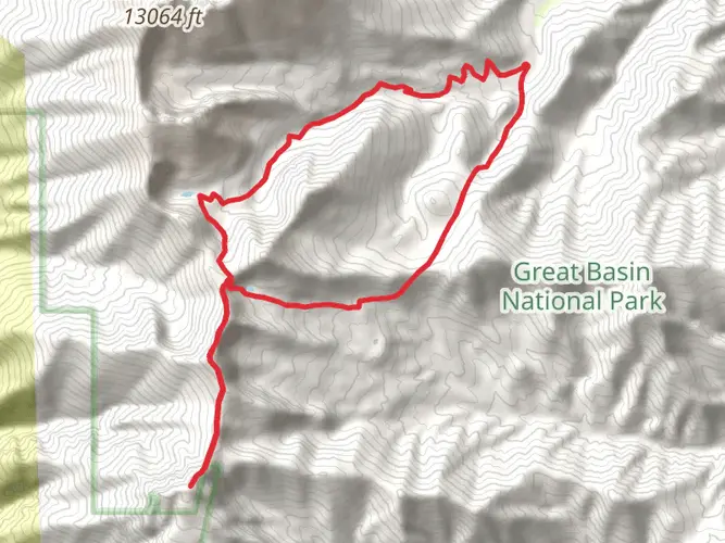
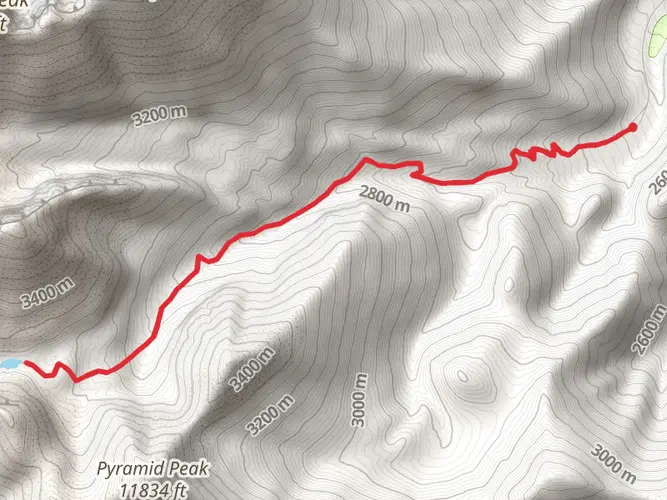
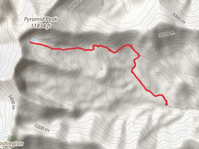
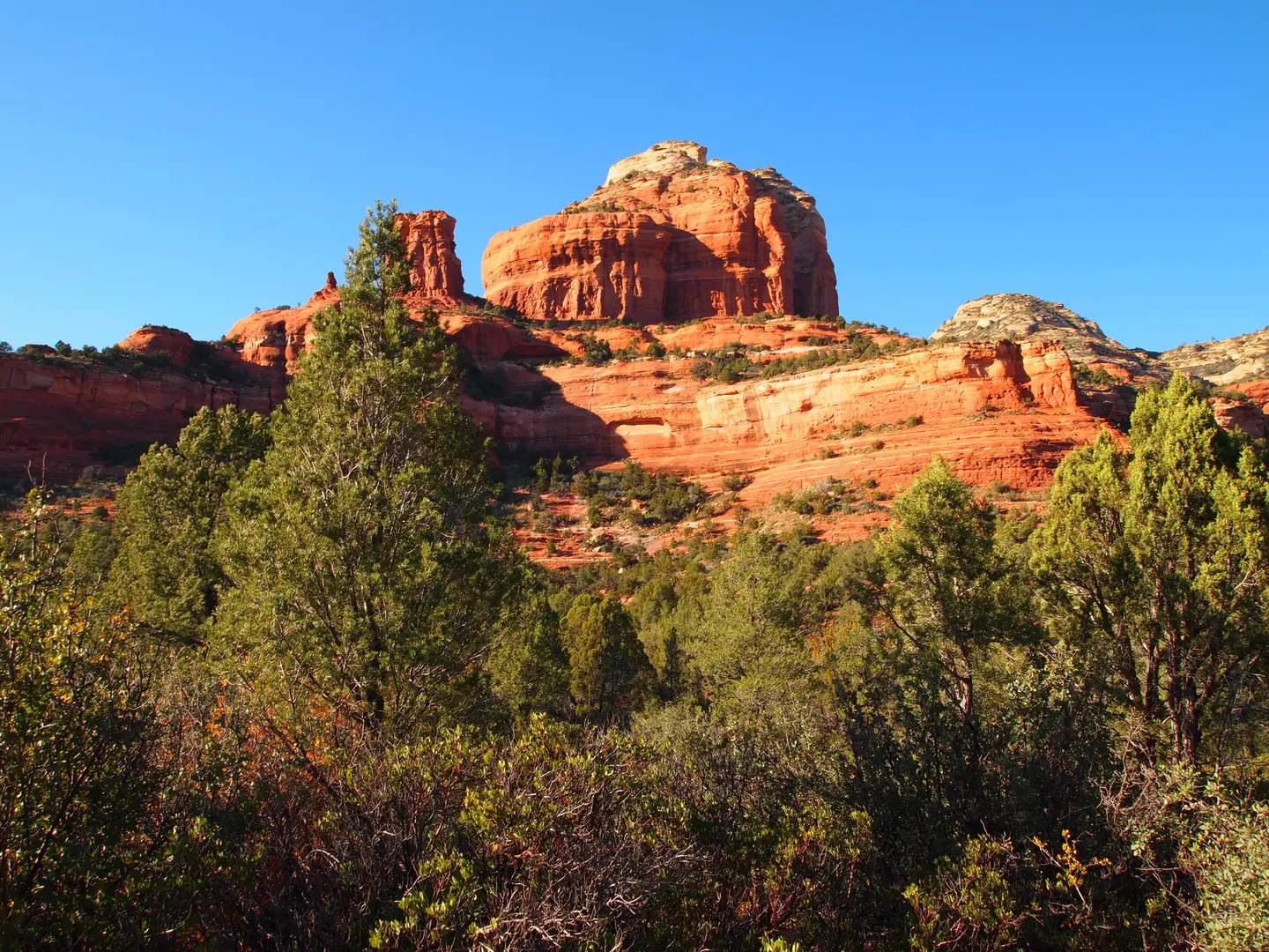
As you progress, the trail offers a diverse array of natural landmarks. One of the early highlights is the crossing of the Schell Creek Range, which provides a challenging ascent and descent but rewards hikers with panoramic views. The trail then winds through the Egan Range, another series of climbs that test one's endurance.
Wildlife is abundant, with chances to spot mule deer, pronghorn antelope, and various bird species, including hawks and eagles. The trail's isolation also means that encounters with other hikers are infrequent, allowing for a serene experience with nature.
Historical Significance
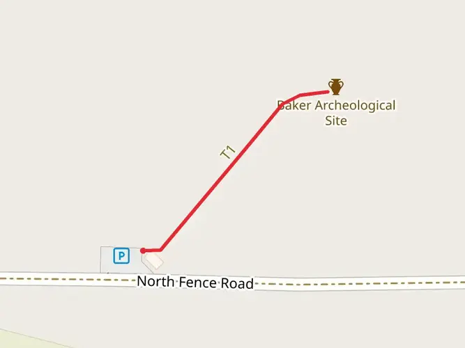
The trail traverses regions rich in history. Hikers will pass through areas that were once the stomping grounds of indigenous tribes, followed by settlers during the westward expansion. Ghost towns and abandoned mines dot the landscape, serving as silent reminders of Nevada's mining boom.
Preparation and Planning
Given the trail's length and remote nature, preparation is key. Water sources are scarce, so carrying an adequate supply and a means of purification is crucial. The climate can be extreme, with hot days and cold nights, so layered clothing is recommended. Resupply points are few and far between, so careful planning of food and supplies is necessary.
Navigation and Safety
While the trail is marked, the vastness of the Nevada section can make navigation challenging. Hikers should be equipped with a GPS device and the HiiKER app, which provides detailed maps and trail information. It's also wise to inform someone of your itinerary and expected return, as cell service can be unreliable.
Conclusion
The American Discovery Trail in Nevada is a journey through time, nature, and the elements. It's a trail that demands respect and preparation but offers rewards in the form of stunning landscapes, solitude, and a deep connection with the land. Whether you're a seasoned hiker or looking to challenge yourself, this trail is a testament to the spirit of discovery and the rugged beauty of the American West.

What to expect?
Activity types
Frequently asked questions
How long is the American Discovery Trail - Nevada and how many days does it usually take?
The American Discovery Trail - Nevada is 819.98 km, or about 510 miles, with 13,567 m of total elevation gain. At that scale, it is a true multi-day thru-hike rather than a weekend route, and most completions require several weeks depending on pace, resupply strategy, weather, and how much time is spent crossing the basin-and-range terrain of eastern and central Nevada.
How difficult is the American Discovery Trail - Nevada?
The American Discovery Trail - Nevada is rated Extra Difficult, which fits both its length and its cumulative climbing. Over nearly 820 km, the route gains 13,567 m and crosses repeated desert basins and mountain ranges, including country around the Schell Creek Range and Egan Range, so the challenge comes from both endurance and sustained elevation change.
What kind of scenery does the American Discovery Trail - Nevada pass through?
The American Discovery Trail - Nevada crosses classic Great Basin country, with long sagebrush valleys broken up by mountain ranges and higher passes. The Nevada section of the American Discovery Trail is known for repeated range-and-valley travel, and eastern Nevada around White Pine County includes the broad high-desert landscapes near Ely as well as climbs into ranges such as the Schell Creek and Egan.
When is the best time of year to hike the American Discovery Trail - Nevada?
Late spring and fall are usually the most practical seasons for the American Discovery Trail - Nevada because Nevada is the driest state in the U.S. and the route crosses exposed desert and mountain country. Summer heat can be severe in the basins, while higher sections can still hold cold, wind, or snow outside the warm season, especially on elevated range crossings.
Can dogs go on the American Discovery Trail - Nevada?
Dogs can often accompany hikers on large stretches of Nevada public land, especially on Bureau of Land Management land, where pets are generally allowed if kept under control. That said, the American Discovery Trail - Nevada is so long that rules can vary by land manager and by specific segment, so any dog plan needs to account for local restrictions, livestock areas, wildlife, heat exposure, and long dry carries.
Where do hikers usually start the American Discovery Trail - Nevada near White Pine County?
Hikers tackling the American Discovery Trail - Nevada from the White Pine County side typically use Ely as the main access town. Ely is the most practical staging point for fuel, food, lodging, and shuttle planning before heading out to the trail corridor in eastern Nevada, where road access becomes much more limited once the route enters open backcountry.
Is the American Discovery Trail - Nevada well suited to beginners or kids?
The American Discovery Trail - Nevada is not a beginner-friendly hike. With an Extra Difficult rating, 819.98 km of distance, and 13,567 m of ascent, it is better suited to experienced long-distance hikers who are comfortable with remote navigation, sparse services, and the physical demands of repeated mountain-range crossings in Nevada backcountry.
Comments and Reviews
User comments, reviews and discussions about the American Discovery Trail - Nevada, Nevada.
4.14
average rating out of 5
14 rating(s)