Download
Preview
Add to list
More
125.7 km
~6 days
462 m
Multi-Day
“Embark on the Mesabi Trail for a scenic hike through Minnesota's rich mining history and diverse landscapes.”
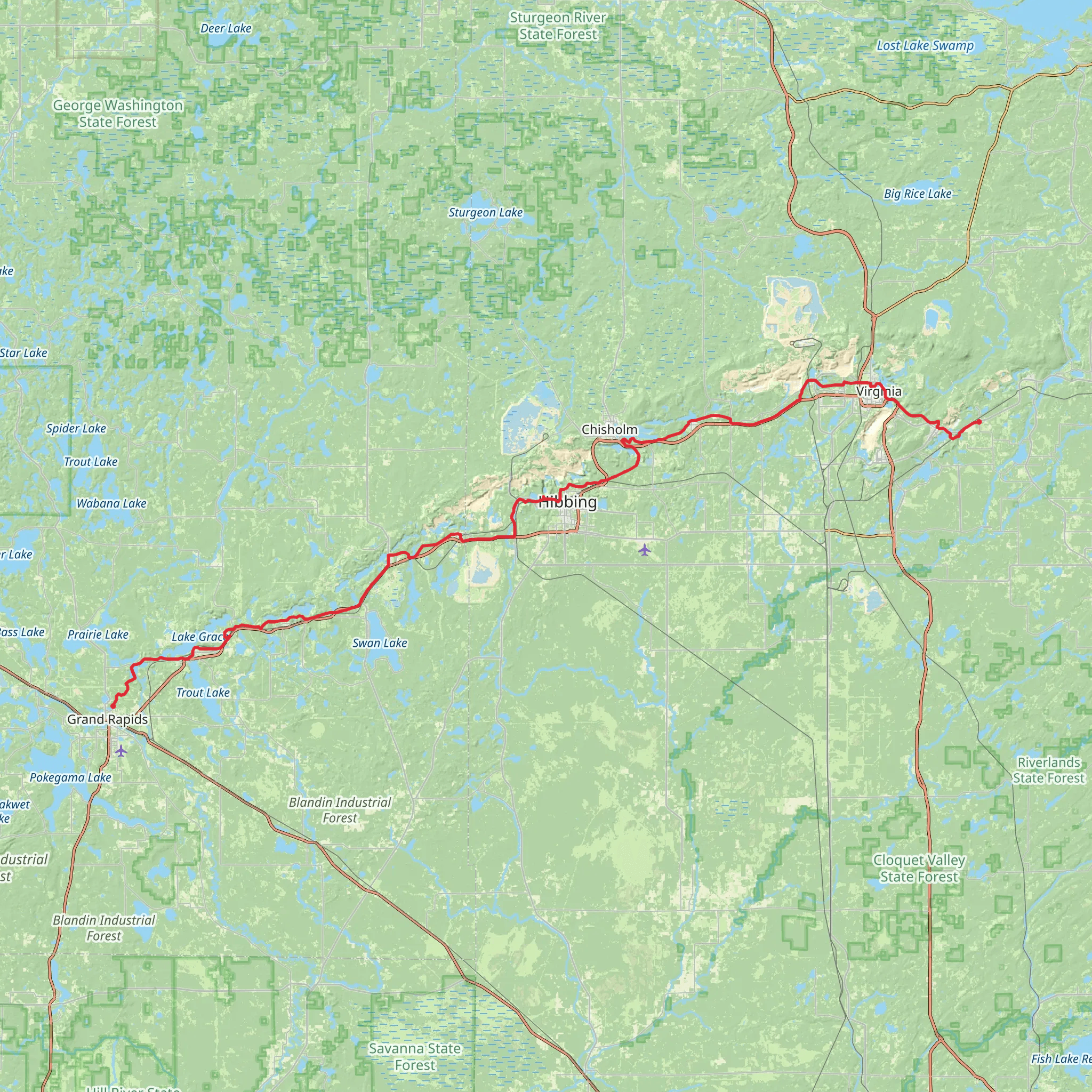
The Mesabi Trail stretches approximately 126 kilometers (about 78 miles) through the picturesque landscapes of Minnesota's Iron Range. With an elevation gain of around 400 meters (approximately 1,312 feet), the trail offers a moderately challenging experience that is accessible to hikers of various skill levels. This point-to-point trail begins near the town of Grand Rapids in St. Louis County and meanders through the heart of Minnesota's mining region before concluding in the city of Ely.
Getting to the Trailhead
To reach the starting point of the Mesabi Trail, hikers can drive to the Itasca County Fairgrounds, located on the outskirts of Grand Rapids. For those relying on public transportation, regional bus services may provide access to Grand Rapids, where you can then take a taxi or a local shuttle to the trailhead.
Navigating the Trail
Hikers can utilize the HiiKER app to navigate the trail, ensuring they stay on the correct path and can pinpoint their location at any time. The app provides detailed maps and trail information that can be invaluable for planning rest stops and identifying nearby amenities.
Landmarks and Scenery
As you embark on the Mesabi Trail, you'll be greeted by a landscape rich in natural beauty and industrial history. The trail passes through a mix of dense forests, serene lakes, and rolling hills, offering a diverse array of scenery. Notable landmarks include the Hull Rust Mahoning Mine View in Hibbing, which provides a panoramic vista of one of the largest open-pit iron mines in the world.
Wildlife and Nature
The trail is home to an abundance of wildlife, including white-tailed deer, black bears, and various bird species. Hikers should be prepared to encounter wildlife and are advised to respect their habitat by keeping a safe distance and not feeding the animals.
Historical Significance
The Mesabi Trail traverses a region steeped in mining history. The Iron Range was a pivotal area for iron ore extraction, which fueled the nation's steel industry and played a crucial role in World War II. Along the trail, hikers will find interpretive signs and historical markers that tell the story of the region's mining heritage.
Trail Conditions and Preparation
The trail surface varies, including paved sections and gravel paths, which can affect the difficulty of the hike. It's recommended that hikers wear sturdy footwear and bring along trekking poles for added stability. Weather conditions can change rapidly, so layered clothing and rain gear are essential. Additionally, hikers should pack sufficient water and snacks, as there are stretches of the trail with limited access to services.
Conclusion
By preparing adequately and respecting the natural and historical significance of the area, hikers can enjoy a memorable experience on the Mesabi Trail. Whether you're seeking a multi-day adventure or a series of day hikes, the trail offers a unique opportunity to explore the beauty and history of Minnesota's Iron Range.
What to expect?
Activity types
Comments and Reviews
User comments, reviews and discussions about the Mesabi Trail, Minnesota.
4.53
average rating out of 5
17 rating(s)

