Download
3D Flyover
Add to list
More
36.2 km
~7 hrs 22 min
83 m
Multi-Day
“Explore the Cannon Valley Trail's serene 22-mile stretch, rich with history, wildlife, and scenic Midwestern vistas.”
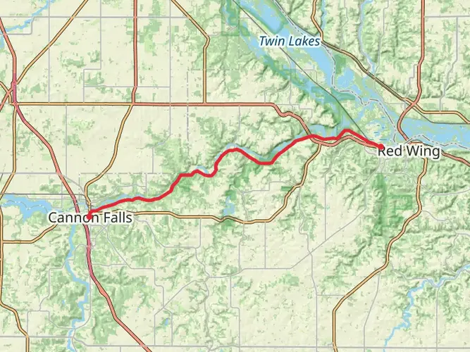
The Cannon Valley Trail stretches approximately 36 kilometers (about 22 miles) through the picturesque landscape of Goodhue County, Minnesota. With virtually no elevation gain, this trail offers a relatively flat journey, making it accessible for hikers of varying abilities, though it is rated medium due to its length.
Getting to the Trailhead
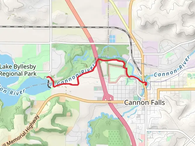
To begin your hike on the Cannon Valley Trail, you'll want to head to the trailhead located near the city of Cannon Falls. If you're driving, you can park your car at the Cannon Falls' parking lot, which is situated off Highway 19. For those opting for public transportation, check local schedules for buses that service the area, as they can vary seasonally.
Navigating the Trail
As you embark on this point-to-point trail, you can rely on the HiiKER app for detailed maps and navigation assistance. The trail is well-marked, but having a digital tool can enhance your experience and ensure you stay on the right path.
Landmarks and Scenery
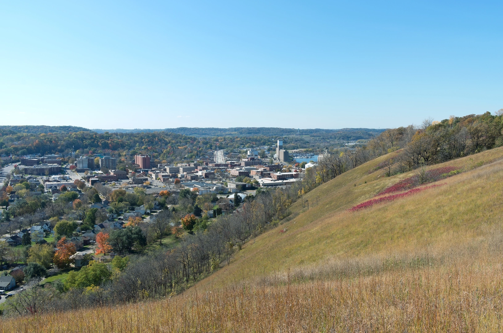
The Cannon Valley Trail is renowned for its scenic beauty, winding along the Cannon River. As you hike, you'll be treated to views of lush woodlands, open prairies, and wetlands teeming with life. The trail is also a haven for birdwatchers, with opportunities to spot a variety of species, including bald eagles, especially near the river.
Historical Significance
The region holds historical significance, with the trail itself following a former Chicago Great Western Railroad line. As you traverse the path, you'll encounter remnants of this past, including old rail bridges that have been repurposed for the trail. The area's rich history is also reflected in the nearby towns, where you can learn about the local heritage.
Wildlife and Nature
The Cannon Valley Trail is a corridor for wildlife. In addition to birds, keep an eye out for deer, foxes, and other native animals that inhabit the Minnesota landscape. The trail's diverse ecosystems, from its riverbanks to its prairies, support a wide range of flora and fauna.
Preparation and Planning
Before setting out, ensure you have enough water and snacks for the journey, as the trail's length can take several hours to complete. Wear comfortable footwear and dress in layers to adjust to changing temperatures. Restrooms and picnic areas are available at various points along the trail, providing convenient spots to take a break and refuel.
Remember, the Cannon Valley Trail requires a Wheel Pass for bicyclists and skaters from April 1st to November 1st, but walking and hiking are free year-round. Passes can be purchased at local vendors or self-service stations along the trail.
By preparing accordingly and respecting the natural environment, your hike along the Cannon Valley Trail is sure to be a memorable experience, filled with the natural beauty and historical charm of Goodhue County.

What to expect?
Activity types
Comments and Reviews
User comments, reviews and discussions about the Cannon Valley Trail, Minnesota.
4.57
average rating out of 5
7 rating(s)