Download
3D Preview
Add to list
More
51.5 km
~2 days
571 m
Multi-Day
“Embark on Michigan's scenic Waterloo-Pinckney Trail for a historic and wildlife-rich hiking adventure.”
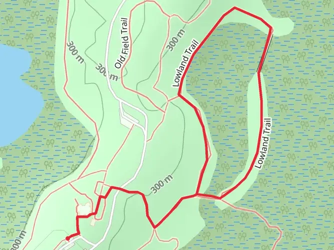
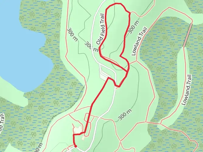
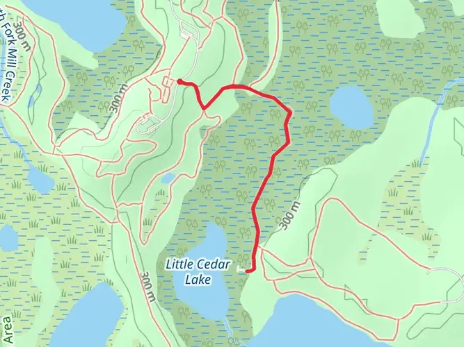
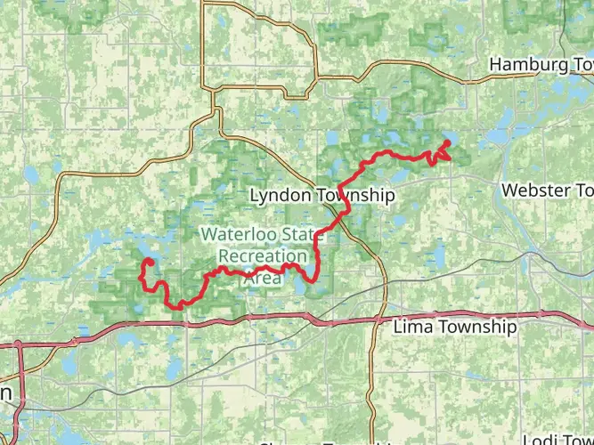
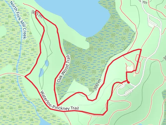
Spanning approximately 51 kilometers (around 32 miles) with an elevation gain of around 500 meters (approximately 1640 feet), the Waterloo-Pinckney Trail offers a medium-difficulty hiking experience through the scenic landscapes of Michigan. This point-to-point trail is nestled near Jackson County and is known for its diverse environments, including wetlands, forests, and open meadows.
Getting to the Trailhead
The trailhead is accessible by car, located near the Waterloo Recreation Area, a short drive from the city of Jackson. For those relying on public transportation, options may be limited, and it's advisable to check local transit resources for the most current routes and schedules. Hikers often arrange for a pick-up at the end of the trail or leave a second vehicle at the finishing point due to the trail's point-to-point nature.
Trail Experience
As you embark on the Waterloo-Pinckney Trail, you'll traverse a variety of terrains, starting with mixed hardwood forests that gradually transition into open meadows dotted with wildflowers during the spring and summer months. The trail is well-marked, but carrying a reliable navigation tool like HiiKER is recommended to keep track of your progress and waypoints.
Landmarks and Wildlife
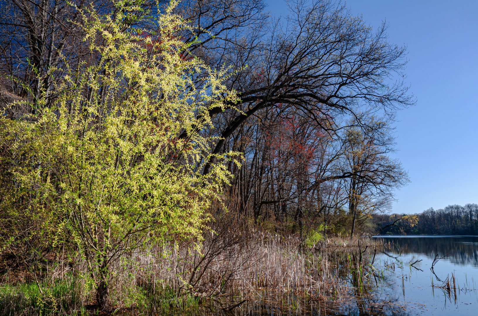
One of the highlights of the trail is the abundance of wildlife. It's not uncommon to spot white-tailed deer, wild turkeys, and various bird species, including the pileated woodpecker. The trail also meanders past several small lakes and streams, which are perfect spots for a rest or a picnic.
Historical Significance
The region holds historical significance, with the trail passing near historic sites from the 19th century. These areas provide a glimpse into Michigan's past, with old farmsteads and remnants of early settlements.
Navigation and Preparation
Throughout the hike, elevation changes are moderate, but it's essential to be prepared for some steep sections. The trail is well-suited for multi-day hikes, with designated campgrounds along the route for overnight stays. Ensure you have a detailed map or a digital tool like HiiKER to help with navigation, as some sections may have limited signage.
Seasonal Considerations
The trail is accessible year-round, but the experience can vary greatly depending on the season. Spring and fall offer milder temperatures and beautiful foliage, while summer provides lush greenery. Winter hikes can be serene with snow-covered paths, but hikers should be prepared for cold temperatures and potentially challenging conditions.
Environmental Protection
Hikers are encouraged to practice Leave No Trace principles to preserve the trail's natural beauty. This includes packing out all trash, respecting wildlife, and minimizing the impact on surrounding vegetation.
By preparing adequately and respecting the natural environment, hikers can enjoy a memorable experience on the Waterloo-Pinckney Trail, taking in the beauty and history of this unique Michigan landscape.

What to expect?
Activity types
Frequently asked questions
How long does it take to hike the Waterloo-pickney Trail end to end?
The Waterloo-pickney Trail is 51.47 km, or about 32 miles, point to point. Most backpackers split it into 2 to 3 days, especially if using the designated camp areas in Waterloo and Pinckney recreation areas. Strong day hikers can cover it in one long outing, but the usual plan is an overnight or weekend trip.
Where are the trailheads and parking areas for the Waterloo-pickney Trail?
The route runs between Waterloo Recreation Area and Pinckney Recreation Area, so it is commonly hiked as a shuttle. On the Waterloo side, park access is through Waterloo Recreation Area near 16345 McClure Road, Chelsea. On the Pinckney side, the recreation area headquarters is at 8555 Silver Hill Road, Pinckney. A Michigan Recreation Passport is required for vehicle entry at state park locations.
Can you camp on the Waterloo-pickney Trail during a thru-hike?
Camping on the Waterloo-pickney Trail is allowed only in designated campgrounds, not anywhere along the corridor. In Waterloo Recreation Area, designated options include Portage Lake, Sugarloaf Lake, Green Lake, Horseman’s Campground, and the Pines campground near the 10-mile marker. In Pinckney Recreation Area, designated trail camping includes Blind Lake and Crooked Lake Campground, and permits or reservations are required where applicable.
Is the Waterloo-pickney Trail dog friendly?
Dogs are generally allowed on Michigan state park trails, including the recreation areas the Waterloo-pickney Trail crosses, as long as they are kept under control and typically on a leash. Because this is a multi-day, point-to-point route with campgrounds, lakes, and shared-use sections near other trail systems, good leash control and cleanup are especially important. Checking current park rules before setting out is sensible because site-specific restrictions can change.
Is the Waterloo-pickney Trail good for beginners or kids?
The Waterloo-pickney Trail is listed as easy overall, with 571 m of elevation gain spread across 51.47 km. That makes it manageable in sections for newer hikers, but the full end-to-end route is still a long multi-day commitment. Shorter family-friendly outings are more realistic than the entire trail, especially near the recreation area access points and campgrounds.
Are bikes allowed on the Waterloo-pickney Trail?
No, bikes are not allowed on the Waterloo section of the Waterloo-pickney Trail. In Pinckney Recreation Area, the trail is closed to bikes west of the Potawatomi Trail at intersection 12. For hikers, that means the route stays primarily a foot-travel experience rather than a full shared bike trail.
What kind of scenery and terrain does the Waterloo-pickney Trail pass through?
The Waterloo-pickney Trail crosses southern Michigan lake country through Waterloo and Pinckney recreation areas. The route passes mixed forest, wetlands, open meadows, and a chain of named lakes including Big Portage Lake, Green Lake, Crooked Lake, Blind Lake, Pickerel Lake, Halfmoon Lake, and Silver Lake. The terrain is not mountainous, but the repeated small climbs and rolling ground add up over 51.47 km.
Is hunting allowed near the Waterloo-pickney Trail?
Yes. Portions of the Waterloo-pickney Trail are open to hunting during established seasons in both Waterloo and Pinckney recreation areas. Hikers using the trail in fall should expect shared public land use and take extra precautions, including wearing bright colors during hunting seasons.
Comments and Reviews
User comments, reviews and discussions about the Waterloo-pickney Trail, Michigan.
4.64
average rating out of 5
11 rating(s)