Download
3D Flyover
Add to list
More
33.1 km
~7 hrs 5 min
283 m
Multi-Day
“Explore Grand Island Trail's natural wonders and history on a scenic 33km loop in Michigan.”
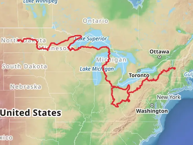
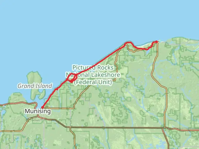
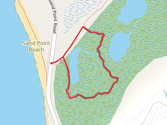
The Grand Island Trail is a captivating loop that spans approximately 33 kilometers (around 20.5 miles) with an elevation gain of roughly 200 meters (about 656 feet), offering a medium difficulty level that appeals to many hikers. This trail encircles Grand Island, which is situated near Alger County, Michigan, and is known for its stunning natural beauty and historical significance.
Getting to the Trailhead
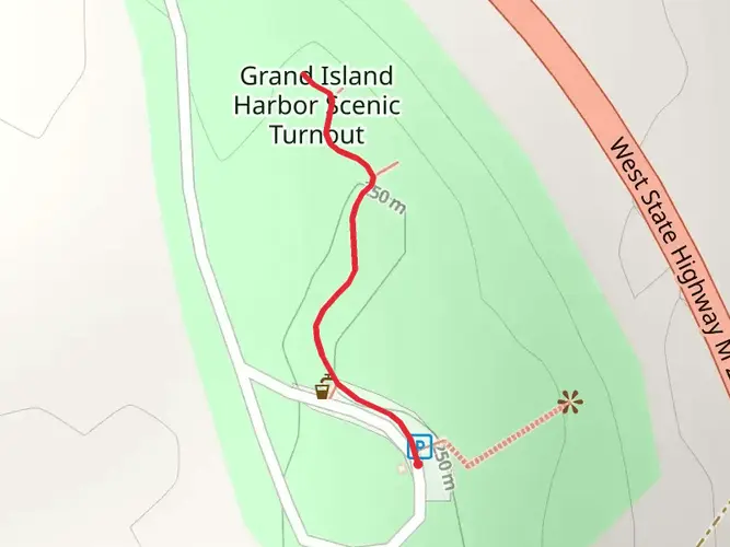
To reach the trailhead, you can drive to the Grand Island Ferry Service located in Munising, Michigan. From there, you'll take a short ferry ride across to Grand Island, where the adventure begins. The ferry service operates seasonally, so it's important to check the schedule in advance. For those relying on public transportation, options may be limited, but the area is accessible by regional bus services that connect to Munising, from where you can catch the ferry.
Navigating the Trail
Once on the island, the trailhead is easily accessible. Hikers can use HiiKER to navigate the trail, ensuring they stay on the correct path throughout their journey. The loop trail offers a comprehensive tour of the island, with the path meandering through diverse landscapes, including dense hardwood forests, serene beaches, and cliff-top vistas.
Landmarks and Natural Beauty
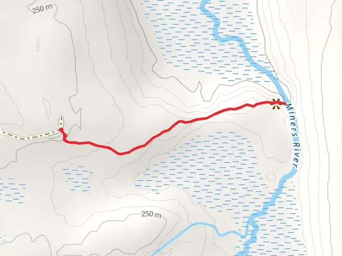
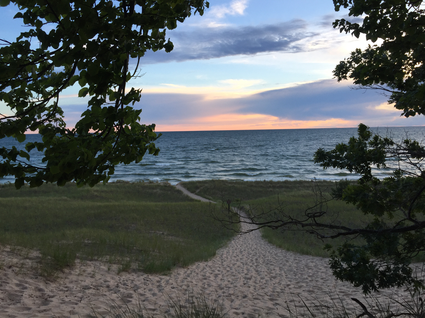
As you embark on the trail, one of the first significant landmarks you'll encounter is the Grand Island East Channel Lighthouse, which stands as a sentinel over the waters. The trail continues along the perimeter of the island, offering breathtaking views of Lake Superior. Approximately 10 kilometers (6.2 miles) in, you'll reach the island's highest point, where you can take in panoramic views that are especially spectacular during sunrise and sunset.
Wildlife and Flora
The island is home to a variety of wildlife, including white-tailed deer, black bears, and numerous bird species. Hikers should be prepared for possible encounters and know how to safely observe wildlife. The trail also winds through areas rich in wildflowers and towering trees, particularly in the spring and summer months when the flora is in full bloom.
Historical Significance
Grand Island carries a rich history, with evidence of Native American settlements dating back as far as 2000 BCE. Throughout the hike, you'll come across old logging camps and historical artifacts that speak to the island's past industry. The trail also passes by old cemeteries and homesteads, offering a glimpse into the lives of early settlers.
Preparation and Planning
Given the trail's length and remote nature, it's important for hikers to come prepared with enough food, water, and supplies to last the duration of the hike. Weather on the island can change rapidly, so layered clothing and rain gear are recommended. Camping is available on the island for those who wish to break the hike into a multi-day adventure, with permits required for overnight stays.
Conclusion
By following these guidelines and preparing accordingly, hikers can fully enjoy the natural splendor and historical richness of the Grand Island Trail. Whether you're looking for a challenging day hike or a leisurely multi-day excursion, this trail offers a memorable experience for all who traverse its path.

What to expect?
Activity types
Frequently asked questions
How long does it take to hike the Grand Island Trail loop in Michigan?
The Grand Island Trail is 33.08 km, or about 20.5 miles, with roughly 283 m of climbing, so most hikers treat it as a full-day hike or an easy overnight. Strong day hikers can finish the loop in 8 to 10 hours, while a multi-day pace leaves more time for beaches, overlooks, and the island’s historic sites.
Where do you catch the ferry for the Grand Island Trail and where can you park?
Access to the Grand Island Trail is typically by passenger ferry from Grand Island Landing on M-28, about 2.5 miles west of Munising. The ferry dock is at N8016 Grand Island Landing Road, and that mainland landing area is the usual place to park before crossing to the island.
When is the best time of year to hike the Grand Island Trail?
The main hiking season for the Grand Island Trail is late spring through early fall, when the ferry to Grand Island is running. The regular passenger ferry season typically starts the Friday before Memorial Day and runs into mid-October, with the most frequent departures in summer, making June through September the easiest window for a full loop hike.
Can you backpack and camp on the Grand Island Trail?
Yes. The Grand Island Trail is well suited to an overnight trip, and Grand Island National Recreation Area has backcountry campsites reached by the island trail system. Bermuda Campsite, for example, is about 1.5 miles from Williams Landing and is one of 17 island campsites; it has a latrine, fire ring, benches, and nearby potable water at Murray Bay Day Use Area.
What are the main sights on the Grand Island Trail loop?
The Grand Island Trail circles an island known for sandstone cliffs, hardwood forest, inland lakes, and sandy Lake Superior shoreline. Notable features include the island’s wave-cut cliffs, beaches around Murray Bay, and lighthouse sites such as the Grand Island North Lighthouse, which stands on a 175-foot cliff at the island’s north end.
Is the Grand Island Trail difficult?
The Grand Island Trail is generally considered easy for its grade, with only about 283 m of elevation gain over 33.08 km. The challenge comes more from the overall distance and the logistics of reaching the island by ferry than from steep climbing, so it fits hikers looking for a long but non-technical loop.
Can you bring a bike on the Grand Island Trail instead of hiking the whole loop?
Yes. Grand Island is set up for both hiking and biking, and the ferry service carries bikes for an extra fee. Standard bicycles are allowed on the island’s non-motorized trails, but the Forest Service notes that e-bikes are not allowed on those bike trails, so the full loop is best done on foot or with a regular bike.
Comments and Reviews
User comments, reviews and discussions about the Grand Island Trail, Michigan.
4.14
average rating out of 5
7 rating(s)