Download
3D Flyover
Add to list
More
55.8 km
~3 days
1706 m
Multi-Day
“Hike from Caratunk to Monson on the Appalachian Trail for a challenging, scenic, and historically rich adventure.”
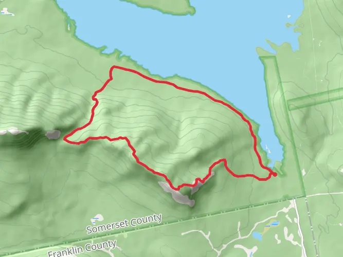
Embarking on the Appalachian Trail section from Caratunk to Monson, hikers will traverse approximately 56 kilometers (about 35 miles) of Maine's rugged backcountry, with an elevation gain of around 1700 meters (approximately 5577 feet). This point-to-point hike is considered to have a medium difficulty rating and offers a rich blend of natural beauty and historical significance.
Getting to the Trailhead
The trailhead is located near Somerset County, Maine. For those driving, the most common starting point is the small town of Caratunk, which is accessible by taking US Route 201 to Caratunk Village. From there, follow the signs to the Appalachian Trail crossing. If you're using public transportation, options are limited, but some shuttle services may be available from nearby towns to the trailhead. It's advisable to arrange these services in advance.
The Hike Itself
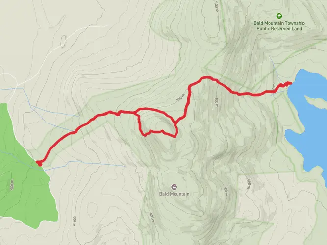
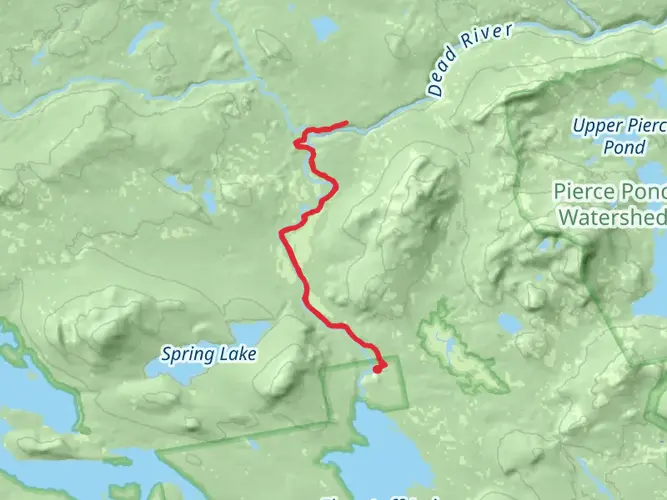
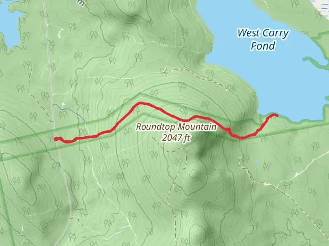
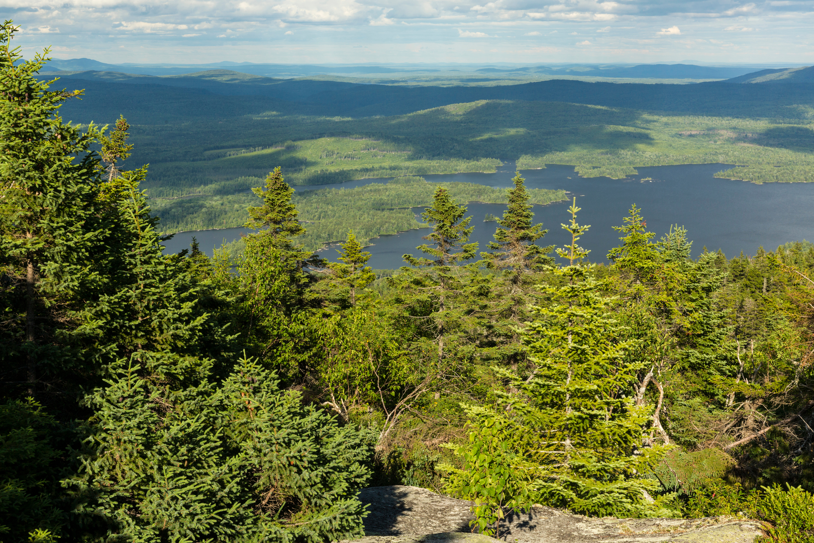
As you set out from the trailhead near Caratunk, the path will lead you through a landscape that is a mix of dense forests, serene lakes, and rolling hills. The initial segment of the trail is relatively flat, allowing hikers to ease into the journey. The terrain becomes more challenging as you progress, with steeper inclines and rocky outcrops.
Notable Landmarks and Scenery
One of the first significant landmarks you'll encounter is the crossing of the Kennebec River, which is facilitated by a seasonal ferry service. This is the only officially recognized ferry along the entire Appalachian Trail and is a unique feature of this section.
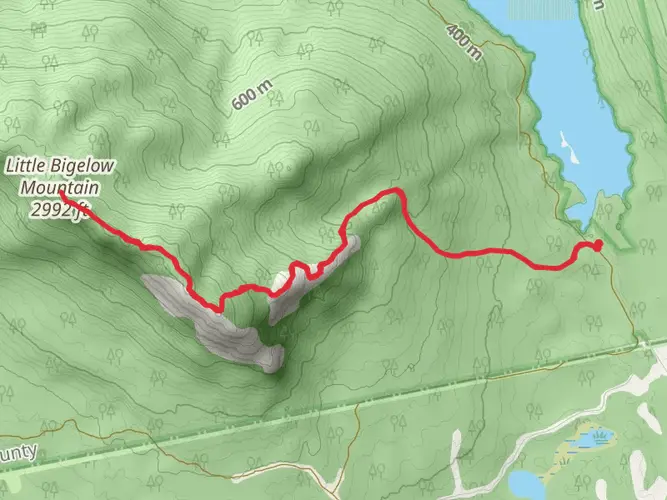
As you continue, you'll be treated to the sight of Pleasant Pond Mountain, which offers panoramic views of the surrounding wilderness. The ascent here is steep but rewarding, with the summit standing at an elevation of 2470 feet (753 meters).
Further along, you'll pass by Moxie Bald Mountain, another highlight of this section. The climb to the top of Moxie Bald, at 2629 feet (801 meters), is strenuous but provides another opportunity for breathtaking vistas.
Flora, Fauna, and Historical Significance
The trail weaves through a variety of ecosystems, home to diverse flora and fauna. Keep an eye out for moose, deer, and a wide array of bird species. The dense forests are a mix of conifers and deciduous trees, with the changing seasons offering a kaleidoscope of colors.
This region is steeped in history, with the trail itself being a monument to conservation and outdoor recreation. The Appalachian Trail, conceived in 1921 and completed in 1937, is one of the longest continuously marked footpaths in the world, and hiking any section of it is to walk in the footsteps of countless nature enthusiasts who have been advocating for the preservation of this corridor for nearly a century.
Preparing for the Hike
Before setting out, ensure you have the necessary gear for variable weather conditions and terrain. Waterproof boots, a map, and a compass are essential. For navigation, the HiiKER app can be a valuable tool, providing detailed maps and trail information that can be accessed offline.
Conclusion
This section of the Appalachian Trail offers a quintessential Maine hiking experience, with its combination of natural beauty, wildlife, and historical significance. Whether you're a seasoned hiker or someone looking to immerse yourself in the wilderness for a few days, the journey from Caratunk to Monson is sure to be memorable.

What to expect?
Activity types
Comments and Reviews
User comments, reviews and discussions about the Appalachian Trail Section Hike - Caratunk to Monson, Maine.
4.27
average rating out of 5
11 rating(s)