Download
3D Flyover
Add to list
More
23.3 km
~7 hrs 15 min
1560 m
Multi-Day
“Traverse Maine's wild heart on a grueling hike through Bigelow Preserve's majestic peaks and dense forests.”
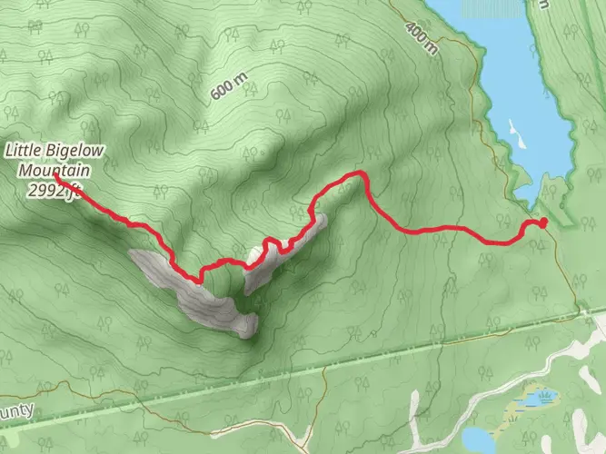
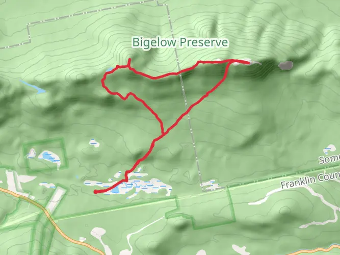
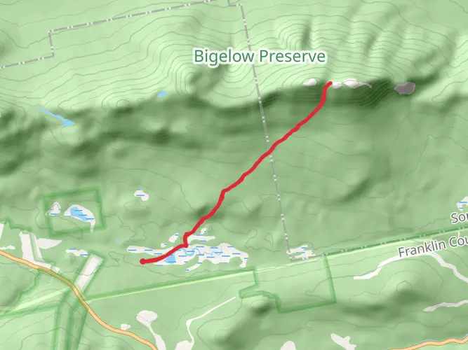
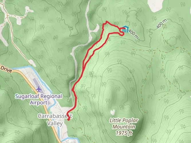
Embarking on the Appalachian Trail Section Hike through the Bigelow Preserve, hikers will traverse approximately 23 kilometers (around 14 miles) of rugged terrain with an elevation gain of roughly 1500 meters (about 4900 feet). This point-to-point trail is nestled near Somerset County, Maine, and is rated as extra difficult due to its challenging climbs and technical sections.
Getting to the Trailhead
To reach the trailhead, hikers can drive to the nearest significant landmark, Stratton, Maine. From there, follow Route 27 north to the access point near the Carrabassett River. There is no direct public transportation to the trailhead, so hikers will need to arrange for a car or a shuttle service from local providers.
Navigating the Trail
As you set out, ensure you have the HiiKER app downloaded for up-to-date trail maps and navigation assistance. The trail begins with a steady ascent, winding through dense forests of spruce and fir. The canopy occasionally breaks to offer glimpses of the surrounding mountains.
Landmarks and Scenery
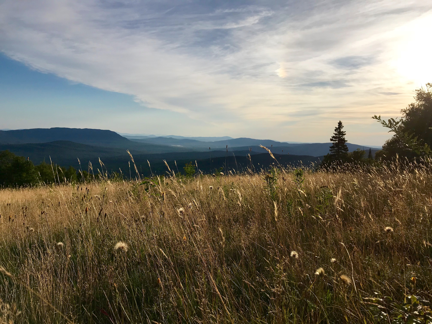
After the initial climb, you'll reach the Avery Peak, which stands at an elevation of 1246 meters (4088 feet). Here, you'll be rewarded with panoramic views of Flagstaff Lake and the vast Maine wilderness. The trail continues to West Peak, slightly higher at 1255 meters (4117 feet), before descending into a col and then ascending again towards the South Horn.
Flora and Fauna
Throughout the hike, keep an eye out for the diverse wildlife, including moose, black bears, and a variety of bird species. The trail is also home to a rich array of plant life, from alpine blueberries to rare high-elevation flowers.
Historical Significance
The Bigelow Preserve is not only a natural wonder but also a place of historical importance. The area was once under threat of development, but conservation efforts in the 1970s led to its protection as a state preserve, ensuring the preservation of its unique ecosystem and historical artifacts, including remnants of old logging operations.
Preparing for the Hike
Given the trail's difficulty, hikers should be well-prepared with proper gear, including sturdy hiking boots, weather-appropriate clothing, and sufficient water and food. The trail is best tackled from late spring to early fall to avoid harsh winter conditions.
Conclusion
Remember, the Appalachian Trail Section Hike - Bigelow Preserve Trail is a challenging yet rewarding experience. It's a journey through the heart of Maine's wilderness, offering a true sense of solitude and connection with nature.

What to expect?
Activity types
Frequently asked questions
How hard is the Appalachian Trail Section Hike - Bigelow Preserve Trail in Maine?
The Appalachian Trail Section Hike - Bigelow Preserve Trail is an extra difficult 23.28 km point-to-point route with about 1,560 meters of climbing. The route crosses the rugged Bigelow Range and includes steep ascents, exposed ridge walking, and major elevation changes around Avery Peak, West Peak, and South Horn.
How long does the Appalachian Trail Section Hike - Bigelow Preserve Trail usually take?
Most hikers should plan on a full day to two days for the Appalachian Trail Section Hike - Bigelow Preserve Trail. At 23.28 km with 1,560 meters of elevation gain, the route is much more demanding than the mileage suggests, especially across the high ridge between Avery Peak at about 4,088 feet and West Peak at about 4,117 feet.
What peaks do you reach on the Appalachian Trail Section Hike - Bigelow Preserve Trail?
The Appalachian Trail Section Hike - Bigelow Preserve Trail crosses some of the best-known summits in the Bigelow Range. Named high points on this section include Avery Peak, West Peak, and South Horn, with broad views over Flagstaff Lake and the surrounding western Maine mountains from the open ridge.
Where do you park for the Appalachian Trail Section Hike - Bigelow Preserve Trail?
Common access for the Appalachian Trail Section Hike - Bigelow Preserve Trail is from the Route 27 corridor near Stratton and Carrabassett Valley. A well-known approach to the Bigelow Range uses Stratton Brook Pond Road, which leads to a large parking area used for the Fire Warden's Trail and access toward Avery Peak, West Peak, and South Horn.
Is there public transportation to the Appalachian Trail Section Hike - Bigelow Preserve Trail?
There is no direct public transportation to the Appalachian Trail Section Hike - Bigelow Preserve Trail trailheads in the Bigelow Preserve. Access is typically by private vehicle via Route 27 near Stratton, and point-to-point hikers usually need a car shuttle or a prearranged pickup because the route does not return to the same trailhead.
Is the Appalachian Trail Section Hike - Bigelow Preserve Trail a backpacking route or a day hike?
The Appalachian Trail Section Hike - Bigelow Preserve Trail is best treated as a strenuous backpacking route or a very long day hike for strong hikers. Its multi-day classification, 23.28 km distance, and 1,560 meters of ascent make it more serious than a standard summit outing, especially in poor weather or when carrying overnight gear.
When is the best time of year to hike the Appalachian Trail Section Hike - Bigelow Preserve Trail?
The most practical hiking season for the Appalachian Trail Section Hike - Bigelow Preserve Trail is typically late spring through fall, when the Bigelow ridge is generally snow-free. Conditions can stay harsher at elevation than in nearby towns, and access roads such as Stratton Brook Pond Road may be less reliable outside the main hiking season, so early-season and shoulder-season trips need extra caution.
Comments and Reviews
User comments, reviews and discussions about the Appalachian Trail Section Hike - Bigelow Preserve Trail, Maine.
4.33
average rating out of 5
6 rating(s)