Download
3D Flyover
Add to list
More
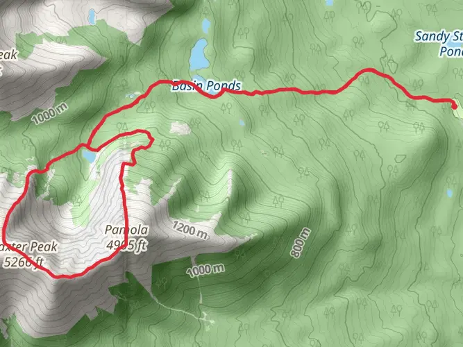
223.5 km
~9 days
2443 m
Multi-Day
“Trek Maine's IAT for a blend of majestic wilds and echoes of history.”
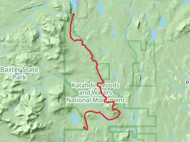
Embarking on the International Appalachian Trail (IAT) in Maine offers a journey through a landscape rich with natural beauty and historical significance. This trail, stretching approximately 224 kilometers (about 139 miles) with an elevation gain of around 2400 meters (roughly 7874 feet), is a continuation of the famed Appalachian Trail and takes hikers through a diverse range of environments, from dense forests to expansive views atop rugged mountains.
Getting to the Trailhead
The trailhead is located near Penobscot County, Maine, and is accessible by car. For those relying on public transportation, options may be limited, but services to nearby towns and coordination with local shuttle services can be arranged. Once in the vicinity, the trailhead is typically a short drive from the nearest town.
Navigating the Trail
Hikers can utilize HiiKER, a navigation tool, to help with planning and staying on the correct path. The trail is marked, but due to its length and remote sections, having a digital tool can be invaluable, especially in areas where the trail may be less defined.
Terrain and Landmarks
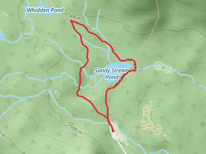
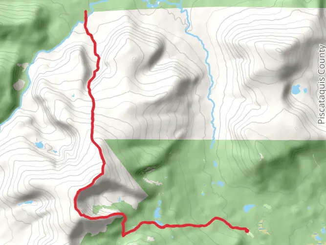
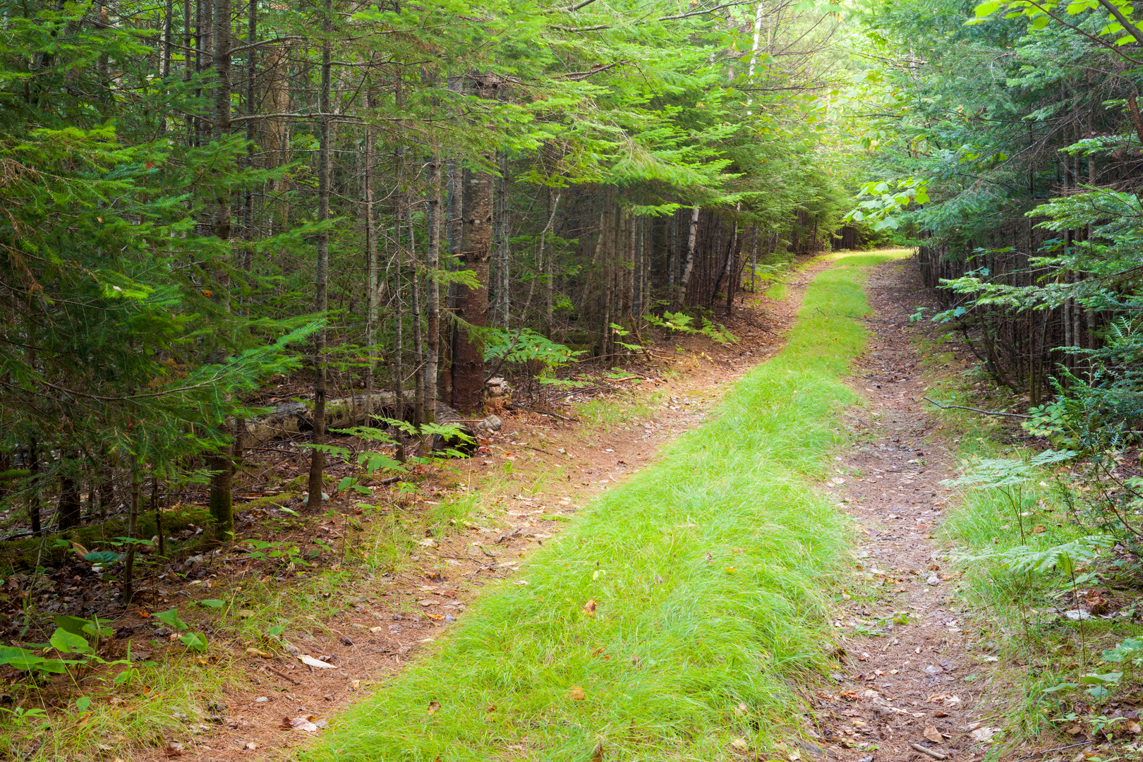
The trail offers a variety of terrain, from relatively flat and easy sections to more challenging climbs. Hikers will traverse through the North Maine Woods, an area known for its vast forests and wildlife. The trail also passes by a number of lakes and streams, providing ample water sources and scenic rest stops.
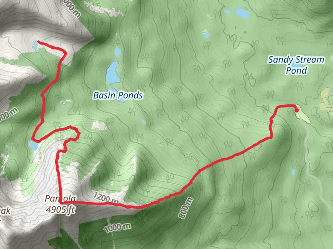
One of the significant landmarks along the trail is Mount Katahdin, the highest peak in Maine, although the IAT diverges before reaching the summit. The trail also winds through areas of historical significance, such as remnants of old logging camps and Native American sites, offering a glimpse into the region's past.
Wildlife and Nature
The Maine section of the IAT is home to a rich array of wildlife, including moose, black bears, and a variety of bird species. Hikers should be prepared for encounters with wildlife and knowledgeable about how to safely interact with them. The trail also showcases a diverse range of flora, from hardwood forests to coniferous stands, and during the fall, the foliage provides a spectacular display of colors.
Preparation and Planning
Given the trail's medium difficulty rating, hikers should be in good physical condition and have experience with multi-day treks. It's essential to carry a map, compass, and HiiKER app for navigation, as well as sufficient food, water, and gear for changing weather conditions. The trail can be hiked in sections or in its entirety, with the full length taking approximately 10 to 15 days to complete, depending on pace.
Accommodations and Resupply
There are a few opportunities for resupply along the trail, so hikers should plan accordingly. Some sections of the trail are remote, and carrying enough supplies is crucial. There are also a number of campsites and shelters along the route, allowing for overnight stays in the backcountry.
Seasonal Considerations
The best time to hike the IAT in Maine is from late spring to early fall when the weather is more predictable, and the days are longer. Winter brings heavy snow and challenging conditions, making the trail suitable only for experienced winter hikers.
Historical Context
The International Appalachian Trail extends the Appalachian Mountain range into Canada and other parts of the world. The Maine section connects with the eastern terminus of the Appalachian Trail at Mount Katahdin and continues northward. The trail not only offers a physical connection to the landscapes but also a historical one, as it traverses lands that were once inhabited by indigenous peoples and later impacted by European settlement and the logging industry.
By preparing adequately and respecting the natural environment, hikers can enjoy a memorable experience on the International Appalachian Trail in Maine, taking in the stunning landscapes and rich history of the region.

What to expect?
Activity types
Frequently asked questions
How long does it take to hike the International Appalachian Trail - Maine?
The International Appalachian Trail - Maine is 223.55 km long with 2,443 m of total ascent, so it is generally approached as a multi-day backpacking route rather than a single long hike. A typical schedule is around 10 to 14 days, depending on daily mileage, weather, road access, and whether the Katahdin section is included at the start or finish.
Where does the International Appalachian Trail - Maine start and end?
The Maine section is commonly described as running between the Katahdin area and Fort Kent in northern Maine. On the southern end, hikers need to account for Baxter State Park access rules around Katahdin, and the broader IAT route continues northeast toward New Brunswick beyond Fort Kent.
Is the International Appalachian Trail - Maine hard?
The International Appalachian Trail - Maine is rated medium overall, but that still means a demanding long-distance hike with 223.55 km of travel and 2,443 m of climbing. The challenge comes less from constant steep gain and more from the route’s length, remote stretches, uneven footing, and the logistics of carrying food and gear through northern Maine.
Do I need parking reservations for the International Appalachian Trail - Maine at Katahdin?
If the International Appalachian Trail - Maine itinerary begins or ends on Katahdin via Baxter State Park, parking rules can apply at the Katahdin trailheads. Baxter State Park requires a Katahdin Trailhead Pass for vehicles using trailheads such as Katahdin Stream Campground unless the lot has remaining capacity or the party is already camping in the park the night before.
Can dogs go on the International Appalachian Trail - Maine?
Dog access on the International Appalachian Trail - Maine depends on the section being hiked. Baxter State Park, which covers the Katahdin area, does not allow pets in the park, so dogs cannot accompany hikers on that portion even if other sections outside the park may have different rules.
What is the best time of year to hike the International Appalachian Trail - Maine?
The main hiking season for the International Appalachian Trail - Maine is typically summer into early fall, when trail conditions are more stable and daylight is longer. In the Katahdin area, high-elevation trails often open only in late May or early June, and black flies are usually at their worst in early summer, so July through September is often the most practical window.
Is the International Appalachian Trail - Maine suitable for beginners?
The International Appalachian Trail - Maine is not usually considered a beginner-friendly first backpacking trip because it is a 223.55 km multi-day route through remote northern Maine. Strong navigation, food planning, weather judgment, and comfort with backcountry camping are important, even though the overall difficulty is listed as medium rather than extreme.
Comments and Reviews
User comments, reviews and discussions about the International Appalachian Trail - Maine, Maine.
4.73
average rating out of 5
15 rating(s)