Download
3D Flyover
Add to list
More
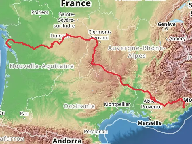
1178.4 km
~44 days
14311 m
Multi-Day
“Embark on the historic Camino Menton-Candanchu trail, a scenic and culturally-rich hike from Italy to Spain.”
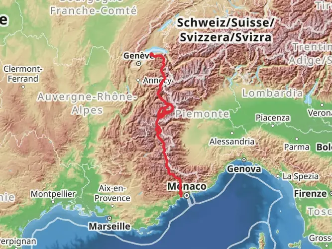
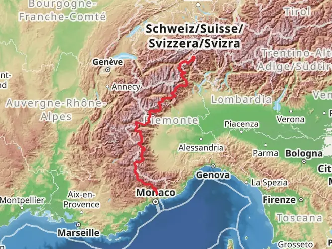
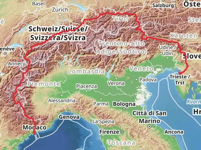
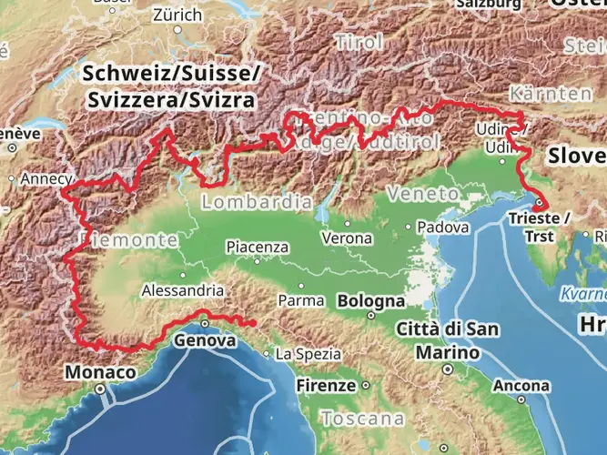
The Camino Menton-Candanchu via Arles is a grand journey that spans approximately 1178 kilometers (732 miles), with an elevation gain of around 14300 meters (46918 feet). This point-to-point trail begins near Ventimiglia, Italy, and stretches all the way to Candanchu in Spain, offering a medium difficulty rating that caters to hikers with some experience under their belts.
Getting to the Trailhead To reach the starting point near Ventimiglia, Italy, hikers can utilize public transportation options such as trains and buses that service the area. For those coming by car, parking is available in the vicinity of the trailhead. It's advisable to use HiiKER to navigate to the exact starting location and to plan your journey accordingly.
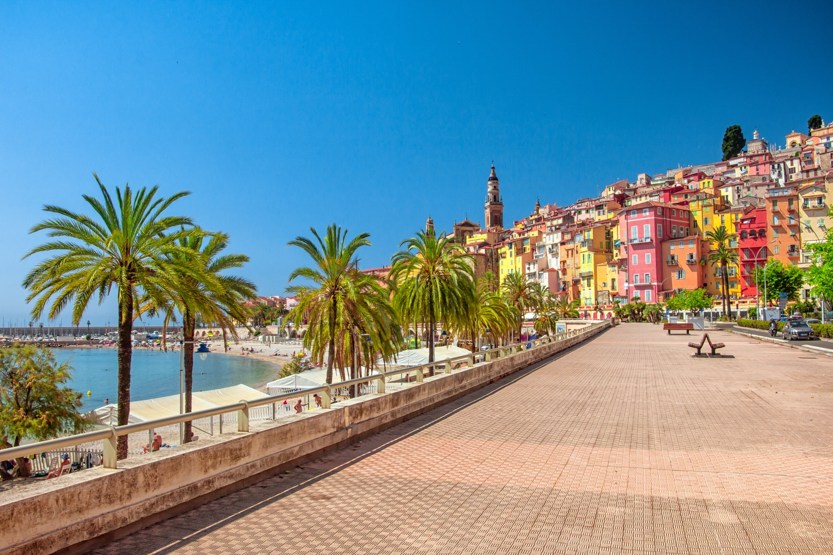
Trail Overview Embarking on this trail, hikers will traverse a variety of landscapes, from the picturesque Italian Riviera to the rugged Pyrenees. The route is a blend of coastal paths, forested tracks, and mountain passes, offering a diverse hiking experience.
Historical Significance The trail passes through regions rich in history, including ancient Roman roads and medieval villages. Hikers will encounter historical landmarks such as the Arles Amphitheatre and the Church of Saint Trophime, showcasing the architectural prowess of past civilizations.
Landmarks and Nature As you progress along the trail, you'll be greeted by the breathtaking views of the Mediterranean Sea and the majestic peaks of the Pyrenees. The route takes you through the Camargue, a natural region known for its wild horses and pink flamingos. The crossing of the Pyrenees is a highlight, with the potential to spot wildlife such as the Pyrenean chamois and the bearded vulture.
Wildlife and Flora The diverse ecosystems along the Camino Menton-Candanchu via Arles support a wide array of flora and fauna. In the lower elevations, hikers can enjoy the fragrant blooms of wild herbs and flowers, while the higher altitudes are home to alpine species adapted to the harsher climate.
Navigation and Preparation Given the length and varied terrain of the trail, it's essential to be well-prepared with appropriate gear, including sturdy hiking boots, weather-appropriate clothing, and a reliable navigation tool like HiiKER. Regularly check the weather forecasts and trail conditions, and plan your itinerary to include rest days and resupply points.
Accommodation and Resupply The trail passes through numerous towns and villages where hikers can find accommodation ranging from hostels to guesthouses. Resupply options are plentiful, allowing for regular restocking of provisions. It's recommended to book accommodations in advance, especially during peak hiking seasons.
Safety and Etiquette Always remember to follow Leave No Trace principles to minimize your impact on the environment. Be prepared for sudden weather changes, especially in the mountainous sections, and carry a first aid kit for emergencies. Respect the wildlife and maintain a safe distance at all times.
By following these guidelines and preparing adequately, hikers can look forward to an unforgettable adventure on the Camino Menton-Candanchu via Arles, a trail that weaves through some of the most stunning and historically rich landscapes of Italy, France, and Spain.

Comments and Reviews
User comments, reviews and discussions about the Camino Menton-Candanchu via Arles, Italy.
4.33
average rating out of 5
6 rating(s)