Download
Preview
Add to list
More
35.6 km
~2 days
615 m
Multi-Day
“Embark on the historic and picturesque Multeen Way, a journey through Ireland's verdant hills and timeless landscapes.”
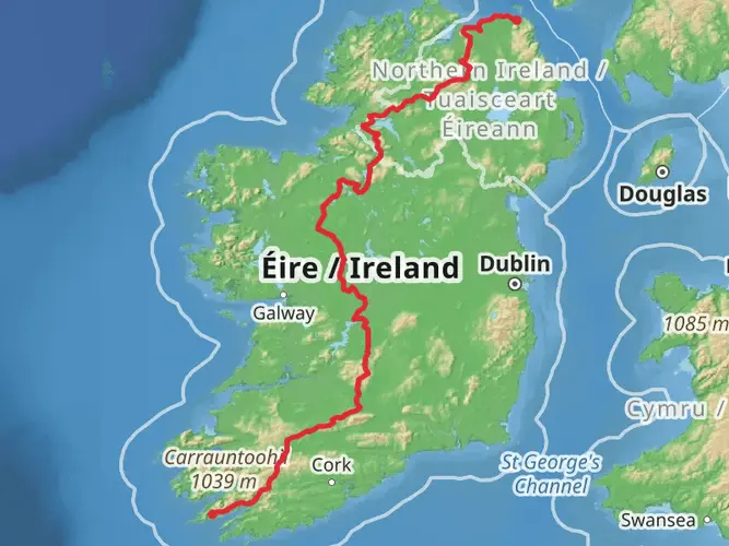
The Multeen Way is a captivating trail that stretches approximately 36 kilometers (about 22 miles) through the scenic landscape of County Tipperary, Ireland. With an elevation gain of around 600 meters (nearly 2000 feet), hikers can expect a moderately challenging journey that offers a blend of rolling hills, lush farmland, and historical intrigue.
Getting to the Trailhead To begin your adventure on the Multeen Way, you'll want to make your way to the trailhead located near the town of Tipperary. If you're coming by car, you can navigate to the starting point which is situated just outside the town. For those relying on public transport, buses serve the area and can drop you off in the town center, from where you can reach the trailhead with a short taxi ride or a warm-up walk.
Navigating the Trail As you embark on the trail, using HiiKER for navigation will ensure you stay on the right path. The trail is marked, but having a digital tool can provide that extra layer of security and convenience.
Historical Significance The region is steeped in history, and as you traverse the Multeen Way, you'll be walking in the footsteps of those who have shaped Ireland's past. The trail takes you through areas that have been significant throughout various periods, from ancient times to the more recent past.
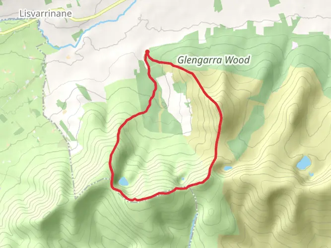
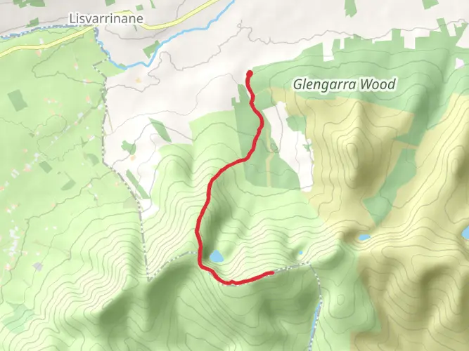
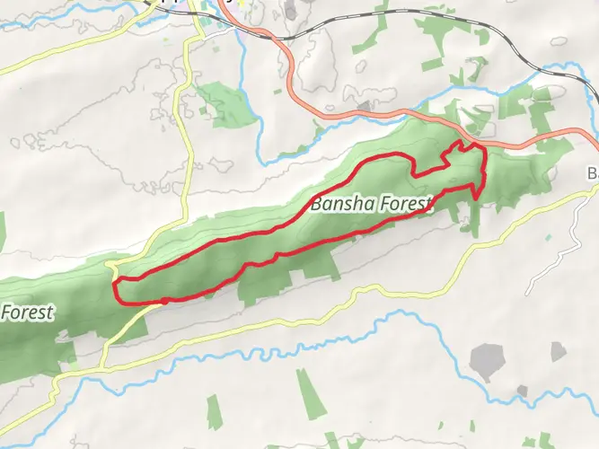
Landmarks and Scenery One of the early highlights of the trail is the charming village of Donohill, where you can appreciate the quaint rural Irish setting. As you continue, you'll pass through a mix of quiet country roads, forested tracks, and open farmland. The trail offers panoramic views of the Galtee Mountains, which are especially breathtaking during the ascent to higher elevations.
Wildlife and Nature The Multeen Way is a haven for nature enthusiasts. The diverse habitats along the trail support a variety of wildlife. Keep an eye out for native bird species, and if you're lucky, you might spot a hare darting across the path or a deer in the distance.
Preparation and Planning Given the trail's length and elevation gain, it's important to be well-prepared. Ensure you have adequate water, food, and clothing for the Irish weather, which can be unpredictable. Good hiking boots are essential, as some sections can be muddy, especially after rain.
Trail Etiquette Remember to respect the environment and local landowners by sticking to the trail, leaving no trace, and closing gates behind you. This helps preserve the trail for future hikers and maintains good relationships with those who live along it.
By the time you reach the end of the Multeen Way, you will have experienced the serene beauty of rural Ireland, encountered historical sites, and hopefully, have spotted some of the local wildlife. Whether you're looking for a long day hike or planning to split the journey into a multi-day trek, the Multeen Way offers a rewarding experience for hikers of all levels.

What to expect?
Activity types
Comments and Reviews
User comments, reviews and discussions about the Multeen Way, Ireland.
4.6
average rating out of 5
25 rating(s)