Download
3D Flyover
Add to list
More
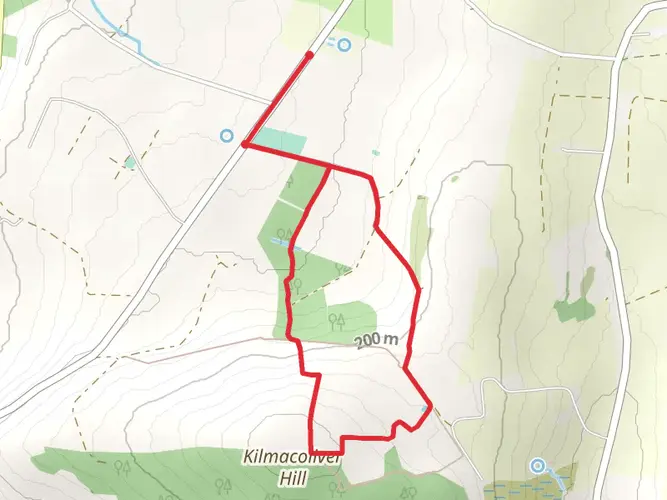
75.6 km
~3 days
1368 m
Multi-Day
“Embark on Ireland's East Munster Way: a historical hike through breathtaking landscapes and vibrant wildlife.”
The East Munster Way is a captivating long-distance trail that stretches approximately 76 kilometers (about 47 miles) across the scenic landscapes of Ireland, with an elevation gain of around 1300 meters (approximately 4265 feet). This point-to-point trail begins near the town of Carrick-on-Suir in County Tipperary and winds its way to the historic town of Cahir.
Getting to the Trailhead
To reach the starting point of the East Munster Way, hikers can travel to Carrick-on-Suir via public transport or by car. The nearest significant landmark to the trailhead is the Ormond Castle, a notable Tudor manor house in Carrick-on-Suir. For those driving, parking is available in the town, and from there, the trailhead is easily accessible. Public transport users can take a bus or train to Carrick-on-Suir and then make their way to the trailhead on foot.
Navigating the Trail
Hikers can utilize the HiiKER app for detailed maps and navigation assistance throughout their journey on the East Munster Way. The trail is well-marked with the standard yellow walking man symbol, making it easy to follow.
Trail Highlights and Landmarks
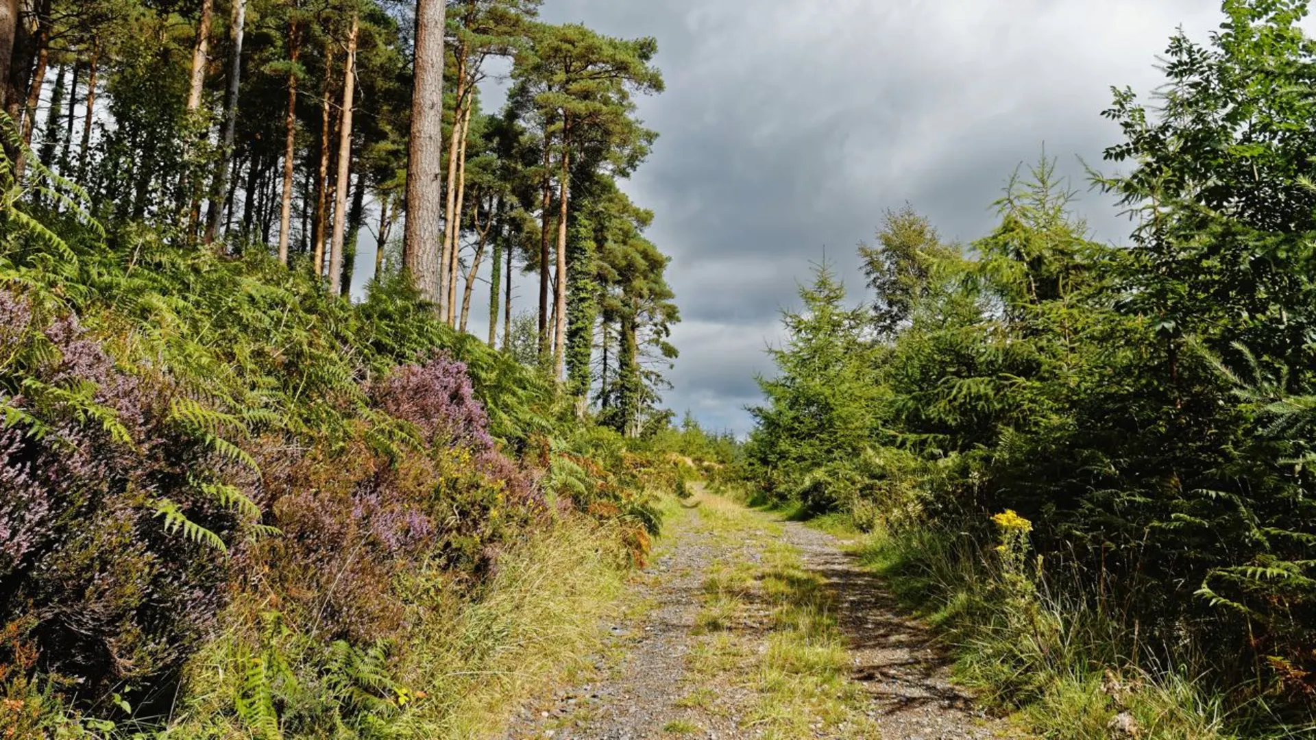
As you embark on the East Munster Way, you'll traverse a variety of landscapes, including quiet country roads, forest paths, open mountainsides, and riverbanks. The trail offers a mix of flat and hilly terrain, with the Comeragh Mountains providing a stunning backdrop for a significant portion of the hike.
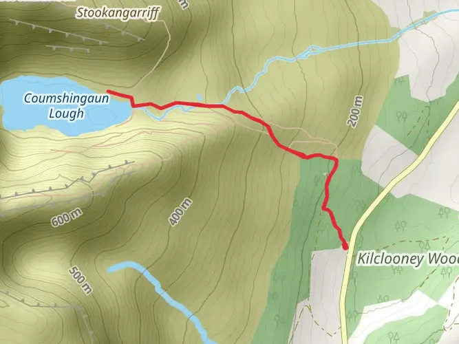
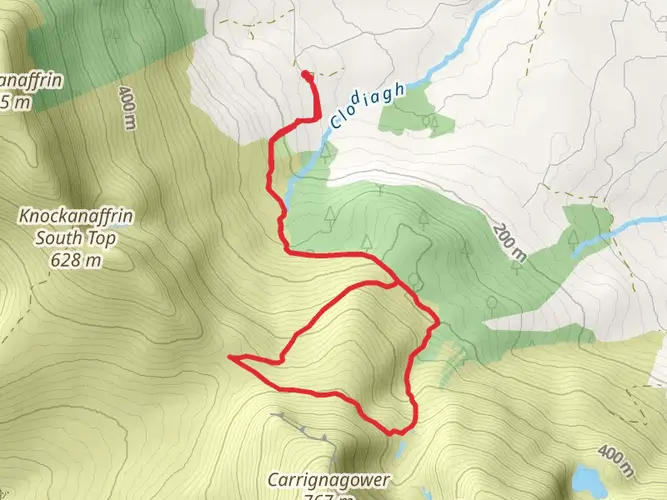
One of the early highlights is the ascent to the summit of Carrick Mountain, which offers panoramic views of the surrounding countryside. The trail then descends into the lush Clodiagh River valley, where hikers can enjoy the serene sounds of flowing water and the sight of local wildlife.
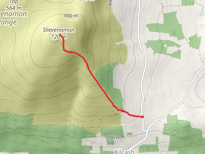
Further along, the trail passes through the picturesque Nire Valley, a glacial valley known for its exceptional beauty and opportunities for spotting native bird species. The valley is also steeped in history, with ancient ring forts and standing stones dotting the landscape.
As you approach the town of Cahir, the trail takes you past the impressive Cahir Castle, one of Ireland's largest and best-preserved castles. This landmark is a testament to the region's rich historical tapestry, dating back to the 13th century.
Wildlife and Nature
The East Munster Way is home to a diverse array of flora and fauna. Hikers may encounter red squirrels, foxes, and a variety of bird species, including the peregrine falcon and the rare hen harrier. The trail also meanders through several important habitats, such as deciduous woodlands and boglands, which are home to unique plant species.
Preparation and Planning
Given the trail's medium difficulty rating, it's suitable for hikers with a moderate level of fitness. It's recommended to wear sturdy hiking boots and to carry waterproof clothing, as the weather can be unpredictable. Hikers should also bring sufficient water and snacks for the journey, as well as a first aid kit for emergencies.
The East Munster Way can be completed in sections or as a multi-day hike. There are accommodations and services available in the towns and villages along the route, allowing for rest and resupply.
Conclusion
The East Munster Way is a journey through the heart of Ireland's natural beauty and historical heritage. Whether you're seeking a challenging hike or a peaceful walk in the countryside, this trail offers an enriching experience for all who traverse its path.

What to expect?
Activity types
Comments and Reviews
User comments, reviews and discussions about the East Munster Way, Ireland.
4.48
average rating out of 5
31 rating(s)