Download
3D Flyover
Add to list
More
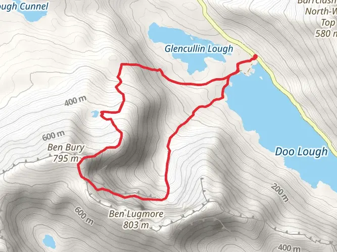
13.7 km
~4 hrs 27 min
1032 m
Loop
“From shimmering lake shores to wind-whipped ridges, this wild circuit brims with drama and soulful history.”
WARNING. This route can experience rapidly changing conditions that can make the time required much longer than expected. Please be well prepared and leave plenty of time. If you are unsure, do not proceed with this route.
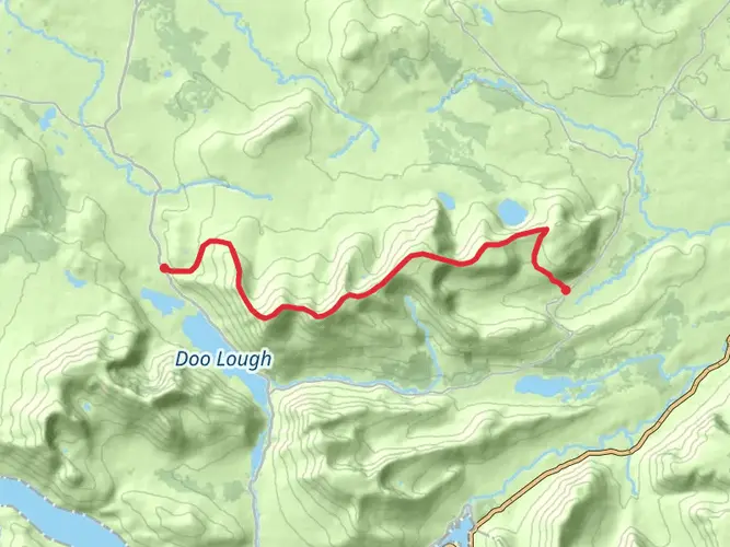
Starting from the shores of Doo Lough, just off the R335 road near Delphi Resort in County Mayo, this loop trail covers approximately 14 km (8.7 miles) with a challenging elevation gain of about 1,000 metres (3,280 feet). The trailhead is accessible by car, with parking available near the Delphi Adventure Resort. For those using public transport, buses from Westport or Galway can drop you at Delphi, though schedules are limited and a taxi may be needed for the final stretch.
Initial Ascent and Doo Lough Valley
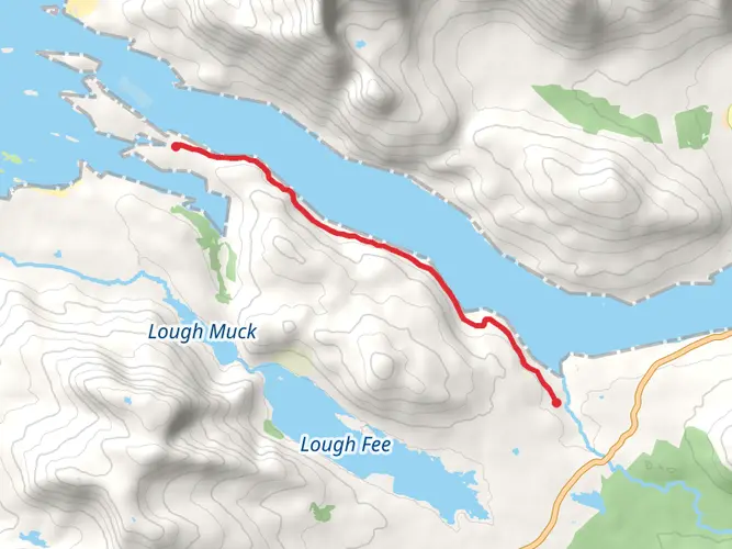
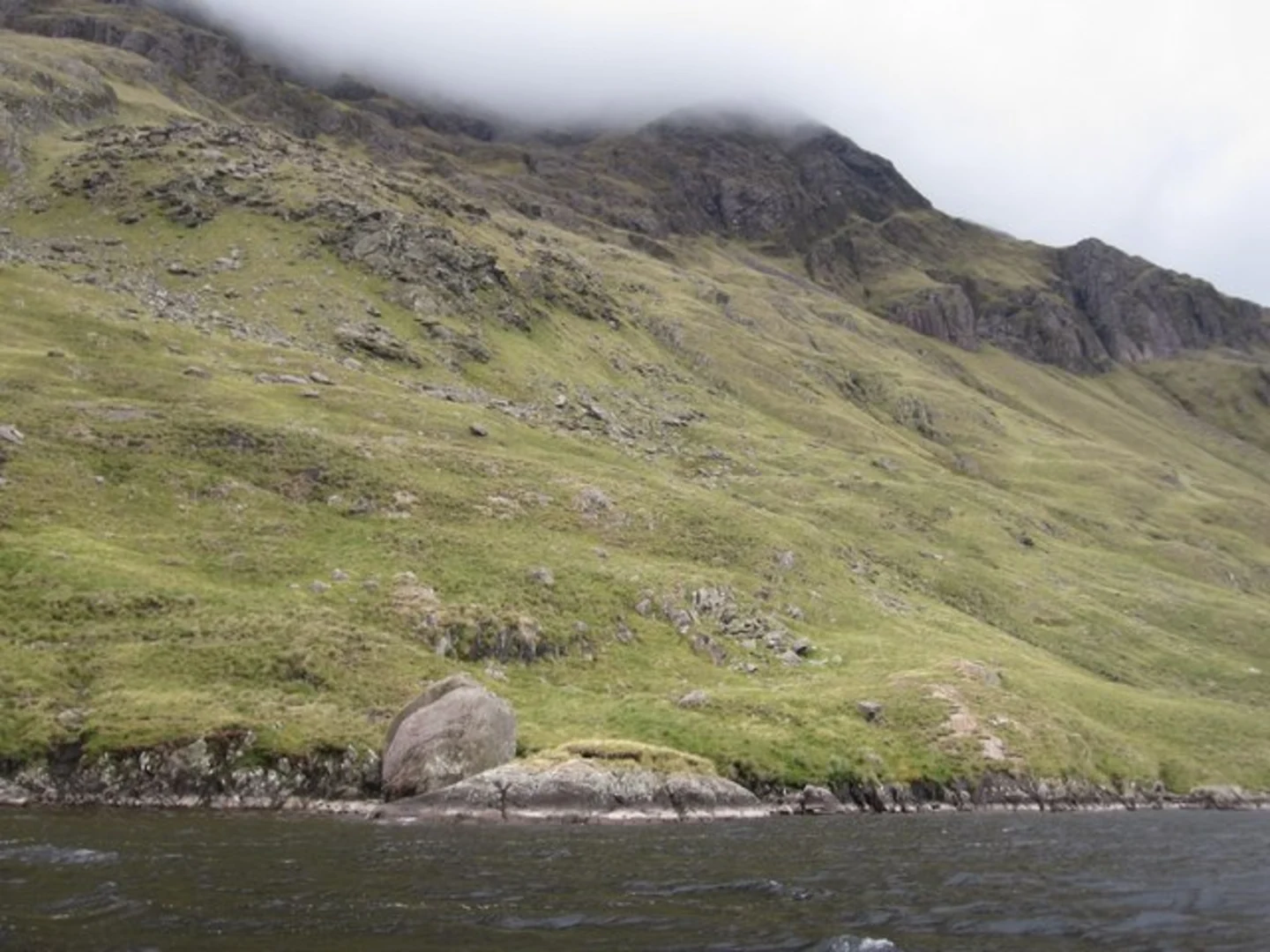
The route begins by skirting the edge of Doo Lough, a glacial lake framed by steep, rugged mountains. Early on, the path is boggy and uneven, requiring sturdy waterproof boots. The first significant climb takes you up the southern slopes of Ben Lugmore, with the terrain quickly becoming steep and rocky. After about 3 km (1.9 miles), you’ll gain roughly 400 metres (1,312 feet) in elevation, with panoramic views back over Doo Lough and the Sheeffry Hills.
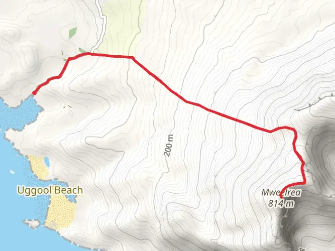
Mweelrea Massif and Summit Ridge
After traversing the saddle between Ben Lugmore and Mweelrea, the highest peak in Connacht at 814 metres (2,671 feet), the trail becomes more exposed. The ascent to Mweelrea’s summit is steep and can be slippery in wet conditions, with loose scree and occasional scrambling required. The summit ridge offers sweeping views of Killary Harbour, the only fjord in Ireland, and the Atlantic coastline. On clear days, the Twelve Bens and Maumturk mountains are visible to the south.
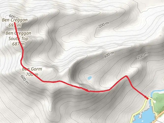
Descent and Return Loop
Descending from Mweelrea, the route follows a narrow ridge before dropping sharply into the Glenconnelly valley. The descent is technical, with grassy slopes that can be treacherous after rain. After about 10 km (6.2 miles), you’ll re-enter bogland and follow the Glenconnelly River back toward Doo Lough. The final section is less defined, often requiring navigation skills—HiiKER is recommended for accurate GPS guidance.
Landmarks, Nature, and History
Along the way, hikers pass the haunting Doo Lough Famine Memorial, commemorating the 1849 tragedy when hundreds perished during the Great Famine. The landscape is dotted with wildflowers in summer, and you may spot red deer, mountain hares, and peregrine falcons. The area is known for its rapidly changing weather, so pack layers and be prepared for mist and wind at higher elevations.
Preparation and Safety
This trail is rated Extra Difficult due to its length, elevation, and exposure. There are no facilities or shelters along the route, and mobile signal is unreliable. Carry a map, compass, and use HiiKER for navigation. Water sources are available from streams, but purification is advised. Weather can change rapidly, so check forecasts and inform someone of your plans before setting out.

What to expect?
Activity types
Comments and Reviews
User comments, reviews and discussions about the Doo Lough to Mweelrea, Ireland.
4.76
average rating out of 5
42 rating(s)