Download
Preview
Add to list
More
4.7 km
~1 hrs 9 min
140 m
Loop
“Explore County Kerry's scenic 5 km trail, rich with historical standing stones and diverse wildlife.”
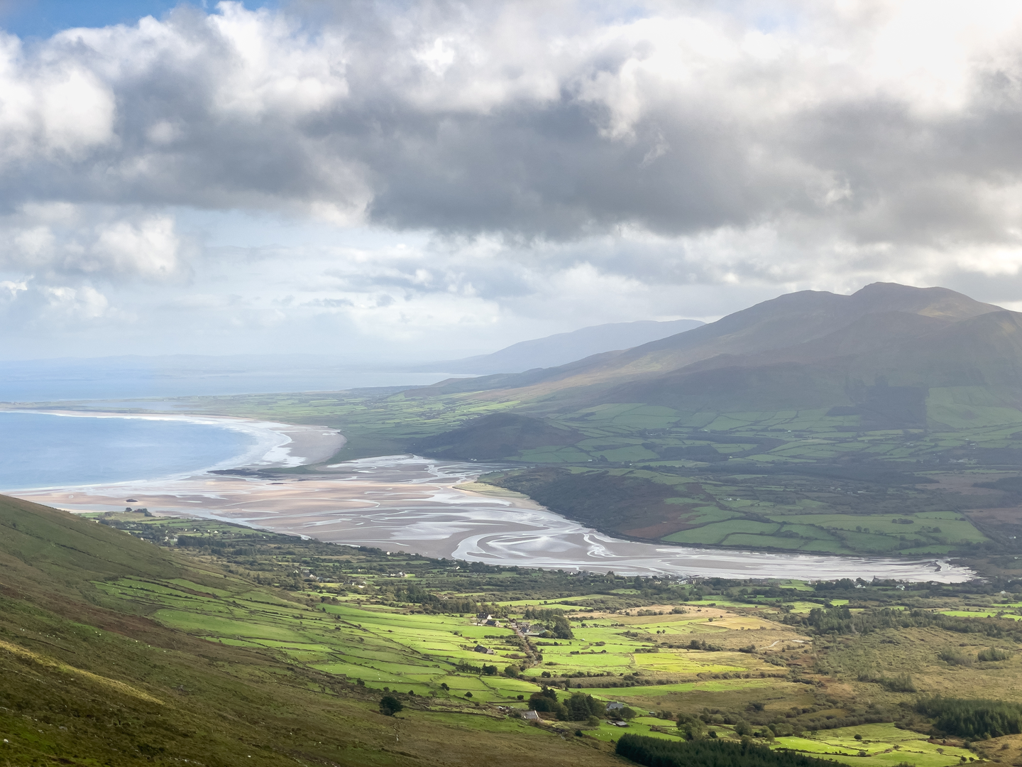
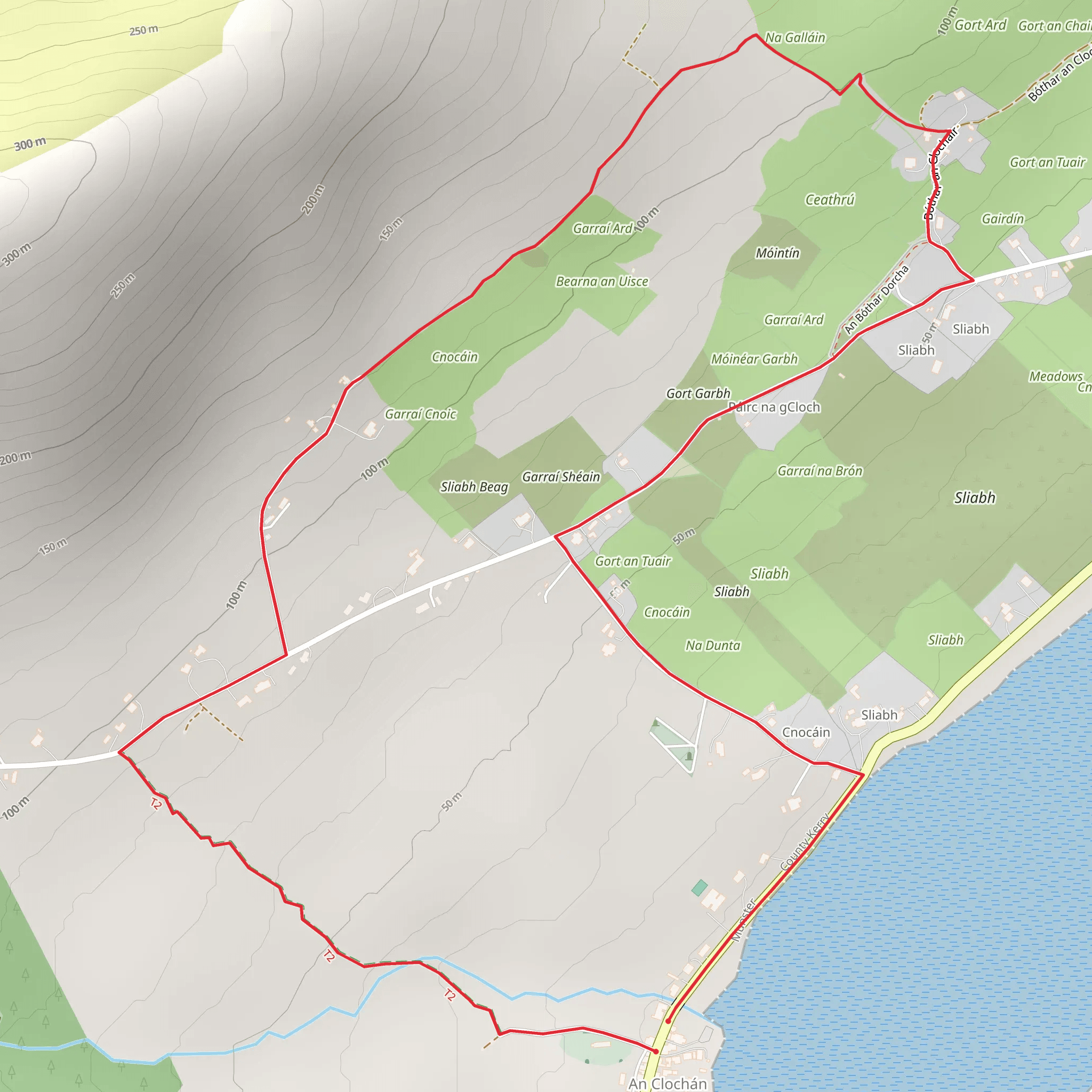
Starting near the picturesque County Kerry in Ireland, this 5 km (approximately 3.1 miles) loop trail offers a delightful mix of natural beauty and historical intrigue. With an elevation gain of around 100 meters (328 feet), the trail is rated as medium difficulty, making it accessible for most hikers with a moderate level of fitness.
Getting There To reach the trailhead, you can drive or use public transport. If driving, head towards the town of Ballyferriter, which is the nearest significant landmark. From Ballyferriter, follow the signs towards the trailhead. For those using public transport, buses run regularly from Dingle to Ballyferriter. From there, it's a short walk to the start of the trail.
Trail Highlights As you embark on this loop trail, you'll be greeted by the lush, rolling hills characteristic of the Irish countryside. The trail is well-marked, but it's always a good idea to have a reliable navigation tool like HiiKER to ensure you stay on track.
#### Historical Significance One of the most captivating aspects of this trail is its historical significance. The name "Slí na nGallán" translates to "Path of the Standing Stones," and true to its name, the trail is dotted with ancient standing stones and ogham stones, which are inscribed with early medieval alphabetic script. These stones are believed to date back to the early centuries AD and offer a fascinating glimpse into Ireland's rich past.
Nature and Wildlife The trail meanders through a variety of landscapes, from open fields to dense woodlands. Keep an eye out for local wildlife, including red foxes, hares, and a variety of bird species such as the chough and the skylark. The flora is equally diverse, with wildflowers like bluebells and foxgloves adding splashes of color to the verdant scenery.
#### Approximate Distances and Elevation - 0-1 km (0-0.6 miles): The initial stretch is relatively flat, allowing you to ease into the hike. You'll pass through open fields with panoramic views of the surrounding hills. - 1-2 km (0.6-1.2 miles): The trail begins to ascend gently, leading you into a wooded area. This section offers some shade and a chance to spot woodland creatures. - 2-3 km (1.2-1.9 miles): As you reach the halfway point, the elevation gain becomes more noticeable. This is where you'll encounter the first of the standing stones. - 3-4 km (1.9-2.5 miles): The trail continues to climb, offering more standing stones and ogham stones. The views from this section are particularly rewarding, with vistas stretching out over the Dingle Peninsula. - 4-5 km (2.5-3.1 miles): The final stretch descends gradually, leading you back to the trailhead. This section is a mix of open fields and woodland, providing a gentle end to your hike.
Practical Tips - **Footwear:** Given the varied terrain, sturdy hiking boots are recommended. - **Weather:** The weather in County Kerry can be unpredictable, so bring a waterproof jacket and layers. - **Supplies:** Carry enough water and snacks, as there are no facilities along the trail. - **Respect the Land:** As always, follow the Leave No Trace principles to preserve the natural and historical beauty of the area.
This trail offers a perfect blend of natural beauty, historical intrigue, and moderate physical challenge, making it a must-visit for anyone exploring County Kerry.
Comments and Reviews
User comments, reviews and discussions about the Slí na nGallán, Ireland.
4.3
average rating out of 5
20 rating(s)

