Download
3D Flyover
Add to list
More
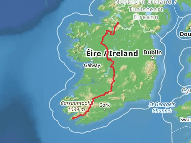
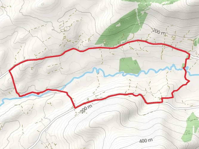
72.1 km
~3 days
1994 m
Multi-Day
“Embark on Ireland's Slí Gaeltacht Mhúscraí, a trail weaving cultural tapestries amid breathtaking vistas.”
The Slí Gaeltacht Mhúscraí is a captivating trail that meanders through the scenic landscapes of County Cork, Ireland, offering hikers a unique blend of cultural heritage and natural beauty. Spanning approximately 72 kilometers (about 45 miles) with an elevation gain of around 1800 meters (roughly 5900 feet), this point-to-point trail is a journey through the heart of the Irish-speaking Gaeltacht region.
Getting to the Trailhead
To reach the starting point of the Slí Gaeltacht Mhúscraí, hikers can travel to the town of Kealkill, which is the nearest significant landmark to the trailhead. For those coming by car, Kealkill is accessible via the R584 road. There is parking available in the town, from where you can embark on your hike. Public transport options are limited in this rural area, but regional buses may run to nearby towns, and from there, a taxi can be taken to Kealkill.
Navigating the Trail
The trail is well-marked with the standard yellow walking man and arrows used in Ireland's National Waymarked Trails. Hikers can also use the HiiKER app to navigate the trail, ensuring they stay on the correct path and can anticipate upcoming changes in terrain or elevation.
Cultural and Historical Significance
As you traverse the Slí Gaeltacht Mhúscraí, you'll be walking through a region steeped in Irish culture and history. The trail passes through areas where Irish is still the primary language, and hikers will have the opportunity to experience the rich traditions and customs of the Gaeltacht communities. Along the route, you'll encounter historical landmarks such as standing stones, ring forts, and ancient burial sites, which offer a glimpse into Ireland's past.
Landmarks and Natural Features
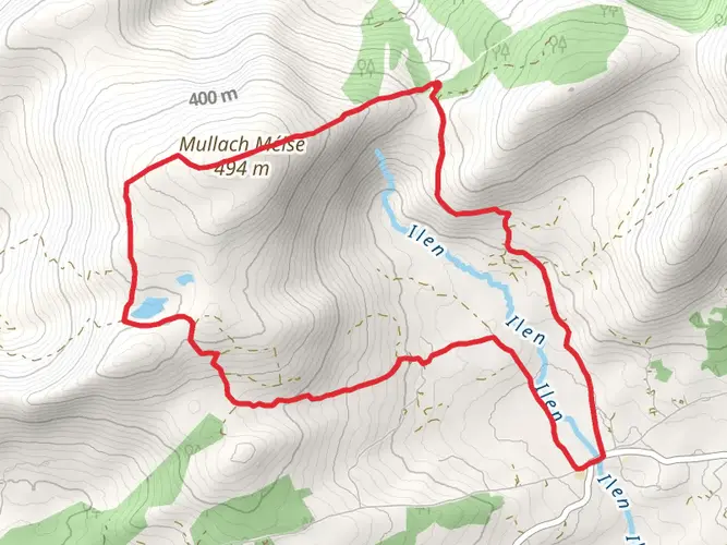
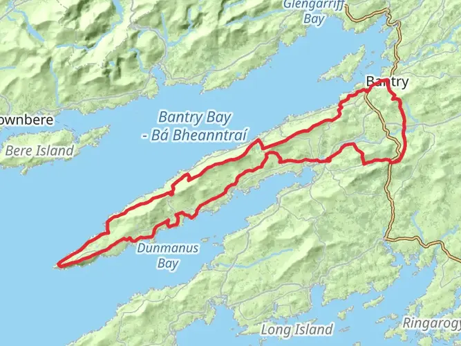
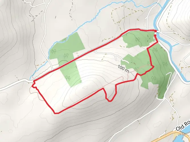
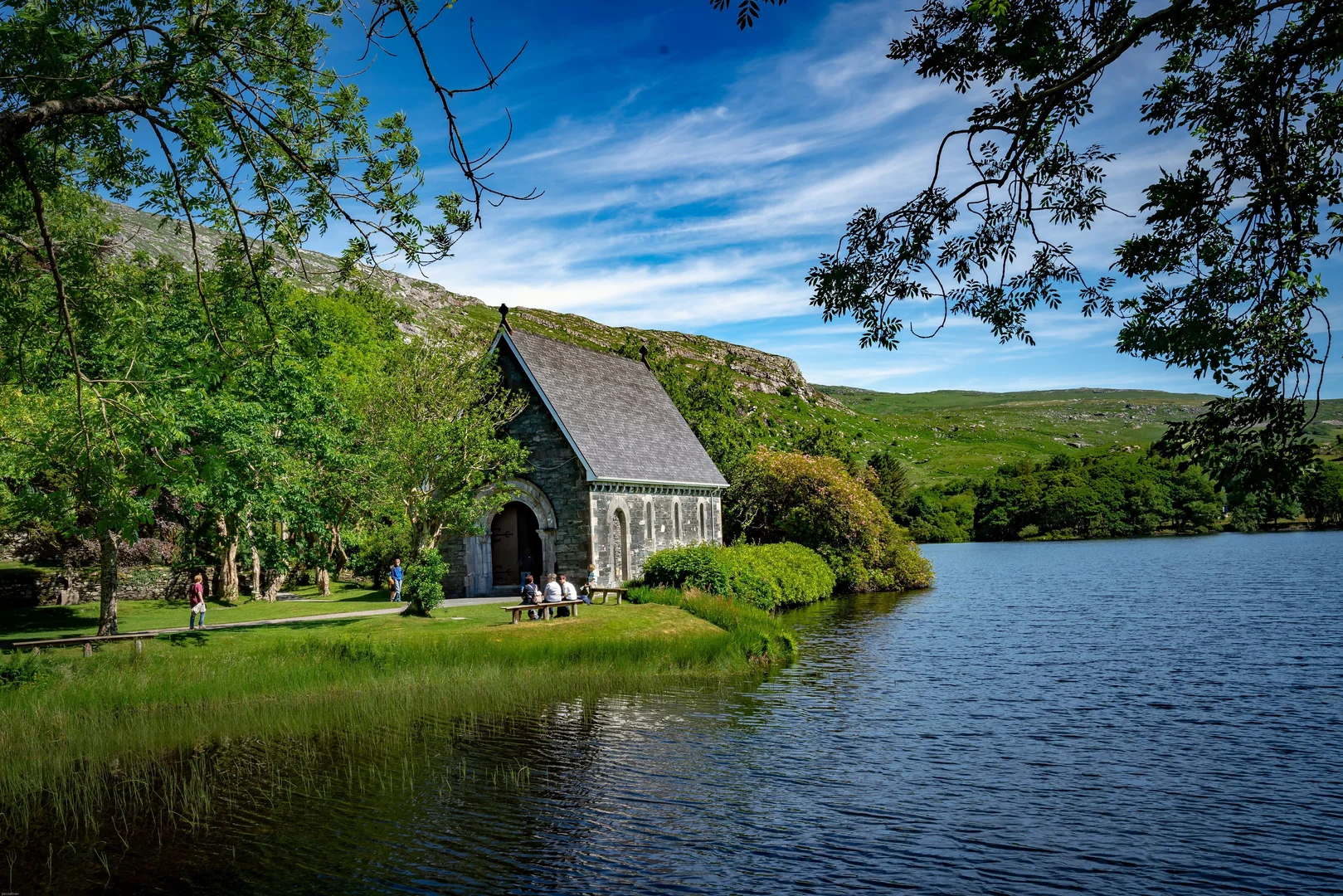
The trail offers a diverse range of landscapes, from rolling hills and quiet woodlands to rugged mountain terrain. One of the significant landmarks you'll pass is Gougane Barra, a picturesque valley where the River Lee rises and the site of a 6th-century monastery founded by St. Finbarr. The area is not only a spiritual and historical site but also a place of stunning natural beauty, with the forest park providing a habitat for a variety of wildlife.
Flora and Fauna
As you hike, keep an eye out for the rich flora and fauna that inhabit the region. The woodlands and heathlands are home to a variety of bird species, while the open mountain areas may offer sightings of native mammals such as red deer and foxes. The plant life is equally diverse, with a range of wildflowers and plants that are native to the Irish countryside.
Preparation and Planning
Given the trail's medium difficulty rating, hikers should be prepared for some challenging sections, particularly where the elevation gain is most significant. It's advisable to wear sturdy hiking boots and bring waterproof clothing, as the weather can be unpredictable. Ensure you have enough food and water for the journey, as there are limited facilities along the route.
Conclusion
The Slí Gaeltacht Mhúscraí is a trail that offers more than just a physical challenge; it's a journey through the living culture and history of Ireland. With its varied landscapes, historical sites, and the chance to immerse oneself in the Irish language and traditions, it's a hike that will leave a lasting impression on all who walk its path.

What to expect?
Activity types
Surfaces
Unknown
Gravel
Asphalt
Comments and Reviews
User comments, reviews and discussions about the Slí Gaeltacht Mhúscraí, Ireland.
4.53
average rating out of 5
32 rating(s)