Download
Preview
Add to list
More
3.8 km
~46 min
10 m
Loop
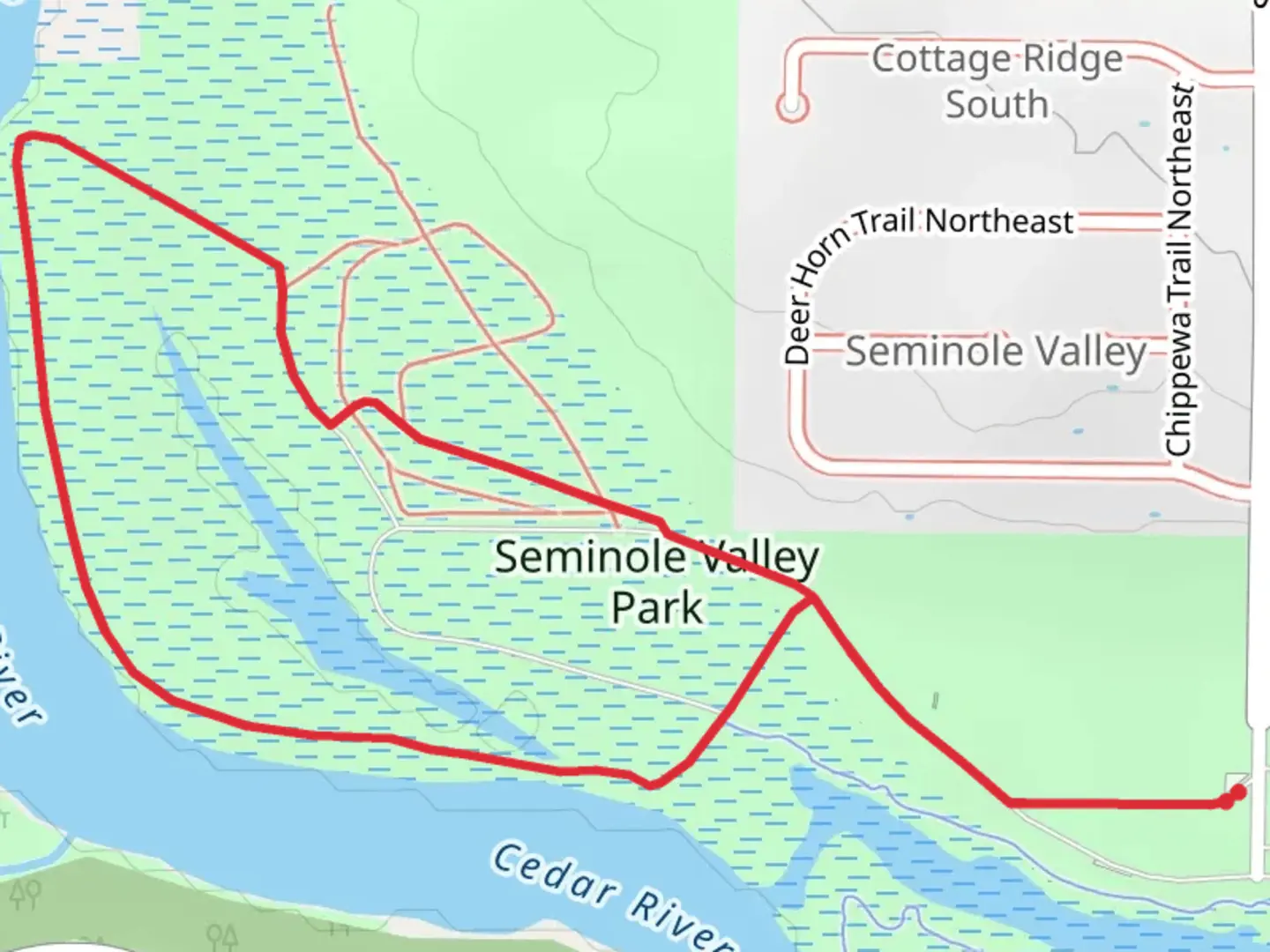
“Explore the scenic, history-rich Seminole Valley and Cedar River Loop, a 2.5-mile trail ideal for all.”
Starting near Linn County, Iowa, the Seminole Valley and Cedar River Loop is a delightful 4 km (approximately 2.5 miles) trail with virtually no elevation gain, making it accessible for a wide range of hikers. The trailhead is conveniently located near the Seminole Valley Park, which can be accessed by car or public transport. If you're driving, you can park at the Seminole Valley Park parking lot. For those using public transport, the nearest bus stop is at the intersection of Seminole Valley Road and Ellis Road, just a short walk from the trailhead.
Trail Navigation and Terrain
The loop trail is well-marked and easy to follow, but it's always a good idea to have a reliable navigation tool like HiiKER to ensure you stay on track. The terrain is relatively flat, with a mix of dirt paths and grassy sections. Given the lack of significant elevation gain, the trail is rated as medium difficulty primarily due to its length and some uneven surfaces.
Natural Features and Wildlife
As you embark on the trail, you'll be greeted by the serene beauty of the Cedar River, which runs parallel to parts of the loop. The river provides a picturesque backdrop and is home to a variety of waterfowl, including ducks and herons. Keep an eye out for turtles basking on logs near the riverbanks.
The trail meanders through a mix of woodlands and open meadows, offering a diverse range of flora. In the spring and summer months, wildflowers such as coneflowers, black-eyed Susans, and goldenrods add vibrant splashes of color to the landscape. The wooded sections are dominated by oak, maple, and hickory trees, providing ample shade and a cool respite during warmer days.
Historical Significance
The region around the Seminole Valley and Cedar River Loop has a rich history. The Cedar River was historically significant for the Native American tribes that inhabited the area, including the Meskwaki and Sauk tribes. The river served as a vital resource for fishing, transportation, and trade. As you hike, you may come across informational plaques that provide insights into the historical and cultural significance of the area.
Points of Interest
Around the 1 km (0.6 mile) mark, you'll encounter a charming wooden footbridge that crosses a small creek feeding into the Cedar River. This is a great spot for a quick rest and some photo opportunities. Approximately halfway through the loop, you'll find a scenic overlook that offers a panoramic view of the Cedar River and the surrounding landscape. This is an ideal location to take a break and soak in the natural beauty.
Preparing for Your Hike
Given the trail's moderate difficulty, it's advisable to wear sturdy hiking shoes, especially since some sections can be uneven or muddy after rain. Bring plenty of water, as there are no water sources along the trail. Insect repellent is also recommended, particularly during the warmer months when mosquitoes and ticks are more prevalent.
Getting There
To reach the trailhead by car, head towards Seminole Valley Park, located at 1795 Seminole Valley Rd NE, Cedar Rapids, IA 52411. If you're using public transport, take the local bus to the stop at the intersection of Seminole Valley Road and Ellis Road, and then walk a short distance to the park entrance.
Enjoy your hike on the Seminole Valley and Cedar River Loop, where the blend of natural beauty and historical significance offers a rewarding outdoor experience.
What to expect?
Activity types
Comments and Reviews
User comments, reviews and discussions about the Seminole Valley and Cedar River Loop, Iowa.
4.62
average rating out of 5
60 rating(s)
