Download
3D Flyover
Add to list
More
42.7 km
~2 days
987 m
Multi-Day
“Embark on the rugged, history-rich Adventure Hiking Trail for an immersive journey through Indiana's natural splendor.”
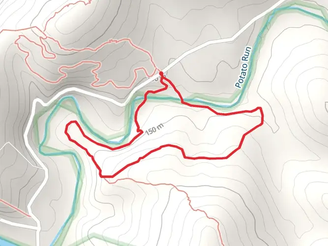
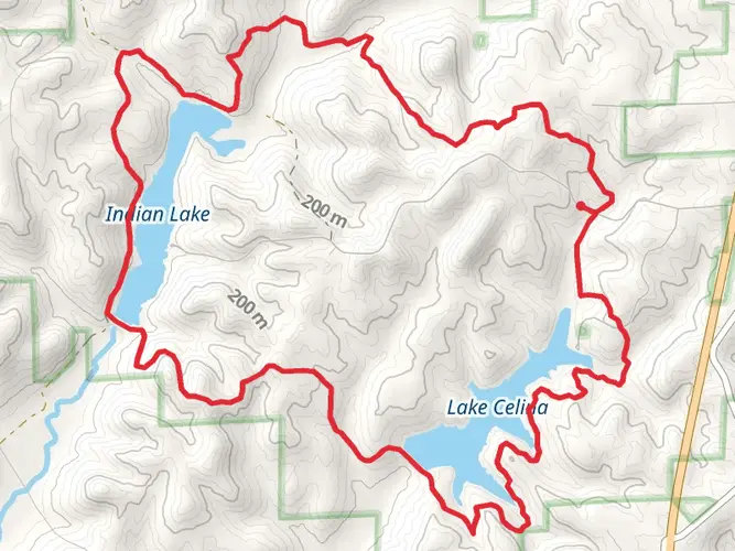
The Adventure Hiking Trail is a challenging loop that spans approximately 43 kilometers (around 26.7 miles) with an elevation gain of about 900 meters (roughly 2950 feet), nestled in the lush forests near Harrison County, Indiana. This trail is not for the faint of heart, as it is rated difficult due to its length and the rugged terrain it traverses.
Getting to the Trailhead
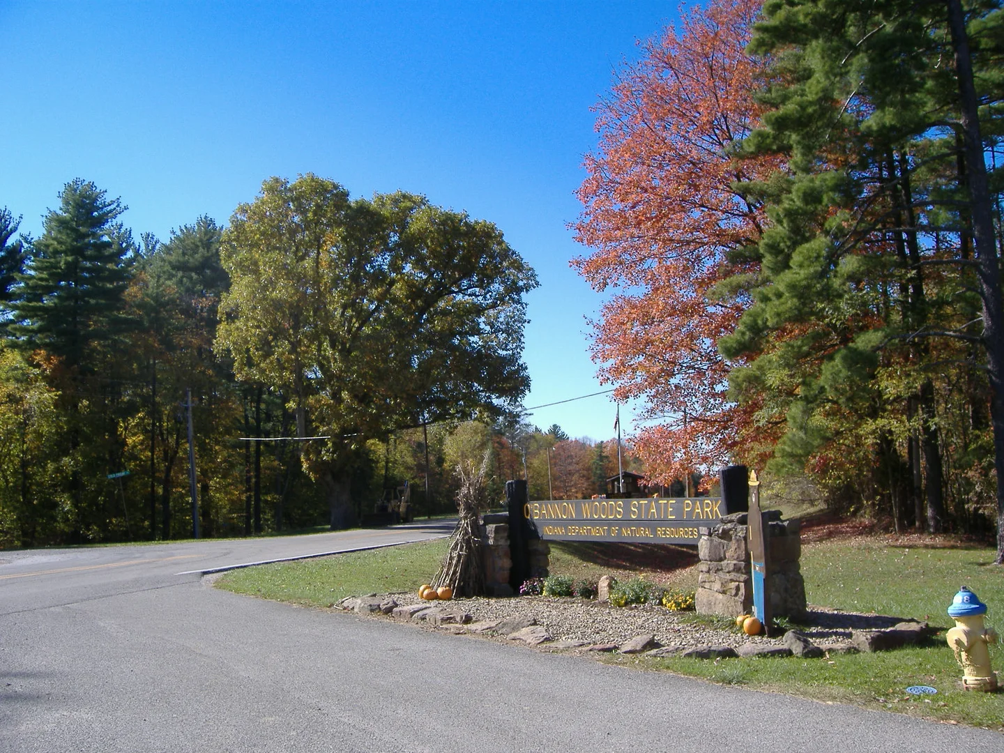
To reach the starting point of the Adventure Hiking Trail, hikers can drive to the O'Bannon Woods State Park, which is the nearest significant landmark. The trailhead is accessible via Highway 462, leading to the park's entrance. For those relying on public transportation, options are limited, and it's advisable to check the latest schedules and routes for any available services to nearby towns, from where a taxi or a ride-share service can be used to reach the park.
Trail Experience
As you embark on the Adventure Hiking Trail, prepare to be enveloped by dense hardwood forests, which are home to a diverse array of flora and fauna. The trail will lead you through a series of steep inclines and declines, with the terrain varying from rocky outcrops to soft forest floor covered in a blanket of fallen leaves.
Landmarks and Natural Features
Approximately 10 kilometers (6.2 miles) into the hike, you'll encounter the first significant landmark, the Cold Friday Viewpoint. Here, hikers can take a moment to rest and enjoy the panoramic views of the Blue River valley. As you continue, the trail meanders close to the Ohio River, offering glimpses of the waterway that played a crucial role in the development of the region.
Historical Significance
The area surrounding the Adventure Hiking Trail is steeped in history. The land was once inhabited by indigenous peoples, and later, European settlers used the Ohio River as a vital transportation and trade route. Throughout the hike, you may come across remnants of early settlements and old homesteads, providing a tangible connection to the past.
Wildlife Encounters
The forests of Harrison County serve as a habitat for a variety of wildlife. Deer, wild turkeys, and numerous bird species are commonly sighted. Hikers should be aware that the area is also home to snakes, including venomous species, so caution is advised when navigating through underbrush or rocky areas.
Navigation and Preparation
Given the trail's length and difficulty, it is essential to be well-prepared with adequate supplies, including water, food, and a first-aid kit. Weather conditions can change rapidly, so layered clothing is recommended. For navigation, the HiiKER app can be an invaluable tool, offering detailed maps and GPS coordinates to keep you on the right path.
Elevation Profile
The trail's elevation gain is gradual but noticeable, with the highest point reaching around 900 meters. This is encountered roughly halfway through the hike, so it's important to pace yourself and conserve energy for the ascent and the subsequent descent.
Conclusion
The Adventure Hiking Trail offers a rewarding experience for those seeking a challenging hike amidst the natural beauty of Indiana's woodlands. With its historical significance and the potential for wildlife encounters, it provides an enriching journey through one of the state's most scenic areas. Proper preparation and awareness of the trail's demands will ensure a safe and enjoyable adventure.

What to expect?
Activity types
Frequently asked questions
How long does the Adventure Hiking Trail take to hike in Harrison County, Indiana?
The Adventure Hiking Trail is 42.69 km, or about 26.5 miles, with 987 m of climbing, so it is usually treated as a multi-day backpacking route rather than a short day hike. Many hikers split it into two or three days because the loop includes repeated steep climbs and descents through O'Bannon Woods State Park and Harrison-Crawford State Forest.
Where do you park for the Adventure Hiking Trail in O'Bannon Woods State Park?
Adventure Hiking Trail access includes parking at O'Bannon Woods State Park and another public parking area just off State Road 62 in Harrison-Crawford State Forest. The route also crosses State Road 462, and that road is a key access corridor for reaching trail entry points near the park and forest.
Can you camp on the Adventure Hiking Trail, and are there shelters on the route?
The Adventure Hiking Trail is one of Indiana's designated backpacking trails, and the route has backcountry shelters reserved for hikers on the trail. In the Harrison-Crawford State Forest section, shelters are first come, first served and are only available to Adventure Trail hikers, which is one reason the loop is commonly done as an overnight trip.
Is the Adventure Hiking Trail a loop trail or an out-and-back hike?
The Adventure Hiking Trail is a loop in southern Indiana, running through both O'Bannon Woods State Park and Harrison-Crawford State Forest. That makes logistics simpler than a point-to-point backpack, because the route returns to the starting area after roughly 42.69 km.
How difficult is the Adventure Hiking Trail near Corydon, Indiana?
The Adventure Hiking Trail is best described as a strenuous medium-to-hard backpacking route. Even though the listed difficulty is medium, the trail packs 987 m of elevation gain into 42.69 km and includes rugged ridge-and-hollow terrain, steep hillside climbs, and repeated descents toward creek and river bottoms.
What are the main landmarks on the Adventure Hiking Trail?
The Adventure Hiking Trail passes through the forested hills above the Blue River and includes named points such as Cold Friday Road and the State Road 462 crossing. A commonly noted scenic stop is Cold Friday Viewpoint, which looks out over the Blue River valley and helps break up the longer miles on the loop.
Is the Adventure Hiking Trail inside O'Bannon Woods State Park or Harrison-Crawford State Forest?
The Adventure Hiking Trail is not confined to just one property. It runs through both O'Bannon Woods State Park and Harrison-Crawford State Forest, so the hike combines state park access and facilities with a longer backcountry-style forest section on the same loop.
Comments and Reviews
User comments, reviews and discussions about the Adventure Hiking Trail, Indiana.
4.63
average rating out of 5
16 rating(s)