Download
3D Flyover
Add to list
More
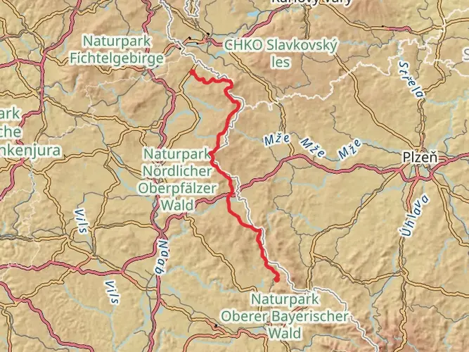
75.5 km
~3 days
1084 m
Multi-Day
“Embark on the Glasschleifereweg, a scenic Bavarian hike blending historical intrigue with natural splendor over rolling hills.”
The Glasschleifereweg is a captivating loop trail that spans approximately 76 kilometers (about 47 miles) and features an elevation gain of around 1000 meters (approximately 3280 feet), offering a moderately challenging experience for hikers. This trail is nestled near Pleystein, a small town in the Upper Palatinate region of Bavaria, Germany, known for its picturesque landscapes and historical significance.
Getting to the Trailhead
To reach the starting point of the Glasschleifereweg, hikers can drive to the vicinity of Pleystein, where parking is available. For those relying on public transportation, buses serve the area, and the nearest significant bus stops are within Pleystein itself. From there, it's a short walk to the trailhead, where the adventure begins.
Navigating the Trail
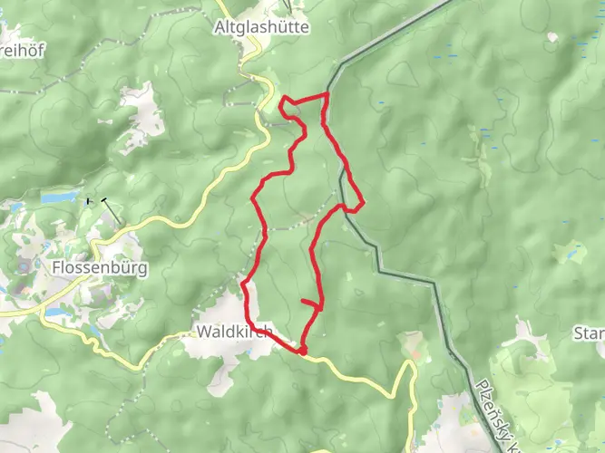
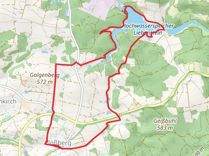
As you embark on the Glasschleifereweg, you'll traverse a variety of terrains, including lush forests, rolling hills, and serene river valleys. The trail is well-marked, but carrying a reliable navigation tool like HiiKER is advisable to ensure you stay on the right path and can track your progress along the route.
Historical Significance and Landmarks
The region is steeped in history, with the trail's name, "Glasschleifereweg," paying homage to the traditional glass grinding industry that once thrived here. As you hike, you'll encounter remnants of this past, including old grinding workshops and historical sites where glassblowers and craftsmen honed their trade.
Natural Beauty and Wildlife
The trail offers an immersive experience into the natural beauty of the Upper Palatinate's landscape. Expect to see a diverse array of flora and fauna, with the possibility of spotting deer, birds of prey, and other wildlife in their natural habitat. The changing seasons bring a kaleidoscope of colors, from the vibrant greens of spring to the rich hues of autumn.
Elevation and Terrain Challenges
While the total elevation gain is significant, it's spread out over the length of the trail, with no excessively steep sections. However, be prepared for some gradual ascents and descents as you navigate through the varied topography. The trail is suitable for hikers with a moderate level of fitness and experience.
Preparation and Planning
Before setting out, ensure you have adequate supplies, including water, snacks, and appropriate clothing for the weather conditions. The trail can be completed in several days, so plan your accommodations accordingly, whether you prefer camping or staying in local guesthouses along the route.
Conclusion
The Glasschleifereweg is a journey through history, nature, and the cultural heritage of the Bavarian landscape. With its moderate difficulty and rich experiences, it's a trail that offers something for every hiker looking to explore the heart of Germany's countryside.

Frequently asked questions
How long does the Glasschleifereweg take to hike as a multi-day route?
The Glasschleifereweg is a 75.52 km multi-day loop with 1,084 meters of climbing, so most hikers split it across about 4 days. That works out to roughly 18 to 20 km per day, which fits the trail’s difficult rating better than trying to cover the full circuit in a weekend day hike.
Can the Glasschleifereweg be hiked in stages, and how many stages does the Glasschleifereweg usually have?
Yes. The Glasschleifereweg is commonly broken into multi-day stages rather than walked in one push. A practical plan is about 4 days based on the 75.52 km total distance, while some published itineraries in the Upper Palatinate Forest region divide the broader Glasschleifererweg circuit into 5 or 6 shorter stages between places such as Pleystein, Moosbach, Waidhaus, Eslarn, Tröbes, and Gehenhammer.
Where does the Glasschleifereweg start, and is there parking for the Glasschleifereweg near Pleystein?
The route is in the Pleystein area of Bavaria, and local tourism information places the Glasschleifererweg in the northern Upper Palatinate Forest with access from the Pleystein and Georgenberg area. Parking is available in the vicinity of Pleystein, making it practical for hikers starting or joining the loop by car rather than public transit.
Is there a map for the Glasschleifereweg, and is the Glasschleifereweg waymarked on the ground?
Yes. The Glasschleifererweg is a signed long-distance circuit in the Oberpfälzer Wald, and the route is marked with a wine-glass symbol on a red background. A map is useful because the full loop is around 75.52 km on HiiKER and about 80 km in regional tourism listings, so navigation matters over several days and through multiple villages.
What kind of scenery and landmarks are on the Glasschleifereweg?
The Glasschleifereweg combines low mountain scenery with industrial heritage in the Upper Palatinate Forest. Regional route descriptions mention the Zott, Pfreimd, and Tröbesbach valleys, and the trail passes through or near Pleystein, Moosbach, Burgtreswitz, Eslarn, and Waidhaus, with repeated references to former glass-grinding and polishing sites along the way.
Is the Glasschleifereweg a good long-distance hike in Germany for a 3- to 4-day trip?
Yes. At 75.52 km with 1,084 meters of ascent, the Glasschleifereweg fits well into a 3- to 4-day long-distance hiking plan in Germany. The route is long enough to feel like a true multi-day trek, but the elevation is moderate enough that strong hikers can cover it in shorter daily sections if accommodations are planned in advance around the Pleystein area.
Comments and Reviews
User comments, reviews and discussions about the Glasschleifereweg, Germany.
4.67
average rating out of 5
6 rating(s)