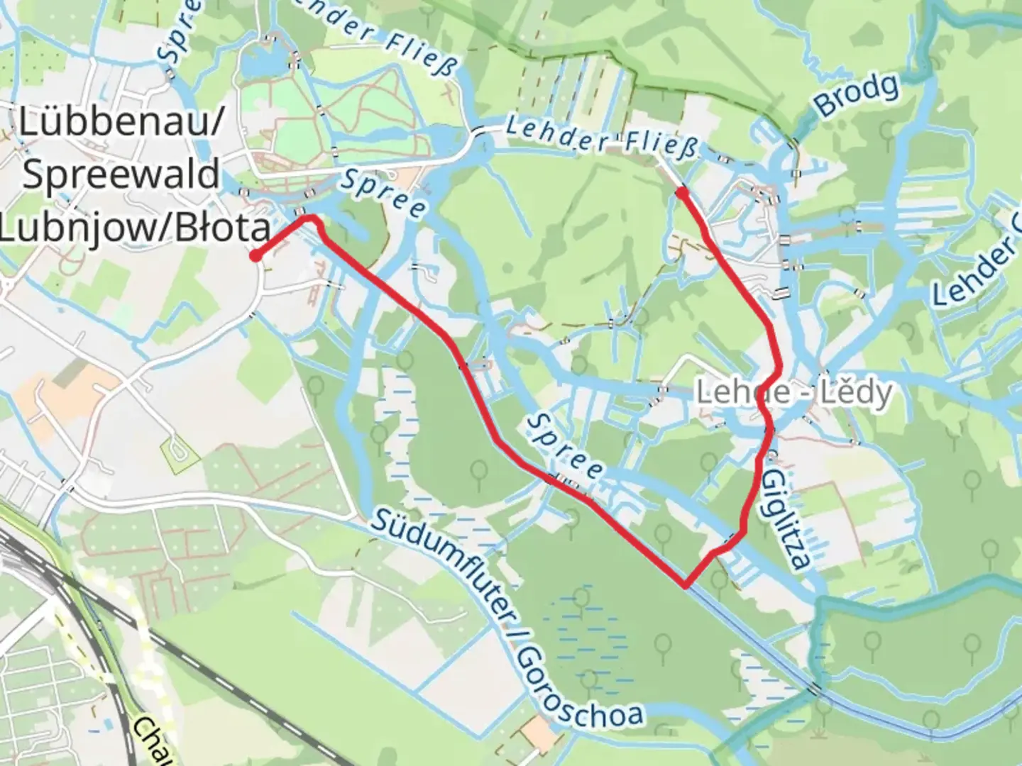
SpreeNav Kanal via Am Neuen Fließ
Download
3D Flyover
Add to list
More
2.5 km
~29 min
0 m
Point-to-Point
“Explore the serene Spreewald region on an easy, scenic 2 km trail rich in biodiversity and history.”
Starting near Oberspreewald-Lausitz - Górne Błota-Łužyca, Germany, this 2 km (1.24 miles) point-to-point trail offers an easy and scenic hike with no elevation gain, making it accessible for hikers of all levels. The trailhead is conveniently located near the town of Lübbenau, which is well-connected by public transport. You can reach Lübbenau by taking a regional train from Berlin or Dresden, and from the train station, it's a short taxi ride or a leisurely walk to the trailhead.
Trail Overview
The SpreeNav Kanal via Am Neuen Fließ trail meanders through the picturesque Spreewald region, renowned for its network of waterways, lush forests, and rich biodiversity. As you set off, you'll be greeted by the serene ambiance of the Spreewald Biosphere Reserve, a UNESCO-designated area known for its unique landscape and cultural heritage.
Key Landmarks and Points of Interest
1. Spreewald Biosphere Reserve: The trail runs through this protected area, home to a variety of flora and fauna. Keep an eye out for rare bird species such as the white stork and the black woodpecker. The dense forests and tranquil waterways create a perfect habitat for these birds, making it a birdwatcher's paradise.
2. Am Neuen Fließ: Approximately 1 km (0.62 miles) into the hike, you'll come across the Am Neuen Fließ, a small, charming waterway that adds to the trail's scenic beauty. The gentle flow of the water and the surrounding greenery provide a peaceful spot for a short break or a photo opportunity.
3. Historical Significance: The Spreewald region has a rich history dating back to the Slavic settlement in the 6th century. The area is dotted with traditional wooden houses and watermills, reflecting the cultural heritage of the Sorbian people. As you hike, you'll notice some of these historical structures, offering a glimpse into the past.
Navigation and Safety
Given the easy difficulty rating and well-marked paths, navigation is straightforward. However, it's always a good idea to have a reliable navigation tool like HiiKER to ensure you stay on track. The app provides detailed maps and real-time updates, making your hike stress-free.
Getting There
By Public Transport: From Berlin or Dresden, take a regional train to Lübbenau. The train journey from Berlin takes about 1.5 hours, while from Dresden, it takes around 1 hour. Once you arrive at Lübbenau station, you can either take a taxi or enjoy a 20-minute walk to the trailhead.
By Car: If you prefer driving, Lübbenau is easily accessible via the A13 motorway. There are several parking options available near the trailhead, including public parking lots in Lübbenau.
Wildlife and Nature
The Spreewald region is a haven for wildlife enthusiasts. Besides the diverse bird species, you might also encounter deer, foxes, and various amphibians. The lush vegetation includes alder, oak, and beech trees, creating a vibrant and diverse ecosystem. The trail's flat terrain and well-maintained paths make it an enjoyable experience for all ages.
This easy 2 km hike through the Spreewald region offers a delightful blend of natural beauty, historical significance, and cultural heritage. Whether you're a seasoned hiker or a beginner, this trail provides a perfect escape into nature.

What to expect?
Activity types
Comments and Reviews
User comments, reviews and discussions about the SpreeNav Kanal via Am Neuen Fließ, Germany.
4.0
average rating out of 5
2 rating(s)