Download
3D Flyover
Add to list
More
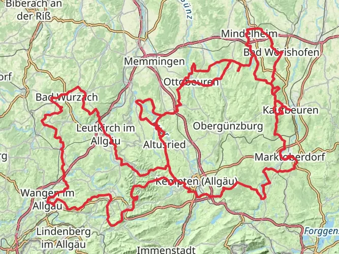
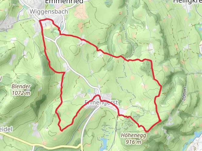
222.7 km
~10 days
7250 m
Multi-Day
“Embark on the Oberallgäuer-Rundwanderweg for a captivating trek through Germany's alpine splendor and cultural tapestry.”
Embarking on the Oberallgäuer-Rundwanderweg, hikers will traverse approximately 223 kilometers (about 139 miles) of varied terrain, with an elevation gain of around 7200 meters (roughly 23,622 feet). This loop trail, nestled in the picturesque region of Oberallgäu in Germany, is a challenging adventure that offers a blend of natural beauty, cultural experiences, and historical insights.
Getting to the Trailhead
The journey begins near the town of Oberallgäu, which is accessible by public transportation or car. If arriving by train, the nearest major railway station is in Kempten. From there, regional buses can take you closer to the trailhead. For those driving, parking is available in the vicinity of the starting point. It's advisable to use a navigation tool like HiiKER to pinpoint the exact location and plan your route to the trailhead.
Navigating the Trail
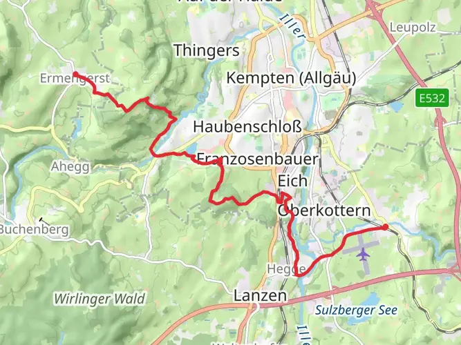
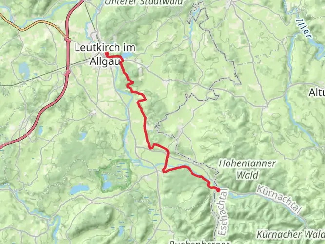
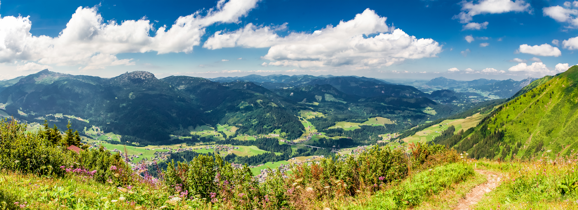
As you set out on the trail, you'll be greeted by the lush Allgäu meadows, with the majestic Alps providing a stunning backdrop. The path will lead you through dense forests, serene valleys, and over high mountain passes. The trail is well-marked, but due to its length and complexity, carrying a reliable navigation tool like HiiKER is essential to stay on track and monitor your progress.
Landmarks and Natural Wonders
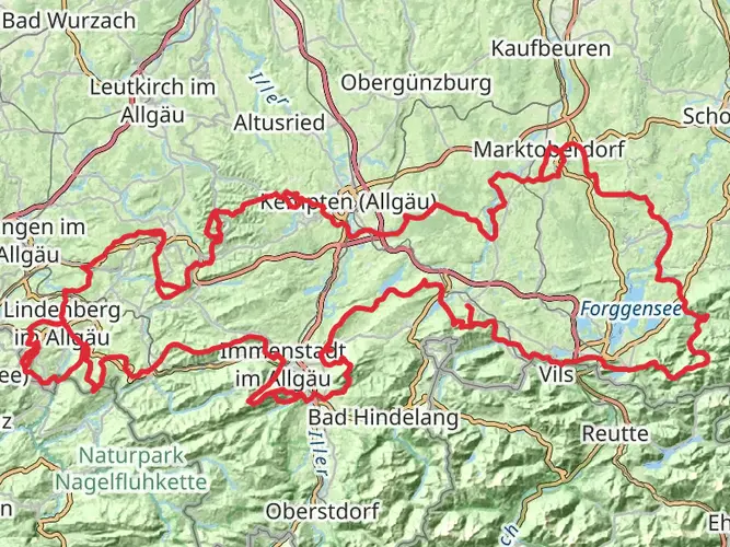
Throughout your journey, you'll encounter a variety of landmarks and natural wonders. The trail takes you past the iconic Schrecksee, a high alpine lake known for its crystal-clear waters and the dramatic mountains that surround it. You'll also pass through the charming village of Bad Hindelang, which offers a glimpse into traditional Allgäu architecture and culture.
Wildlife and Flora
The region is rich in wildlife, and if you're fortunate, you may spot chamois, marmots, and golden eagles. The diverse flora along the trail includes alpine roses, edelweiss, and a range of medicinal herbs that have been used in the area for centuries.
Historical Significance
The Oberallgäu region is steeped in history, with evidence of human settlement dating back to the Bronze Age. As you hike, you'll come across historical sites such as old castles, ancient churches, and ruins that tell the story of the region's past.
Preparation and Planning
Given the trail's difficulty rating, it's crucial to be well-prepared. Ensure you have appropriate gear for varying weather conditions and comfortable hiking boots, as the terrain can be challenging. It's also wise to plan for multiple days of hiking, with stops at mountain huts or inns along the way for rest and replenishment.
Safety and Etiquette
Always respect the natural environment by staying on marked paths and practicing Leave No Trace principles. Be prepared for sudden weather changes, and always inform someone of your itinerary. Given the trail's length and elevation gain, it's important to assess your fitness level and hiking experience before attempting the full loop.
By taking the time to prepare and plan, hikers can look forward to an unforgettable experience on the Oberallgäuer-Rundwanderweg, immersing themselves in the natural beauty and rich history of this unique region.

Frequently asked questions
How long is the Oberallgäuer-Rundwanderweg and how many days does it usually take?
The Oberallgäuer-Rundwanderweg is 222.66 km long with 7,250 m of total ascent, so it is firmly a multi-day route rather than a weekend loop. A commonly used breakdown is 11 stages, which puts most days at roughly 20 km, but stronger hikers may combine sections while others allow closer to two weeks for a steadier pace.
How difficult is the Oberallgäuer-Rundwanderweg in Oberallgäu?
The Oberallgäuer-Rundwanderweg is rated Extra Difficult, and the numbers explain why: 222.66 km of distance and 7,250 m of climbing add up to a demanding long-distance hike. It crosses a mix of valley paths, forest tracks, meadow walking, and higher alpine terrain, so it suits experienced hikers with solid fitness and multi-day mountain experience.
Is there a map for the Oberallgäuer-Rundwanderweg?
Yes. The Oberallgäuer-Rundwanderweg is a mapped long-distance loop in Oberallgäu, and the route is commonly divided into 11 stages, which makes navigation and daily planning much easier. For on-trail use, a stage-by-stage map is the practical way to follow a 222.66 km circuit with significant elevation change across the Allgäu region.
Where does the Oberallgäuer-Rundwanderweg start, and how do hikers get there?
The route is a circuit in Oberallgäu, so there is no single mandatory start point, but Kempten is the main rail gateway for reaching the region. From Kempten, regional bus connections reach trail-access towns in Oberallgäu, which makes it practical to join the loop without a car as well as to start from a parking area near a chosen stage.
What are the main highlights on the Oberallgäuer-Rundwanderweg?
One of the best-known highlights linked with the Oberallgäuer-Rundwanderweg is Schrecksee, a striking alpine lake above Hinterstein at about 1,813 m. Over the full loop, the route also passes classic Allgäu scenery including meadows, forest, valleys, and higher mountain sections, giving it a broad cross-section of the Oberallgäu landscape rather than a single-peak objective.
Is the Oberallgäuer-Rundwanderweg suitable for beginners or families?
The Oberallgäuer-Rundwanderweg is generally not a beginner or family-focused long-distance trail. With 222.66 km of hiking, 7,250 m of ascent, and an Extra Difficult rating, it is better suited to hikers who are comfortable with consecutive long days, mountain weather, and sustained climbs over multiple stages.
Comments and Reviews
User comments, reviews and discussions about the Oberallgäuer-Rundwanderweg, Germany.
4.8
average rating out of 5
5 rating(s)