
Download
3D Flyover
Add to list
More
3.6 km
~48 min
50 m
Loop
“The Witthausbusch Loop offers a scenic, accessible 4 km hike through forests, meadows, and historical landmarks.”
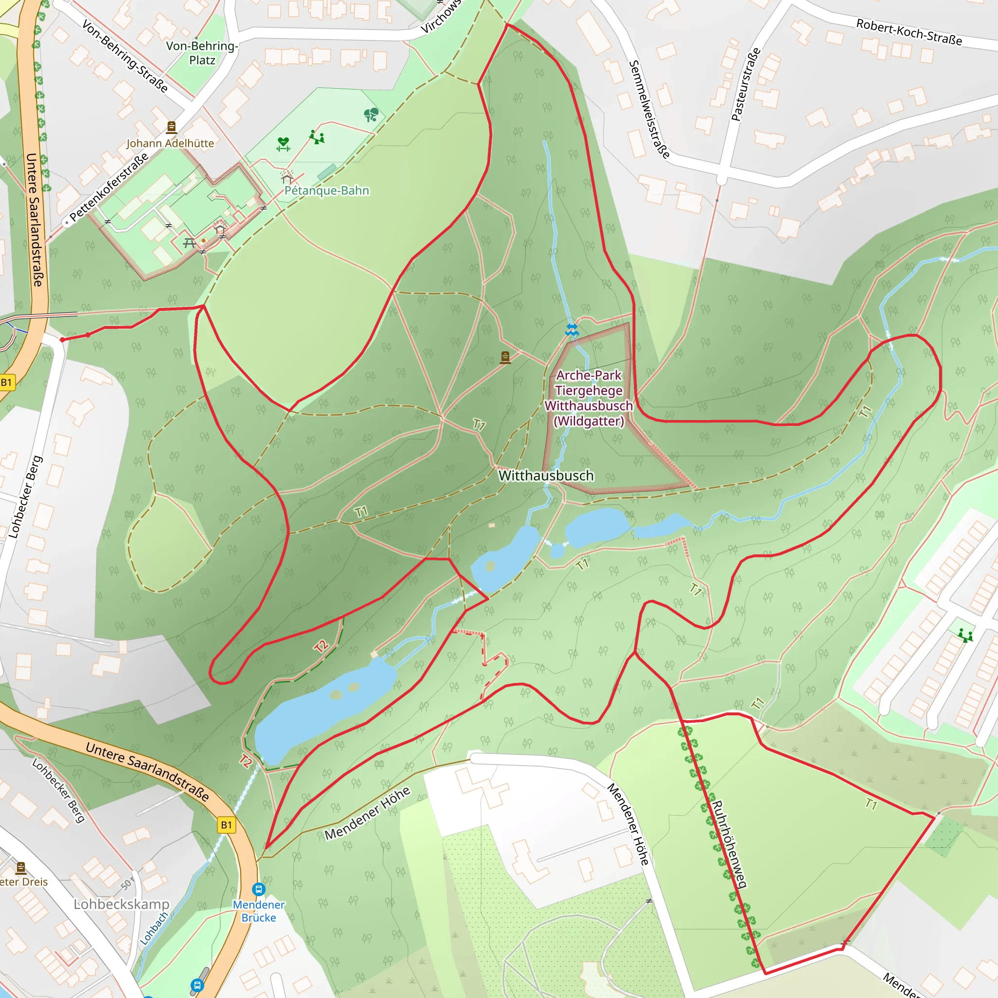
Starting near Mülheim an der Ruhr, Germany, the Witthausbusch Loop via Balken Rumbachtal and GeoRoute Ruhr is a delightful 4 km (approximately 2.5 miles) loop trail with no significant elevation gain, making it accessible for a wide range of hikers. The trailhead is conveniently located near the Witthausbusch Park, a well-known recreational area in Mülheim an der Ruhr.
Getting There
For those using public transport, the Mülheim an der Ruhr Hauptbahnhof (main train station) is the closest major station. From there, you can take a local bus to the Witthausbusch Park. If you're driving, there is ample parking available at the park itself.
Trail Overview
The trail is estimated to be of medium difficulty, primarily due to its varied terrain rather than any significant elevation changes. The loop takes you through a mix of forested areas, open meadows, and along the scenic Rumbachtal valley.
Key Sections and Landmarks
Witthausbusch Park
Starting at Witthausbusch Park, you'll find yourself surrounded by lush greenery and well-maintained paths. This park is a popular spot for locals, featuring a small zoo and playgrounds, making it a great place to start or end your hike.
Balken Rumbachtal
As you proceed, you'll enter the Rumbachtal valley, a serene area characterized by its dense forest and the gentle flow of the Rumbach stream. This section is particularly beautiful in the spring and autumn when the foliage is at its most vibrant. Keep an eye out for local wildlife such as deer, foxes, and a variety of bird species.
GeoRoute Ruhr
The trail also intersects with the GeoRoute Ruhr, a geological trail that highlights the region's rich industrial history. Informational plaques along this section provide insights into the area's mining past and the geological formations that are unique to the Ruhr region. This is a great opportunity to learn about the historical significance of the area while enjoying the natural beauty.
Navigation and Safety
Given the trail's moderate difficulty, it's advisable to wear sturdy hiking boots, especially after rain when the paths can become slippery. The trail is well-marked, but for added security, consider using the HiiKER app to ensure you stay on track. The app provides detailed maps and real-time navigation, which can be particularly useful in the more densely forested sections.
Flora and Fauna
The trail offers a rich tapestry of flora and fauna. In the spring, wildflowers carpet the forest floor, while in the summer, the dense canopy provides a cool respite from the sun. Birdwatchers will find plenty to enjoy, with species such as woodpeckers, owls, and various songbirds commonly spotted.
Historical Significance
The Ruhr region has a storied past, particularly in relation to Germany's industrial revolution. The GeoRoute Ruhr section of the trail offers a glimpse into this history, with remnants of old mining operations and geological formations that tell the story of the area's transformation from a natural landscape to an industrial powerhouse and back to a more natural state.
Final Stretch
As you loop back towards Witthausbusch Park, the trail opens up into more open meadows, offering a different but equally beautiful landscape. This final stretch is perfect for a leisurely walk, allowing you to soak in the last of the scenery before returning to the trailhead.
This 4 km loop offers a perfect blend of natural beauty, historical intrigue, and moderate physical challenge, making it a rewarding hike for both novice and experienced hikers alike.
What to expect?
Activity types
Comments and Reviews
User comments, reviews and discussions about the Witthausbusch Loop via Balken Rumbachtal and GeoRoute Ruhr, Germany.
4.67
average rating out of 5
3 rating(s)

