
Download
3D Flyover
Add to list
More
6.6 km
~1 hrs 34 min
150 m
Loop
“Embark on the scenic 7 km Freudenberger Weg loop, rich in history, nature, and panoramic views.”
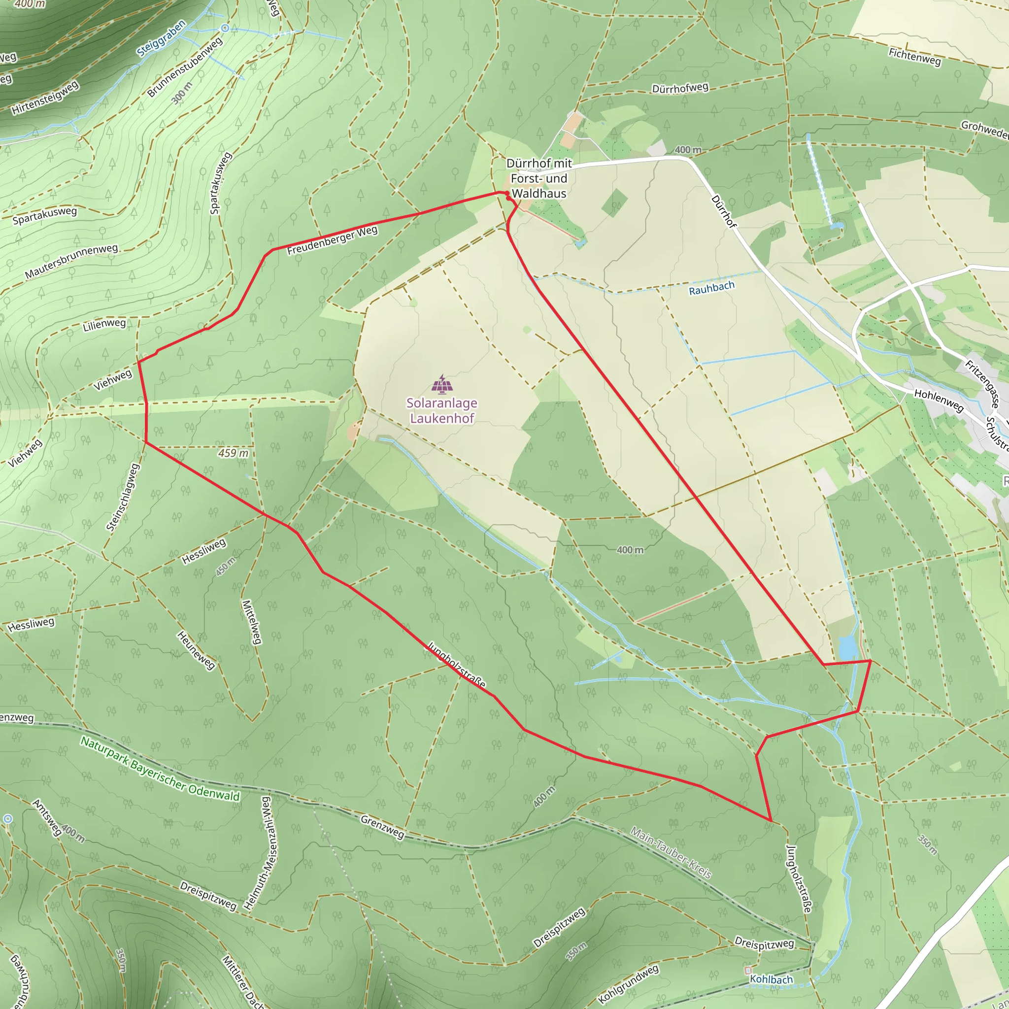
Starting near Main-Tauber-Kreis, Germany, the Freudenberger Weg is a delightful 7 km (4.35 miles) loop trail with an elevation gain of around 100 meters (328 feet). This trail is rated as medium difficulty, making it suitable for moderately experienced hikers.
Getting There
To reach the trailhead, you can drive or use public transport. If driving, set your GPS to Freudenberg am Main, a charming town in the Main-Tauber-Kreis district. There are parking facilities available near the trailhead. For those using public transport, take a train to Wertheim, which is the nearest major station. From Wertheim, you can catch a local bus to Freudenberg am Main.
Trail Overview
The trail begins in the picturesque town of Freudenberg am Main, known for its medieval architecture and scenic views of the Main River. As you start your hike, you'll immediately notice the well-marked paths and the lush greenery that surrounds you.
Key Landmarks and Points of Interest
Freudenberg Castle Ruins: Approximately 1 km (0.62 miles) into the hike, you'll come across the ruins of Freudenberg Castle. This historical site dates back to the 12th century and offers panoramic views of the Main River valley. It's a great spot for a short break and some photography.
Main River Views: As you continue, the trail meanders along the Main River, providing stunning views of the water and the surrounding landscape. This section is relatively flat, making it a pleasant walk.
Forest Sections: Around the 3 km (1.86 miles) mark, the trail enters a dense forest area. Here, the elevation gain becomes more noticeable, but the shade from the trees provides a cool respite. Keep an eye out for local wildlife such as deer and various bird species.
Navigation and Safety
The trail is well-marked, but it's always a good idea to have a reliable navigation tool. HiiKER is an excellent app for this purpose, offering detailed maps and real-time tracking to ensure you stay on course.
Historical Significance
Freudenberg am Main has a rich history that dates back to the Roman era. The town itself was a significant trading post during medieval times, and the remnants of its past are evident in the architecture and ruins you'll encounter along the trail.
Flora and Fauna
The trail is abundant with diverse flora, including oak, beech, and pine trees. In spring and summer, wildflowers add a splash of color to the landscape. Wildlife is also plentiful, with sightings of deer, foxes, and various bird species being quite common.
Final Stretch
As you near the end of the loop, the trail descends gently back towards Freudenberg am Main. This final section offers more beautiful views of the town and the Main River, making for a pleasant and scenic conclusion to your hike.
Practical Tips
- Footwear: Sturdy hiking boots are recommended due to the varied terrain.
- Water and Snacks: Bring enough water and some snacks, especially if you plan to take breaks at the scenic spots.
- Weather: Check the weather forecast before you go, as the trail can be slippery after rain.
By following these guidelines and being prepared, you'll have an enjoyable and memorable hike on the Freudenberger Weg.
What to expect?
Activity types
Comments and Reviews
User comments, reviews and discussions about the Freudenberger Weg, Germany.
5.0
average rating out of 5
2 rating(s)
