
Download
3D Flyover
Add to list
More
12.2 km
~2 hrs 59 min
337 m
Point to Point
“The 12-km Breitscheid to Fuchskaute trail offers scenic vistas, historical sites, and moderate difficulty.”
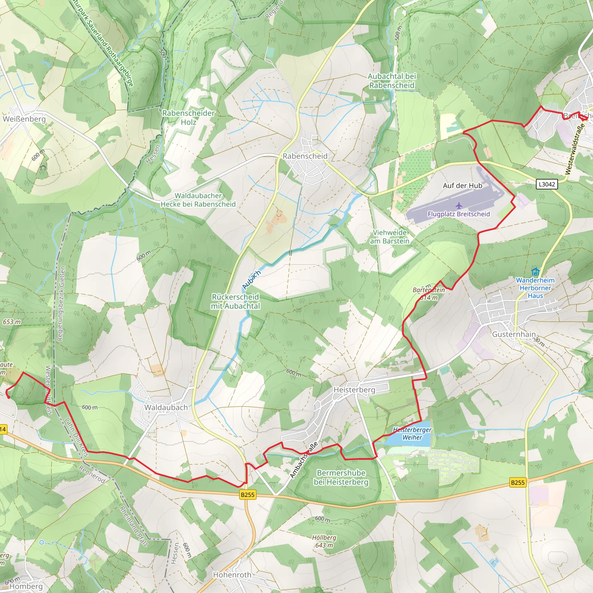
Starting near Lahn-Dill-Kreis, Germany, the Breitscheid to Fuchskaute via Heisterberger Weiher trail spans approximately 12 kilometers (7.5 miles) with an elevation gain of around 300 meters (984 feet). This point-to-point trail is rated as medium difficulty, making it suitable for moderately experienced hikers.
Getting There
To reach the trailhead, you can drive or use public transport. If driving, set your GPS to Breitscheid, a small town in the Lahn-Dill-Kreis district. For those using public transport, take a train to Herborn station, which is well-connected to major cities like Frankfurt and Cologne. From Herborn, you can catch a local bus to Breitscheid.
Trail Overview
The trail begins in Breitscheid, a quaint town known for its historical significance and charming architecture. As you start your hike, you'll pass through lush forests and rolling hills, typical of the Hesse region. The initial part of the trail is relatively flat, allowing you to ease into the hike.
Heisterberger Weiher
Around the 5-kilometer (3.1 miles) mark, you'll reach Heisterberger Weiher, a picturesque lake surrounded by dense woodland. This is an excellent spot for a short break. The lake is home to various bird species, so keep your binoculars handy for some birdwatching. The area around the lake is also rich in flora, with wildflowers blooming in the spring and summer months.
Elevation Gain
After leaving Heisterberger Weiher, the trail begins to ascend more steeply. Over the next 4 kilometers (2.5 miles), you'll gain most of the 300 meters (984 feet) in elevation. The path here can be rocky and uneven, so sturdy hiking boots are recommended. As you climb, you'll be rewarded with panoramic views of the surrounding countryside, including distant villages and expansive forests.
Historical Significance
The region has a rich history dating back to the Roman era. Along the trail, you may come across remnants of ancient settlements and old stone walls. These historical markers offer a glimpse into the area's past and are often accompanied by informational plaques.
Wildlife and Nature
The trail is home to a variety of wildlife, including deer, foxes, and numerous bird species. The forested sections are particularly vibrant in the autumn when the leaves change color, creating a stunning natural tapestry. Keep an eye out for small streams and brooks that crisscross the trail, adding to the serene atmosphere.
Fuchskaute
The trail culminates at Fuchskaute, the highest peak in the Westerwald region at 657 meters (2,156 feet) above sea level. The summit offers breathtaking views and is a perfect spot for a well-deserved rest. There are several benches and a small shelter where you can relax and take in the scenery.
Navigation
For navigation, it's advisable to use HiiKER, which provides detailed maps and real-time updates. This will help you stay on track and ensure you don't miss any of the trail's highlights.
Final Stretch
The final stretch of the trail involves a gentle descent into the village of Willingen, where you can catch a bus back to Herborn or continue exploring the Westerwald region.
What to expect?
Activity types
Comments and Reviews
User comments, reviews and discussions about the Breitscheid to Fuchskaute via Heisterberger Weiher, Germany.
4.67
average rating out of 5
3 rating(s)

