Download
3D Flyover
Add to list
More
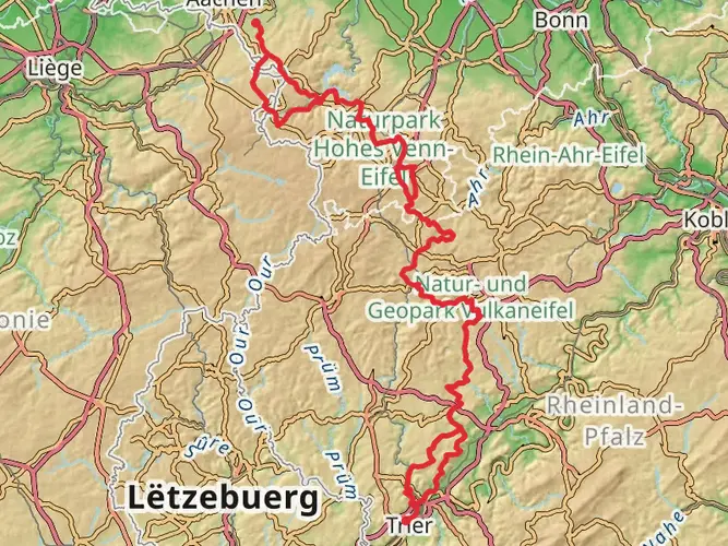
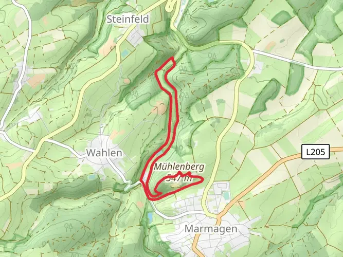
116.0 km
~5 days
1088 m
Multi-Day
“Embark on a historic trek along the Römerkanal-Wanderweg, where ancient Roman engineering meets Germany's breathtaking Rhineland vistas.”
Spanning approximately 116 kilometers (about 72 miles) with an elevation gain of around 1000 meters (3280 feet), the Römerkanal-Wanderweg is a historical journey that takes you through the scenic landscapes of the Rhineland in Germany. This point-to-point trail begins near Kreis Euskirchen, a region easily accessible by public transport or car. For those opting for public transport, the nearest train station is Euskirchen, from which you can take a bus or taxi to the trailhead. If driving, parking is available in the vicinity of the starting point.
Historical Significance and Landmarks
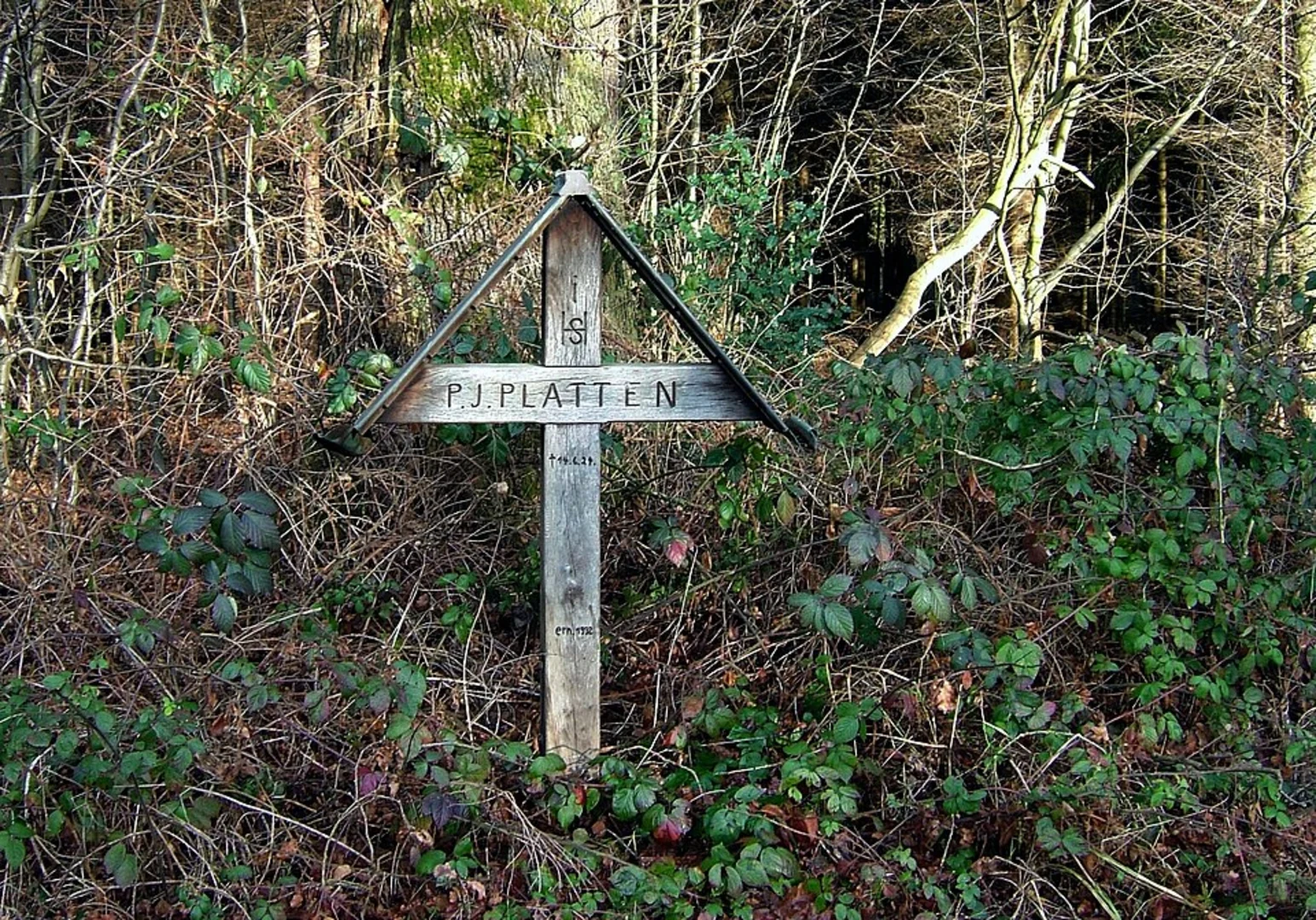
As you embark on the Römerkanal-Wanderweg, you're not just traversing a path; you're walking alongside history. The trail follows the route of an ancient Roman aqueduct, which was engineered to transport water from the Eifel region to the Roman city of Colonia Claudia Ara Agrippinensium, present-day Cologne. Along the way, you'll encounter remnants of this impressive feat of engineering, including well-preserved sections of the aqueduct and informative plaques detailing its construction and use.
Navigating the Trail
The trail is well-marked, with signage guiding hikers along the route. For additional navigation support, HiiKER is an excellent tool to ensure you stay on track and can also provide insights into the trail's topography and points of interest.
Natural Beauty and Wildlife
The Römerkanal-Wanderweg meanders through a variety of landscapes, from dense forests and open meadows to rolling hills and tranquil streams. The diversity of habitats makes it a haven for wildlife, with opportunities to spot deer, birds of prey, and a plethora of native flora. The changing seasons offer a kaleidoscope of colors, from the vibrant greens of spring to the rich hues of autumn.
Trail Experience
The trail is rated as medium difficulty, which means it's accessible to hikers with a reasonable level of fitness. The elevation gain is gradual, and the terrain varies, with some sections that may be more challenging than others. It's advisable to wear sturdy hiking boots and carry sufficient water, as well as snacks to maintain energy levels throughout the hike.
Accommodations and Resupply Points
For those looking to complete the trail over several days, there are towns and villages along the route where you can find accommodations ranging from hotels to guesthouses. Resupply points for food and water are also available, allowing hikers to replenish their provisions.
Preparation and Safety
Before setting out, ensure you have a detailed map or have downloaded the trail on HiiKER. Check the weather forecast and dress appropriately, as conditions can change rapidly. It's also wise to inform someone of your hiking plans and expected return time.
The Römerkanal-Wanderweg offers a unique blend of natural beauty and historical exploration. Whether you're a history enthusiast or a nature lover, this trail promises an enriching experience through one of Germany's most picturesque and storied regions.

Frequently asked questions
How long is the Römerkanal-Wanderweg and how many stages does the Römerkanal-Wanderweg have?
The Römerkanal-Wanderweg is 116.04 km long with 1,088 m of total ascent, and it is typically divided into 7 stages. Official stage lengths are generally in the 13 to 22 km range, which makes it a realistic 4- to 7-day walk depending on pace and overnight stops.
Where does the Römerkanal-Wanderweg start and finish?
The Römerkanal-Wanderweg runs from Nettersheim in the Eifel to Cologne, following the line of the ancient Roman aqueduct that once supplied water to Colonia Claudia Ara Agrippinensium. It is a point-to-point route rather than a loop, so transport planning matters at both ends.
What are the stages of the Römerkanal-Wanderweg and how long are they?
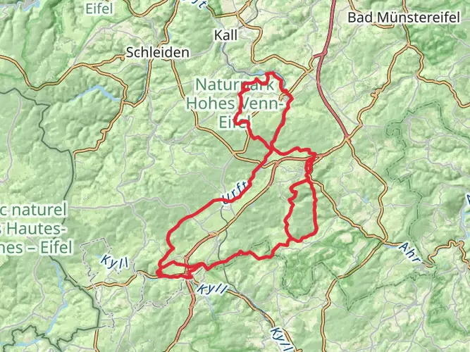
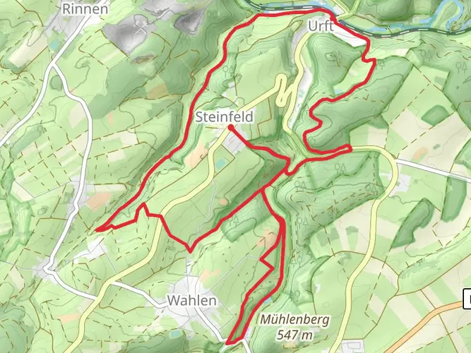
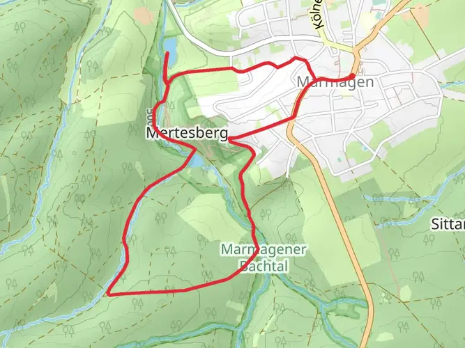
The Römerkanal-Wanderweg is split into 7 stages rather than one continuous day hike. Published stage distances vary by source, but the route is consistently described as a 7-stage walk with individual sections between about 13 km and 22 km, including a Mechernich to Euskirchen section of about 13 km.
What is Römerkanal-Wanderweg Etappe 1 like?
Stage 1 of the Römerkanal-Wanderweg begins around Nettersheim in the Eifel, near the source region of the Roman aqueduct. It introduces the trail’s main theme immediately: a medium-difficulty walk through Eifel landscapes while tracing surviving remains and interpretation points linked to the Roman water system.
What is Römerkanal-Wanderweg Etappe 4 and where does it go?
Etappe 4 of the Römerkanal-Wanderweg is the section from Euskirchen-Kreuzweingarten to Rheinbach. It is one of the middle stages on the route from Nettersheim to Cologne and continues the aqueduct story through the Rhineland with signed walking routes and historical stations along the way.
What is Römerkanal-Wanderweg Etappe 6 and where does it go?
Etappe 6 of the Römerkanal-Wanderweg runs from Bornheim-Brenig to Brühl. This stage sits close to the Cologne end of the trail and is often described as one of the more lake-rich sections, reflecting the changing landscape as the route leaves the Eifel behind and approaches the urban Rhineland.
Is the Römerkanal-Wanderweg hard to hike?
The Römerkanal-Wanderweg is generally rated medium difficulty. Over 116.04 km it gains 1,088 m in elevation, so it is not especially steep by alpine standards, but the full route is best treated as a multi-day hike with steady daily mileage rather than a casual walk.
Comments and Reviews
User comments, reviews and discussions about the Römerkanal-Wanderweg, Germany.
4.18
average rating out of 5
11 rating(s)