Download
3D Flyover
Add to list
More
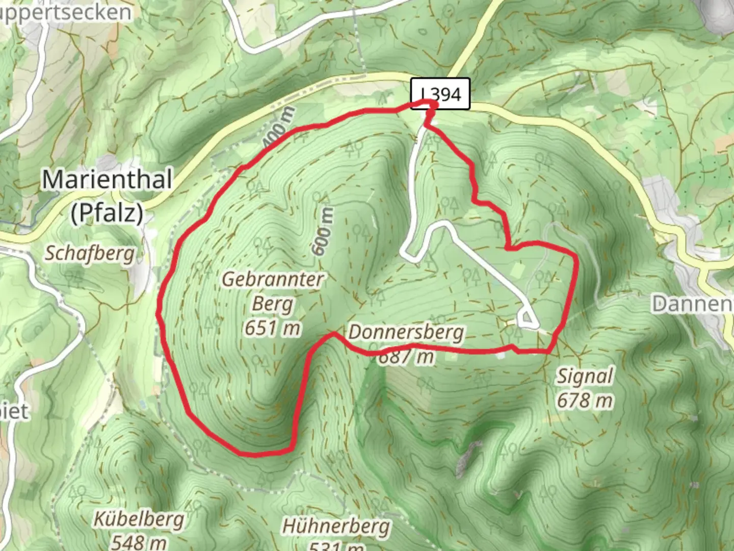
9.0 km
~2 hrs 23 min
353 m
Loop
“Discover the Der Hoechste Loop: a 9 km trail blending nature, history, and wildlife near Donnersbergkreis.”
Starting your adventure near Donnersbergkreis, Germany, the Der Hoechste Loop via Pfaelzer Hoehenweg is a captivating 9 km (5.6 miles) loop trail with an elevation gain of approximately 300 meters (984 feet). This medium-difficulty trail offers a blend of natural beauty, historical landmarks, and diverse wildlife, making it a rewarding experience for hikers.
Getting There
To reach the trailhead, you can drive or use public transport. If driving, set your GPS to Donnersbergkreis, and look for parking near the village of Dannenfels. For those using public transport, take a train to Kirchheimbolanden and then a bus to Dannenfels. The trailhead is conveniently located near the village, making it easily accessible.
Trail Highlights
Nature and Wildlife
As you embark on the trail, you'll be greeted by lush forests and open meadows. The region is home to a variety of flora and fauna, including oak and beech trees, wildflowers, and a range of bird species. Keep an eye out for deer and foxes, which are commonly spotted along the trail.
Historical Significance
One of the most significant landmarks on this trail is the Donnersberg, the highest peak in the Palatinate region. The mountain has a rich history, dating back to Celtic times. You can explore the remnants of a Celtic hill fort, which offers a glimpse into the ancient past. The fort's strategic location provides panoramic views of the surrounding landscape, making it a perfect spot for a break and some photography.
Trail Navigation
The trail is well-marked, but it's always a good idea to have a reliable navigation tool. HiiKER is an excellent app for this purpose, providing detailed maps and real-time updates to ensure you stay on track.
Elevation and Terrain
The trail features a moderate elevation gain of around 300 meters (984 feet), with some steep sections that require a bit of effort. The terrain varies from forest paths to rocky outcrops, so sturdy hiking boots are recommended. The highest point of the trail offers breathtaking views of the Palatinate Forest and the Rhine Valley.
Points of Interest
- Celtic Hill Fort: Approximately 4 km (2.5 miles) into the hike, you'll reach the ancient Celtic hill fort. Take some time to explore the ruins and enjoy the panoramic views.
- Donnersberg Summit: The highest point of the trail, located around 5 km (3.1 miles) from the start, offers stunning vistas and is a great spot for a picnic.
- Wildlife Observation Points: Scattered along the trail, these points provide opportunities to observe local wildlife in their natural habitat.
Practical Tips
- Weather: The weather can be unpredictable, so check the forecast before you go and dress in layers.
- Water and Snacks: Bring enough water and snacks to keep your energy levels up, especially if you plan to spend time exploring the historical sites.
- Safety: While the trail is generally safe, always let someone know your plans and estimated return time.
This trail offers a perfect blend of natural beauty, historical intrigue, and moderate physical challenge, making it a must-visit for any hiking enthusiast.

What to expect?
Activity types
Comments and Reviews
User comments, reviews and discussions about the Der Hoechste Loop via Pfaelzer Hoehenweg, Germany.
4.67
average rating out of 5
3 rating(s)