Download
3D Flyover
Add to list
More
169.8 km
~8 days
7203 m
Multi-Day
“Embark on a breathtaking Alpine odyssey around Lac de Serre-Ponçon, brimming with natural splendor and cultural heritage.”
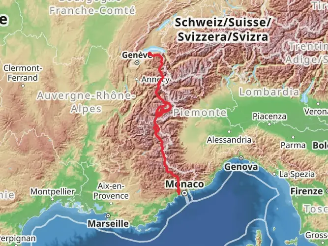
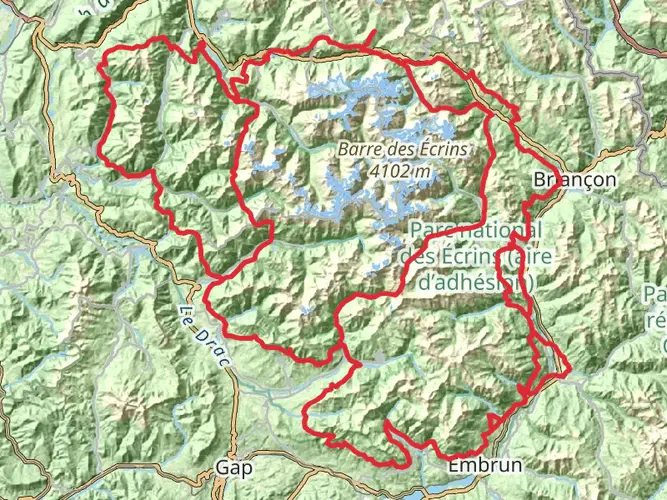
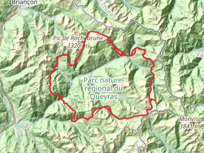
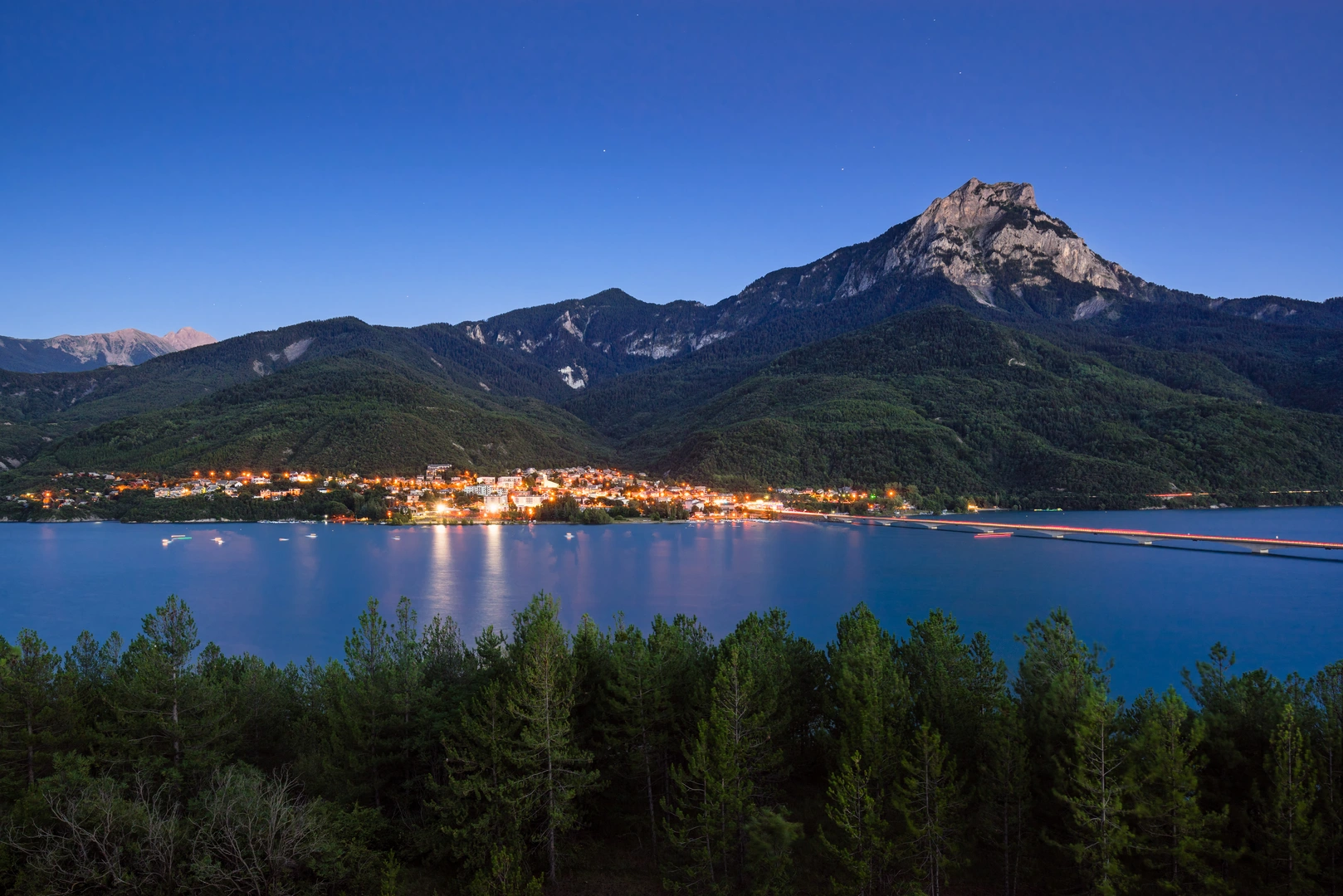
Embarking on the Lac de Serre-Ponçon trail, hikers will find themselves circumnavigating one of the largest artificial lakes in Western Europe, nestled in the French Alps. The trail spans approximately 170 kilometers (about 105 miles) with an elevation gain of around 7200 meters (roughly 23,622 feet), presenting a challenging yet rewarding experience.
Getting to the Trailhead The journey begins near the town of Embrun, France, which is accessible by car or public transport. For those driving, Embrun is well-connected by road, and parking is available in the vicinity of the trailhead. Public transport users can take advantage of the regional train services to Embrun station, followed by local buses or taxis to reach the starting point.
Navigating the Trail As you set out, the trail will lead you through a variety of terrains, including rocky paths, forested areas, and alpine meadows. The loop can be tackled in sections, with several access points along the route for those preferring shorter hikes. HiiKER is an invaluable tool for navigation, offering detailed maps and waypoints to ensure you stay on the right path.
Landmarks and Natural Beauty The trail offers breathtaking views of the Lac de Serre-Ponçon, with its turquoise waters contrasting against the backdrop of the majestic Alps. Along the way, hikers will encounter the impressive Dam of Serre-Ponçon, a feat of engineering that created the lake in the 1960s for hydroelectric power and irrigation.
Flora and Fauna The region is rich in biodiversity, with a chance to spot wildlife such as chamois, marmots, and golden eagles. The diverse plant life includes alpine flowers and ancient larch trees, particularly stunning in the fall.
Historical Significance The area around Lac de Serre-Ponçon is steeped in history, with remnants of old villages submerged by the lake's creation. The trail also passes through several quaint Alpine villages where hikers can learn about the local culture and history.
Preparation and Planning Given the trail's difficulty, it's essential to be well-prepared with appropriate gear, including sturdy hiking boots, weather-appropriate clothing, and sufficient water and food supplies. The elevation gain requires a good fitness level, and acclimatization to the altitude may be necessary for some.
Accommodation and Resupply Points There are various accommodation options along the route, from campgrounds to guesthouses, allowing for rest and resupply. It's advisable to book in advance during peak seasons to secure a spot.
Safety and Regulations Always check the weather forecast before setting out and be aware of the potential for rapid weather changes in the mountains. Respect the local regulations, including staying on marked trails and preserving the natural environment.
By preparing adequately and respecting the trail, hikers can look forward to an unforgettable adventure around Lac de Serre-Ponçon, filled with natural wonders, cultural insights, and physical challenges.

Comments and Reviews
User comments, reviews and discussions about the Lac de Serre-Ponçon, France.
4.8
average rating out of 5
5 rating(s)