Download
3D Flyover
Add to list
More
186.7 km
~7 days
31 m
Multi-Day
“Embark on LOST's serene 116-mile loop around Lake Okeechobee, steeped in nature and history, accessible yet vast.”
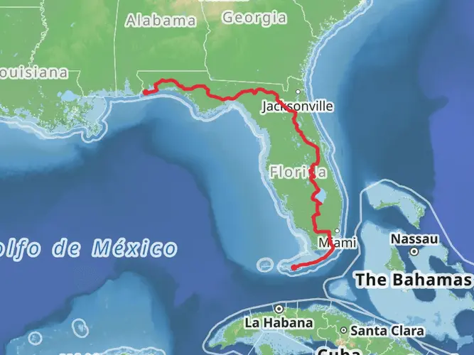
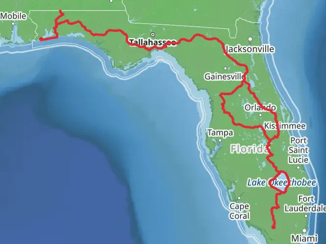
The Lake Okeechobee Scenic Trail, affectionately known as LOST, encircles the second-largest freshwater lake in the contiguous United States, Lake Okeechobee. This expansive loop trail spans approximately 187 kilometers (116 miles) and offers hikers a unique, flat terrain experience with virtually no elevation gain, making it accessible for individuals of all skill levels.
Getting There Accessing the trail is straightforward. For those driving, the trailhead is conveniently located near Okeechobee County, Florida. You can start your journey at multiple points around the lake, such as the City of Okeechobee or any of the small towns like Pahokee, Belle Glade, or Clewiston. Public transportation options are limited in this rural area, so driving is the most feasible option for reaching the trailhead.
Navigating the Trail As you embark on the Lake Okeechobee Scenic Trail, you can utilize the HiiKER app to navigate the loop, ensuring you stay on the correct path. The trail is well-marked, and the app will help you track your progress and locate nearby amenities.
Wildlife and Nature The trail offers an abundance of wildlife viewing opportunities. As you traverse the Herbert Hoover Dike, you'll be at an elevated vantage point, perfect for birdwatching. Keep an eye out for herons, egrets, ospreys, and the occasional bald eagle. The surrounding waters are also home to alligators, turtles, and a variety of fish species.
Landmarks and Historical Significance The Herbert Hoover Dike, which the trail follows, is a significant landmark in itself. Constructed after the devastating hurricanes of the 1920s, the dike was built to protect the surrounding communities from flooding. As you hike, you'll be walking alongside a piece of history that transformed the region.
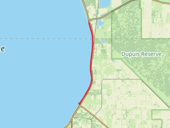
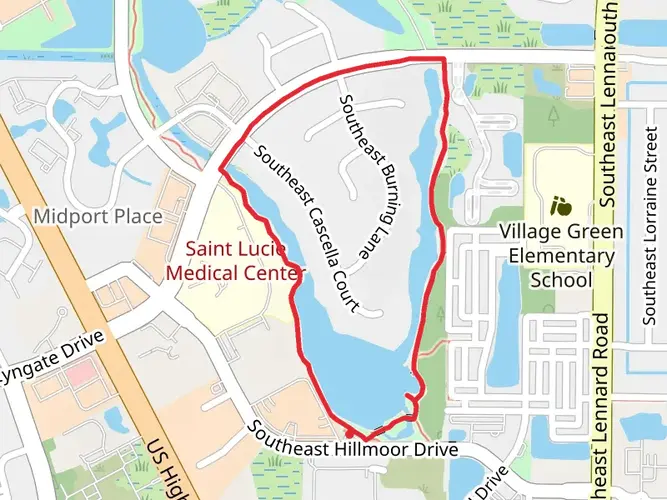
Trail Experience The trail is predominantly paved, with some sections consisting of a gravel or grassy path. It's open to both hikers and cyclists, so be mindful of others sharing the route. The flat terrain allows for a leisurely pace, and the uninterrupted views across the lake and surrounding wetlands are truly spectacular, especially at sunrise and sunset.
Preparation and Amenities Given the trail's length, you should plan for multiple days to complete the entire loop. There are campgrounds and lodging options in the towns around the lake for overnight stays. It's essential to carry plenty of water, as the Florida heat can be intense, and there are long stretches without shade or facilities. Sun protection is also crucial.
Seasonal Considerations The best time to hike the Lake Okeechobee Scenic Trail is during the cooler months from November to March. Summer hikes can be challenging due to the high temperatures and humidity, along with the increased activity of insects, including mosquitoes.
Whether you're looking for a multi-day adventure or a scenic day hike, the Lake Okeechobee Scenic Trail offers a unique glimpse into Florida's natural beauty and historical landscape. With careful planning and respect for the wildlife and ecosystem, your hike around Lake Okeechobee can be a memorable experience.

What to expect?
Activity types
Frequently asked questions
How long is the Lake Okeechobee Scenic Trail and how many days does it take to complete?
The Lake Okeechobee Scenic Trail is 186.75 km, or about 116 miles, as a full loop around Lake Okeechobee. Because the route is almost completely flat with only 31 m of total elevation gain, strong hikers often break it into several long days, while a more relaxed multi-day trip usually takes closer to 4 to 7 days depending on daily mileage.
Is the Lake Okeechobee Scenic Trail difficult, or is it good for beginners?
The Lake Okeechobee Scenic Trail is rated easy and is one of the flattest long-distance hikes in Florida, with just 31 m of elevation gain over the entire 186.75 km loop. The main challenge is not climbing but exposure, since the route runs on top of the Herbert Hoover Dike with long open stretches and very little natural shade.
What is the surface like on the Lake Okeechobee Scenic Trail?
The Lake Okeechobee Scenic Trail follows the top of the Herbert Hoover Dike, about 35 feet above the surrounding land in many sections. More than half of the route is paved, and the rest is generally a two-track gravel road, so the footing is firm and straightforward rather than technical. ([saj.usace.army.mil](https://www.saj.usace.army.mil/Missions/Civil-Works/Recreation/Lake-Okeechobee-Scenic-Trail/?utm_source=openai))
Where can hikers start the Lake Okeechobee Scenic Trail and park near the route?
Because the Lake Okeechobee Scenic Trail is a loop, hikers can start from several lake communities rather than a single trailhead. Common access areas are around Okeechobee, Clewiston, Pahokee, and Belle Glade, with official access points mapped by the U.S. Army Corps of Engineers around the dike. ([saj.usace.army.mil](https://www.saj.usace.army.mil/Missions/Civil-Works/Recreation/Lake-Okeechobee-Scenic-Trail/?utm_source=openai))
Are there any closures on the Lake Okeechobee Scenic Trail?
Some sections of the Lake Okeechobee Scenic Trail have been subject to closures tied to Herbert Hoover Dike rehabilitation work, so full loop access cannot always be assumed. Reported closure areas have included sections near Taylor Creek, Nubbin Slough, Pahokee, Torry Island, South Bay, Clewiston, Liberty Point, and Lakeport. ([saj.usace.army.mil](https://www.saj.usace.army.mil/Portals/44/docs/Recreation/120415LakeOkeechobeeScenicTrailUpdate120415.pdf?utm_source=openai))
What towns and landmarks does the Lake Okeechobee Scenic Trail pass?
The Lake Okeechobee Scenic Trail circles Lake Okeechobee on the Herbert Hoover Dike and passes through or near communities including Okeechobee, Pahokee, Belle Glade, South Bay, Clewiston, Moore Haven, and Lakeport. It is also part of the Florida National Scenic Trail, so it combines a major Florida long-distance route with continuous lake views. ([clewiston-fl.gov](https://www.clewiston-fl.gov/290/Trails?utm_source=openai))
What wildlife can hikers expect on the Lake Okeechobee Scenic Trail?
The Lake Okeechobee Scenic Trail is known for broad views over the lake and marshes, which makes it a strong route for spotting wading birds and raptors. Hikers regularly watch for herons, egrets, ospreys, and sometimes bald eagles, and the waters and canals around the dike are also habitat for alligators and turtles. ([lakeokeervpark.com](https://lakeokeervpark.com/lake-okeechobee-scenic-trail-hiking-biking/?utm_source=openai))
Comments and Reviews
User comments, reviews and discussions about the Lake Okeechobee Scenic Trail, Florida.
4.71
average rating out of 5
7 rating(s)