Download
3D Flyover
Add to list
More
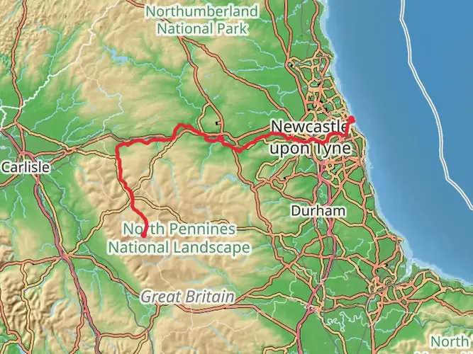
138.7 km
~5 days
1187 m
Multi-Day
“Embark on a historic 86-mile trek along Hadrian's Wall, brimming with Roman legacies and diverse British vistas.”
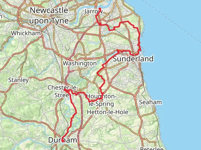
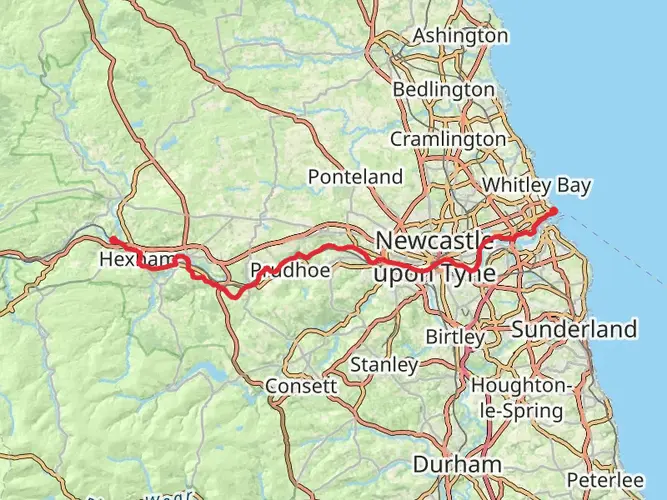
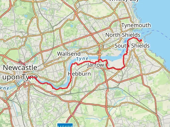
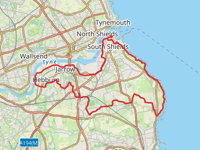
Spanning approximately 139 kilometers (86 miles) with an elevation gain of around 1100 meters (3609 feet), Hadrian's Wall Path is a captivating journey through British history, nature, and landscapes. This point-to-point trail, starting near Tyne and Wear in England, follows the historic line of Hadrian's Wall, the Roman Empire's northernmost boundary.
Getting to the Trailhead
The eastern trailhead is situated near Wallsend, Tyne and Wear, which is accessible by public transport. Visitors can take the Tyne and Wear Metro to Wallsend Metro Station, which is a short walk from the start of the trail. For those driving, parking is available in the vicinity of the Segedunum Roman Fort, which also serves as a significant landmark and museum at the trail's beginning.
Historical Significance
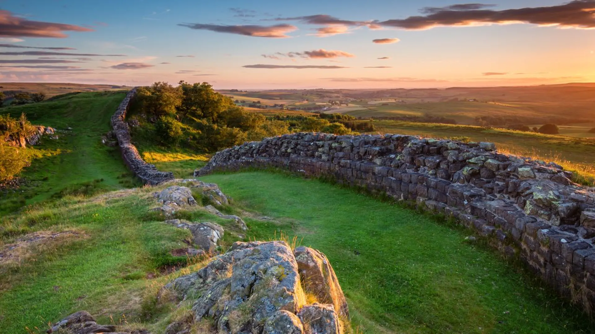
As you embark on the trail, you're walking alongside a UNESCO World Heritage Site. Hadrian's Wall was constructed under the reign of Emperor Hadrian in AD 122 and stretched across the width of Britain. The path takes you past ancient Roman forts, milecastles, and turrets, offering a tangible connection to the past.
Navigating the Trail
The trail is well-marked, and hikers can use the HiiKER app for detailed maps and navigation assistance. The path traverses a variety of landscapes, including urban areas, rolling fields, and rugged moorland.
Key Landmarks and Sections
- Urban Beginnings and River Tyne: Starting in an urban setting, the trail follows the River Tyne, allowing hikers to ease into the journey.
- Heddon-on-the-Wall to Chollerford: This section includes a mix of countryside and small villages, with a gradual ascent leading to more open landscapes.
- Northumberland National Park: As you enter the national park, the trail becomes more remote, offering expansive views of the surrounding countryside.
- The Central Section: This is where you'll encounter the most significant elevation changes, with the path weaving up and down the crags. The Sycamore Gap, featuring a lone tree set in a dramatic dip, is a notable landmark here.
- From Greenhead to Carlisle: The trail flattens out somewhat as you approach Carlisle, with pastoral scenes dominating the landscape.
- Carlisle to Bowness-on-Solway: The final stretch to the western terminus at Bowness-on-Solway is characterized by flat marshlands and views of the Solway Firth.
Nature and Wildlife
The path offers a chance to see a variety of wildlife, including native bird species such as skylarks and curlews. The changing habitats from urban to countryside to coastal areas provide a rich biodiversity for nature enthusiasts.
Preparation and Planning
Hikers should be prepared for variable weather conditions, especially in the more exposed sections. Waterproof gear is essential, and layers are recommended to adapt to changing temperatures. Accommodations range from camping to bed and breakfasts, so planning ahead is crucial, especially during peak seasons.
Conclusion
Hadrian's Wall Path is not just a hike; it's a journey through time, offering a unique blend of history, culture, and natural beauty. With proper preparation and respect for the trail's heritage, hikers can enjoy a memorable experience traversing this ancient landscape.

What to expect?
Activity types
Frequently asked questions
How long does it take to walk Hadrian's Wall Path from Wallsend to Bowness-on-Solway?
Hadrian's Wall Path is 138.66 km in this route listing, and the National Trail is generally described as about 84 miles or 135 km coast to coast. Most walkers split it into about 6 to 10 days, depending on daily mileage and how much time is spent at Roman sites such as Segedunum, Housesteads, Chesters, and Birdoswald.
Where does Hadrian's Wall Path start, and can you reach the start in Wallsend by public transport?
Hadrian's Wall Path starts at Wallsend in Tyne and Wear and finishes at Bowness-on-Solway on the Cumbrian coast. The eastern start is reachable by Tyne and Wear Metro via Wallsend station, and the opening section is close to Segedunum Roman Fort on Buddle Street, which marks the eastern end of the Wall.
Is there parking at the Hadrian's Wall Path trailhead in Wallsend?
Yes. The main practical parking option at the eastern end of Hadrian's Wall Path is the free car park at Segedunum Roman Fort in Wallsend, which also has Blue Badge spaces. That lot is gated and tied to museum opening hours, so it is not a good choice for leaving a vehicle overnight.
How difficult is Hadrian's Wall Path, and which section of Hadrian's Wall Path is hardest?
Hadrian's Wall Path is widely considered a relatively easy National Trail overall, and this route is graded easy despite covering 138.66 km with 1,187 m of ascent. The toughest stretch is usually the central section between Chollerford and Birdoswald, where the trail crosses craggy country with repeated short climbs and descents around the best-preserved wall remains.
What are the main landmarks to see on Hadrian's Wall Path near the eastern start?
The eastern end of Hadrian's Wall Path begins beside major Roman remains at Segedunum in Wallsend. Highlights there include the excavated fort, an 80-meter section of original Hadrian's Wall, a reconstructed wall section, and the Roman bath house remains about 100 meters from the main site on the path itself.
Is Hadrian's Wall Path dog friendly?
Hadrian's Wall Path itself is commonly walked with dogs, but rules can vary at individual heritage sites and museums along the route. At the eastern trailhead, Segedunum Roman Fort specifically allows assistance dogs, so anyone planning to combine the walk with indoor site visits should check site-by-site access before setting out.
What is the best time of year to walk Hadrian's Wall Path?
Late spring through early fall is usually the best window for Hadrian's Wall Path, when daylight is longer and the central moorland and ridge sections are easier to enjoy. Summer brings the easiest logistics and longest days, while spring and early fall often offer quieter trails and clearer views across the Wall country.
Comments and Reviews
User comments, reviews and discussions about the Hadrian's Wall Path, England.
4.65
average rating out of 5
116 rating(s)