Download
3D Flyover
Add to list
More
7.1 km
~1 hrs 50 min
257 m
Loop
“Explore history, nature, and stunning views on the captivating Dunster Castle and Bat's Castle Loop in Somerset.”
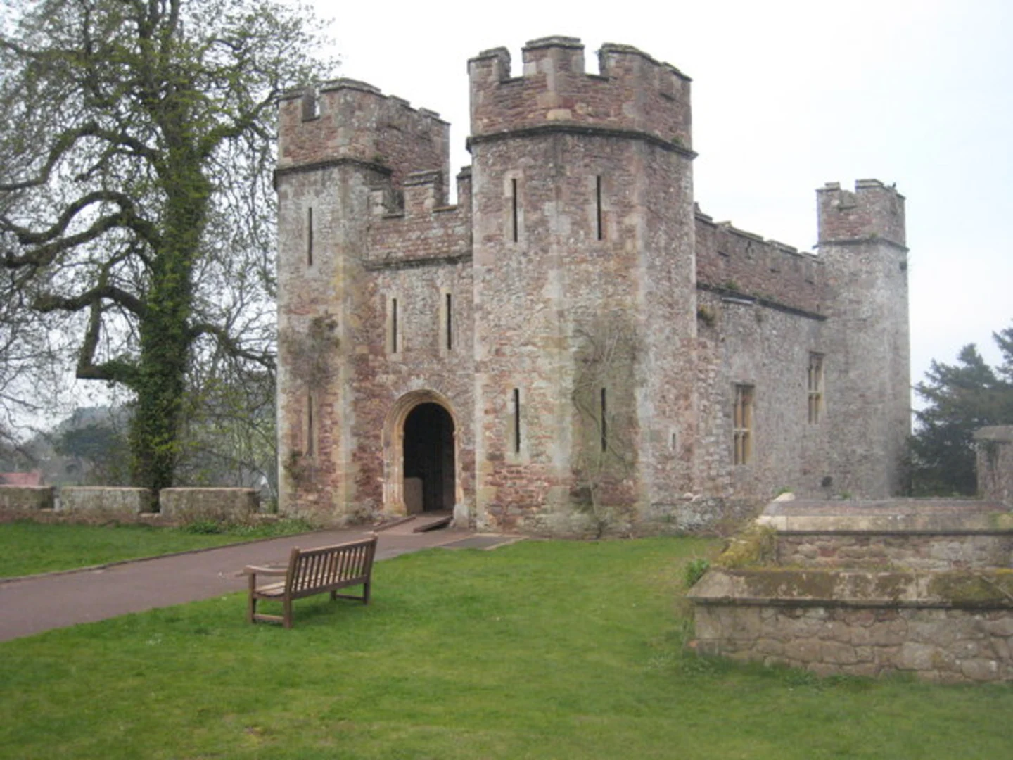
Starting your hike near the charming village of Dunster in Somerset, England, the Dunster Castle and Bat's Castle Loop is a captivating 7 km (approximately 4.3 miles) journey with an elevation gain of around 200 meters (656 feet). This loop trail offers a blend of historical intrigue, natural beauty, and moderate physical challenge, making it an excellent choice for hikers looking to explore the English countryside.
Getting There
To reach the trailhead, you can either drive or use public transport. If driving, set your GPS to Dunster Castle, located at Castle Hill, Dunster, Minehead TA24 6SL, UK. There is parking available near the castle. For those using public transport, the nearest train station is in Minehead, from where you can take a local bus or taxi to Dunster Castle.
Trail Overview
The trail begins near the entrance of Dunster Castle, a historic site dating back to the Norman era. As you start your hike, you'll be greeted by the castle's impressive architecture and well-maintained gardens. The first section of the trail is relatively gentle, allowing you to warm up as you walk through the picturesque village of Dunster.
Historical Significance
Dunster Castle itself is a significant landmark, having played a crucial role in English history, particularly during the English Civil War. As you continue, you'll encounter Bat's Castle, an Iron Age hillfort that offers a glimpse into ancient history. The fort's earthworks are still visible, and the site provides panoramic views of the surrounding countryside.
Nature and Wildlife
The trail meanders through a variety of landscapes, including woodlands, open fields, and heathland. Keep an eye out for local wildlife such as deer, foxes, and a variety of bird species. The woodlands are particularly enchanting in the spring and autumn, with vibrant foliage and a rich array of flora.
Key Sections and Landmarks
- Dunster Castle to Gallox Bridge (1 km / 0.6 miles): This initial stretch is relatively flat and takes you through the village and past the medieval Gallox Bridge, a picturesque stone bridge that spans the River Avill.
- Gallox Bridge to Bat's Castle (3 km / 1.9 miles): The trail begins to ascend gradually as you make your way towards Bat's Castle. This section offers a mix of shaded woodland paths and open heathland, with occasional steep sections.
- Bat's Castle to Withycombe Hill (1.5 km / 0.9 miles): After exploring the hillfort, the trail continues to climb, reaching its highest point at Withycombe Hill. Here, you'll be rewarded with stunning views of the Bristol Channel and Exmoor National Park.
- Withycombe Hill to Dunster Castle (1.5 km / 0.9 miles): The descent back to Dunster Castle is more gradual, taking you through serene woodlands and past ancient hedgerows.
Navigation and Safety
Given the moderate difficulty of the trail, it's advisable to use a reliable navigation tool like HiiKER to ensure you stay on track. The trail is well-marked, but having a digital map can be particularly useful in the more remote sections. Wear sturdy hiking boots, bring plenty of water, and be prepared for changing weather conditions, as the area can be quite exposed in places.
Final Stretch
As you complete the loop and return to Dunster Castle, take some time to explore the castle grounds if you haven't already. The castle offers guided tours, a tea room, and beautifully landscaped gardens, providing a perfect end to your hike.

What to expect?
Activity types
Comments and Reviews
User comments, reviews and discussions about the Dunster Castle and Bat's Castle Loop, England.
4.75
average rating out of 5
4 rating(s)