Download
3D Flyover
Add to list
More
294.6 km
13 days
133 m
Multi Day
“Embark on the Thames Path, a scenic journey from bucolic Kemble to the historic heart of London.”
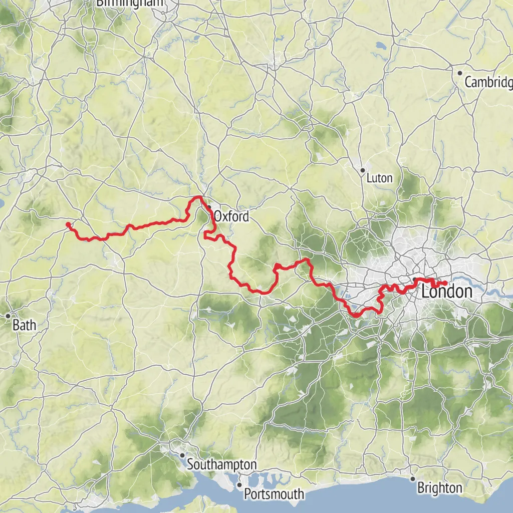
The Thames Path unfurls alongside the iconic River Thames, beginning its journey near the quaint village of Kemble in Gloucestershire, England. This point-to-point trail stretches approximately 295 kilometers (about 184 miles), with an elevation gain that is relatively modest, around 300 meters (roughly 980 feet), making it accessible for hikers of varying abilities, though it is estimated to be of medium difficulty due to its length.
Getting to the Trailhead
To reach the starting point of the Thames Path, hikers can utilize public transportation by taking a train to Kemble station from London Paddington, which is a short walk from the trailhead. For those preferring to drive, parking is available in the area, though it's advisable to plan for transportation back from the trail's end unless a return journey is part of the plan.
Navigating the Trail
The Thames Path is well-marked, with clear signage guiding hikers along the route. For additional navigation support, HiiKER is an excellent tool to use for detailed maps and trail information, ensuring that you stay on the right path.
Landmarks and Scenery
As you commence your hike, the trail reveals the serene countryside, with the young River Thames as your constant companion. The path meanders through charming meadows, historic towns, and past ancient locks, each with its own story. Notable landmarks include the grandeur of Oxford, the regal Windsor Castle, and the UNESCO World Heritage Site of Kew Gardens. As you approach the trail's conclusion, the urban landscape of London presents a stark contrast to the pastoral beginnings, with the Thames Barrier marking the end of this remarkable journey.
Wildlife and Nature
The Thames Path offers an opportunity to witness a diverse range of wildlife. Birdwatchers will delight in the abundance of birdlife, including swans, kingfishers, and even the occasional red kite. The riverbanks are also home to a variety of plants and insects, contributing to a rich ecosystem that thrives along the water's edge.
Historical Significance
The Thames has been a central figure in English history, influencing settlement, trade, and culture. As you hike, you'll pass through areas that have been pivotal to British history, from the ancient university city of Oxford to Runnymede, where the Magna Carta was sealed in 1215. The trail is not just a journey through nature, but a walk through time, offering insights into the past that have shaped the present.
Preparation and Planning
Given the length of the Thames Path, it's essential to plan your hike with consideration for accommodations or camping spots along the way. The trail can be tackled in sections or as a continuous journey, with various towns and villages providing ample opportunities for rest and resupply. Weather along the Thames can be variable, so packing waterproof gear and layers is advisable.
Remember to check the tide times for the final stretch through London, as some parts of the path can be affected by high tides. Always ensure you leave no trace, respecting the natural environment and the communities that call the Thames Path home.
AI Planner
Days planned around your pace, with somewhere to stay each night.
What to expect?
Activity types
Surfaces
Unknown
Asphalt
Grass
Dirt
Unpaved
Concrete
Ground
Gravel
Paved
Wood
Cobblestone
Comments and Reviews
User comments, reviews and discussions about the Thames Path, England.
4.89
average rating out of 5
19 rating(s)