Download
Preview
Add to list
More
445.9 km
~23 days
11438 m
Multi-Day
“Embark on the Pennine Way for a 413 km journey through breathtaking UK landscapes and rich history.”
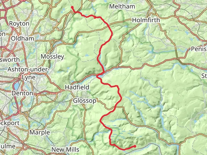
Starting near the village of Edale in Derbyshire, England, the Pennine Way stretches approximately 413 km (256 miles) northward to Kirk Yetholm in the Scottish Borders. This iconic trail, with an elevation gain of around 11,000 meters (36,089 feet), is a point-to-point hike that traverses some of the most stunning landscapes in the UK, including the Yorkshire Dales National Park, Peak District National Park, and Northumberland National Park.
Getting There
To reach the trailhead in Edale, you can take a train from Manchester or Sheffield, both of which have regular services to Edale Station. If you prefer to drive, Edale is accessible via the A6187 road, with parking available near the village.
Trail Overview
The Pennine Way is estimated to be of medium difficulty, making it suitable for experienced hikers. The trail is well-marked, but carrying a reliable navigation tool like HiiKER is recommended for safety and ease of navigation.
Key Sections and Landmarks
Peak District National Park
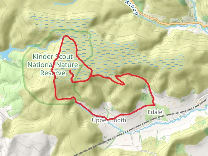
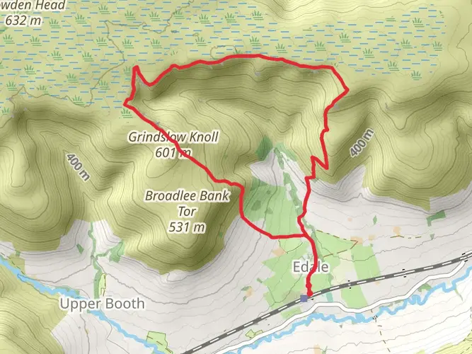
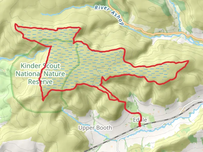
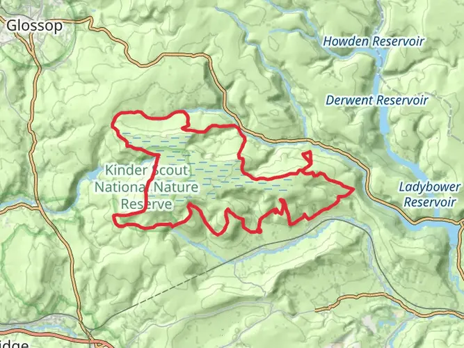
Starting in Edale, the trail ascends to Kinder Scout, the highest point in the Peak District at 636 meters (2,087 feet). This section offers dramatic moorland scenery and panoramic views. The trail then continues through the picturesque village of Crowden and along the reservoirs of the Longdendale Valley.
Yorkshire Dales National Park
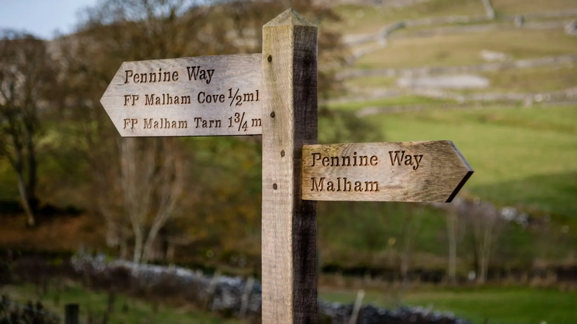
As you enter the Yorkshire Dales, the landscape changes to rolling hills and limestone pavements. Highlights include the Malham Cove, a stunning limestone amphitheater, and Pen-y-Ghent, one of the Yorkshire Three Peaks, standing at 694 meters (2,277 feet). The trail also passes through the charming market town of Hawes, known for its Wensleydale cheese.
Northumberland National Park
The final stretch of the Pennine Way takes you through the remote and rugged landscapes of Northumberland. Key landmarks include Hadrian's Wall, a UNESCO World Heritage Site, and the Cheviot Hills, with the highest point being The Cheviot at 815 meters (2,674 feet). The trail concludes in the quaint village of Kirk Yetholm, just over the Scottish border.
Nature and Wildlife
The Pennine Way is rich in biodiversity. In the Peak District, you may encounter red grouse and mountain hares. The Yorkshire Dales are home to peregrine falcons and rare wildflowers like the Lady's Slipper Orchid. In Northumberland, look out for red squirrels and otters along the rivers.
Historical Significance
The Pennine Way is steeped in history. Kinder Scout was the site of the 1932 mass trespass, a pivotal event in the campaign for public access to the countryside. Hadrian's Wall, built by the Romans in AD 122, marks the northern boundary of the Roman Empire and offers a glimpse into ancient history.
Practical Information
The trail is best hiked between late spring and early autumn when the weather is more predictable. Accommodation options range from campsites and hostels to B&Bs and inns. It's advisable to book in advance, especially during peak season. Carrying sufficient water, food supplies, and appropriate clothing for changing weather conditions is essential.
The Pennine Way offers a challenging yet rewarding experience, showcasing the diverse landscapes and rich history of northern England.

What to expect?
Activity types
Surfaces
Unknown
Asphalt
Frequently asked questions
How long does it take to hike the Pennine Way from Edale to Kirk Yetholm?
The Pennine Way is a 445.9 km point-to-point trail with 11,438 m of climbing, so it is usually treated as a multi-day walk rather than a short backpacking trip. Many end-to-end walkers split it into roughly two to three weeks, depending on daily mileage, weather, and whether tougher sections like Kinder Scout, the Yorkshire Dales, and the Cheviots are done in long stages.
Where does the Pennine Way start and finish, and can it be walked south to north?
The classic Pennine Way starts in Edale in Derbyshire and finishes at Kirk Yetholm in the Scottish Borders. It is commonly walked south to north, beginning with the climb onto Kinder Scout, but the route can also be completed in reverse because it is a waymarked National Trail running between the same two endpoints.
Is the Pennine Way hard, and what is the toughest part of the Pennine Way?
The Pennine Way is generally rated medium overall, but that still means a serious long-distance hike with 445.9 km of walking and 11,438 m of ascent. The hardest stretches are often the exposed moorland and upland sections, especially around Kinder Scout near the start, plus longer remote days farther north where rough ground, wind, and wet conditions can make progress much slower than the mileage suggests.
Can you get to the Pennine Way start in Edale by train?
Yes. Edale is one of the most convenient National Trail starts in England because Edale railway station is in the village at the southern end of the route. Regular rail services connect Edale with Manchester and Sheffield, making it practical to begin the Pennine Way without a car.
Where can you park for the Pennine Way in Edale?
Parking for the Pennine Way start is in Edale village, where there is a public car park used by walkers heading onto Kinder Scout and the National Trail. The Peak District National Park notes that there is no public parking at the Moorland Centre itself, so Pennine Way walkers should use the village public car parks rather than trying to park at the visitor center.
Is wild camping allowed on the Pennine Way?
Wild camping is not generally a legal right along the Pennine Way in England and Wales. On this route, camping is usually done at official campgrounds or with landowner permission, which matters on a long trail crossing places such as the Peak District, Yorkshire Dales, and Northumberland uplands.
What is the best time of year to walk the Pennine Way?
Late spring through early fall is usually the most practical season for the Pennine Way. Conditions are often more favorable from around late May into early September, when daylight is longer and the high moorland sections are less likely to be affected by winter weather, deep bog, or severe wind chill, although rain and low cloud are possible at any time.
Comments and Reviews
User comments, reviews and discussions about the Pennine Way, England.
4.95
average rating out of 5
111 rating(s)