Download
Preview
Add to list
More
28.2 km
~2 days
1126 m
Multi-Day
“A challenging and scenic 28-kilometer trek through Yosemite's heart, culminating in Half Dome's exhilarating ascent.”
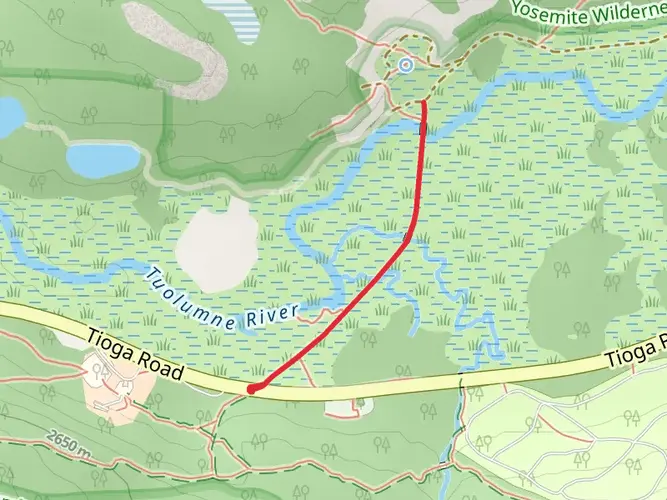
Embarking on the journey from Tuolumne Meadows to Half Dome, hikers will traverse approximately 28 kilometers (17.4 miles) through the heart of Yosemite National Park, with an elevation gain of around 1100 meters (3600 feet). This point-to-point trail is considered difficult due to its length, elevation gain, and technical sections, particularly the final ascent of Half Dome.
Getting to the Trailhead
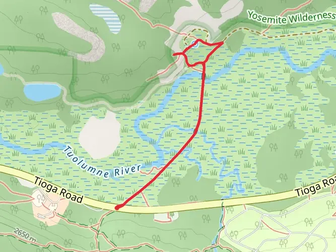
The trailhead is accessible near Tuolumne County, California. For those arriving by car, the starting point can be reached by driving along the Tioga Pass Road (Highway 120) and parking in the Tuolumne Meadows area. Public transportation options include the YARTS (Yosemite Area Regional Transportation System), which provides seasonal bus service to Tuolumne Meadows.
The Journey Begins
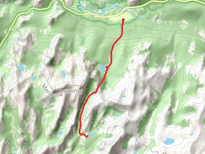
Setting out from Tuolumne Meadows, hikers will be greeted by expansive subalpine meadows dotted with wildflowers during the spring and summer months. The trail meanders through the meadows, offering views of the surrounding granite peaks. The initial segment is relatively flat, allowing hikers to warm up before the ascent begins.
Ascending Toward Sunrise High Sierra Camp
As the trail progresses, it approaches the Sunrise High Sierra Camp, located about 13 kilometers (8 miles) from the trailhead. This area serves as a good checkpoint and rest spot, with the option for hikers to stay overnight if they have secured reservations in advance. The camp is historically significant as part of the High Sierra Camps, which have provided hikers with lodging and meals since the 1920s.
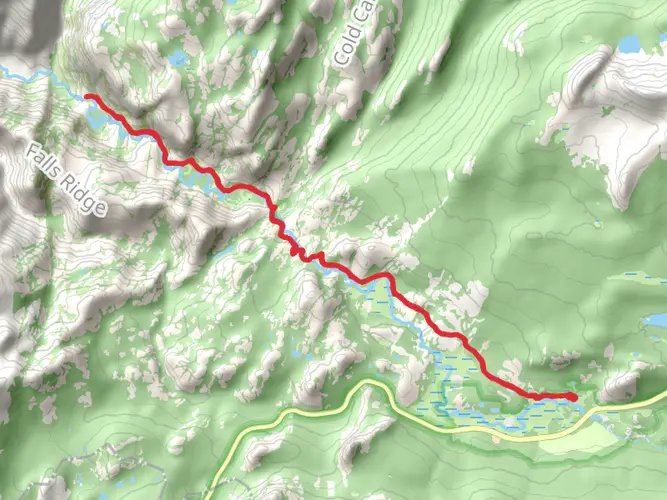
The Challenge of Clouds Rest
Beyond Sunrise High Sierra Camp, the trail becomes more challenging, with a series of switchbacks leading up to the Clouds Rest junction. This section offers an optional detour to the summit of Clouds Rest, adding additional distance and elevation but rewarding hikers with panoramic views of the park.
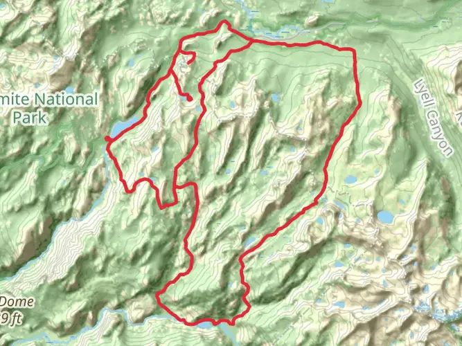
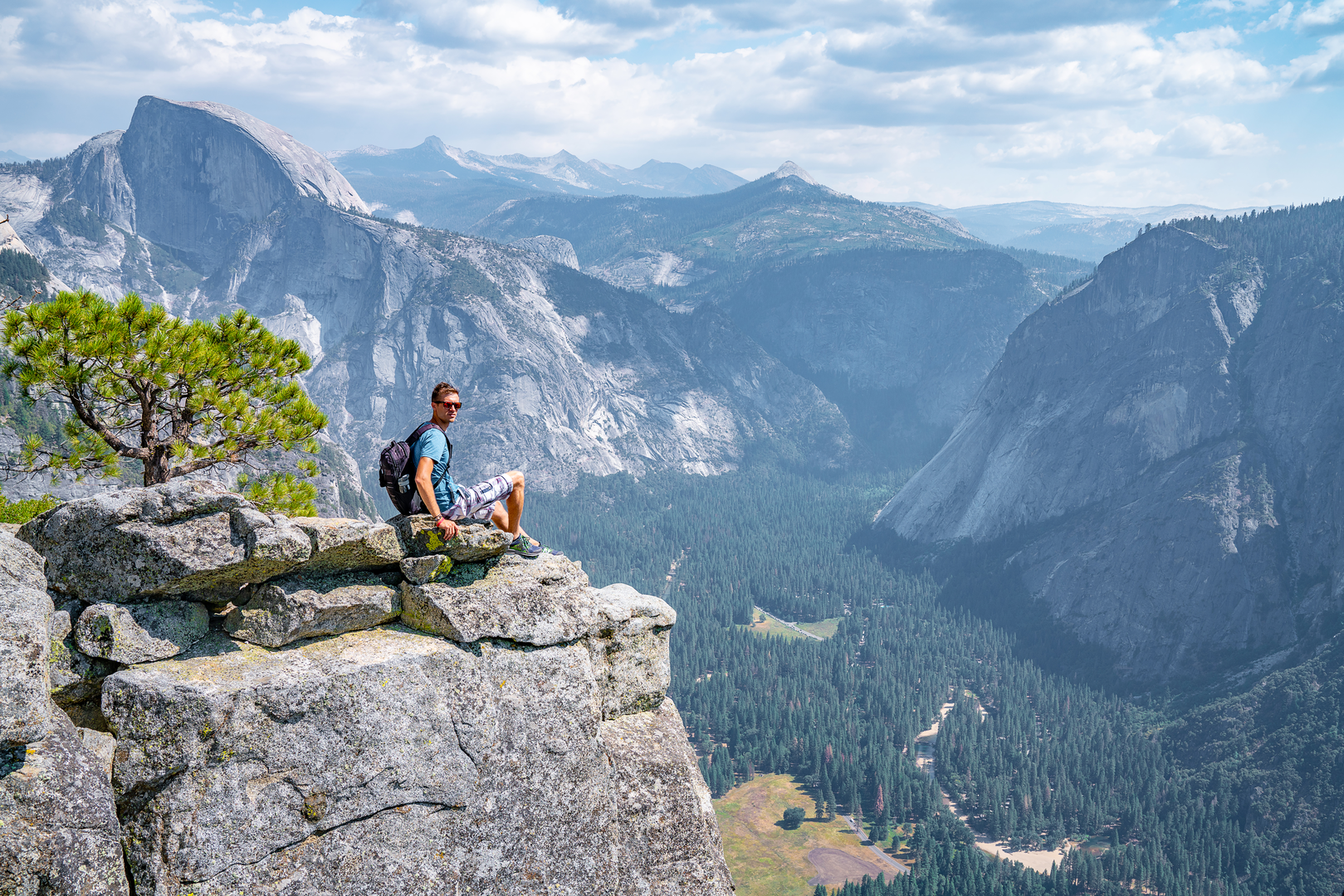
Final Ascent to Half Dome
The last portion of the hike is the most strenuous and iconic, culminating in the ascent of Half Dome. The trail steepens significantly, and hikers will encounter the famous cable route, which assists in the final 120 meters (400 feet) climb to the summit. This section requires a permit, which must be obtained through a lottery system due to the popularity and potential danger of the ascent.
Wildlife and Natural Beauty
Throughout the hike, adventurers may encounter a variety of wildlife, including mule deer, black bears, and a diverse array of bird species. It is crucial to practice proper food storage and wildlife safety measures. The trail also offers a chance to admire the natural beauty of Yosemite, from the serene meadows to the towering granite cliffs.
Preparation and Safety
Given the trail's difficulty, hikers should be well-prepared with adequate water, food, and clothing for changing weather conditions. It is also essential to carry a map and compass or use a navigation tool like HiiKER to stay on the correct path. The final ascent of Half Dome is not to be taken lightly; hikers should wear proper footwear, gloves for the cables, and start early to avoid afternoon thunderstorms.
Historical Significance
The region holds immense historical significance, with Yosemite Valley being a central spiritual and cultural area for the Ahwahneechee people before the arrival of European settlers. The creation of Yosemite National Park in 1890 helped pave the way for the national park system in the United States, preserving this unique landscape for future generations.
Conclusion
In conclusion, the Tuolumne Meadows to Half Dome trail offers a challenging yet rewarding experience for seasoned hikers. With its diverse landscapes, historical landmarks, and the iconic Half Dome ascent, it is a journey that encapsulates the essence of Yosemite's wilderness.

What to expect?
Activity types
Comments and Reviews
User comments, reviews and discussions about the Tuolumne Meadows to Half Dome, California.
4.0
average rating out of 5
2 rating(s)