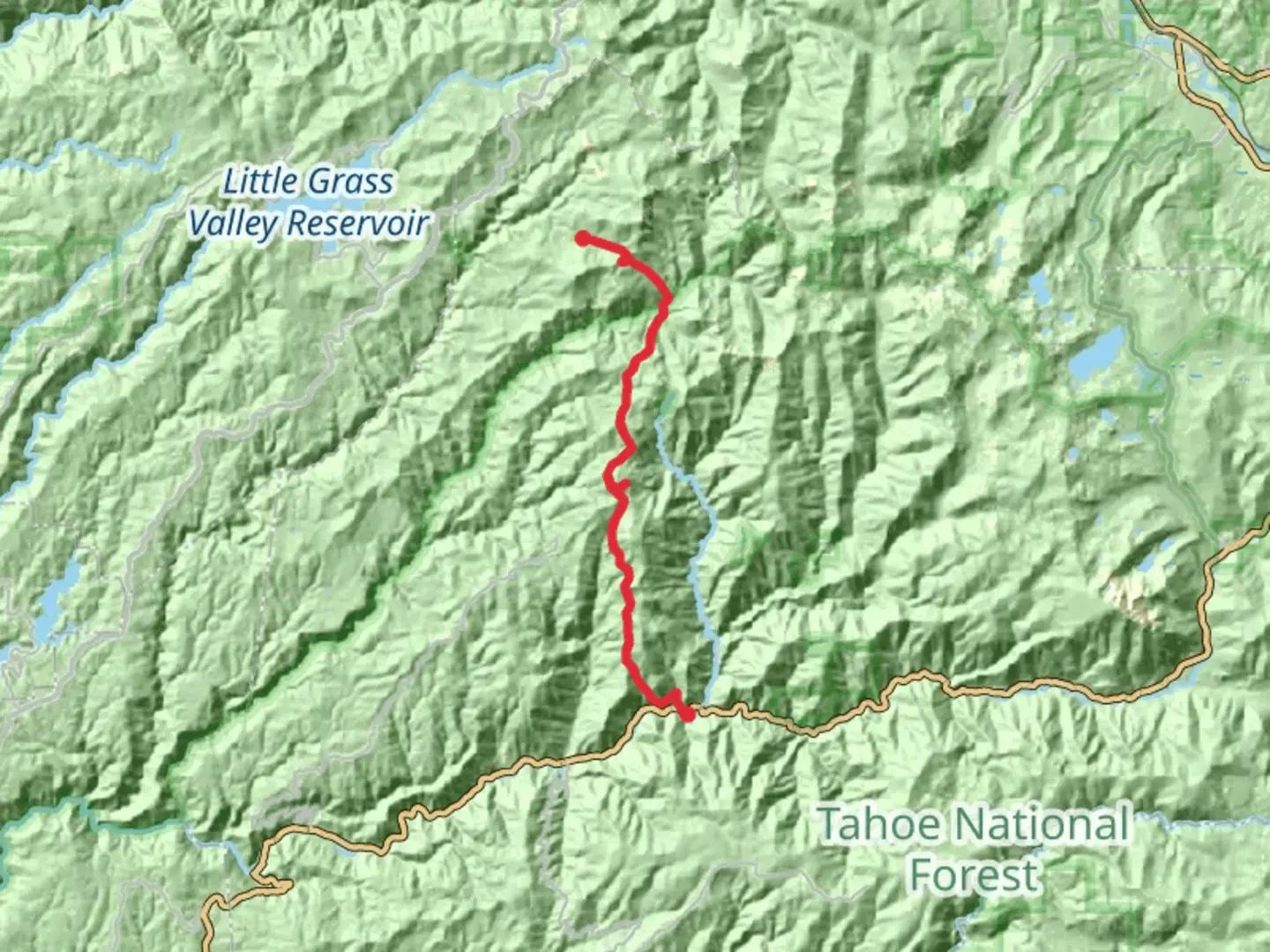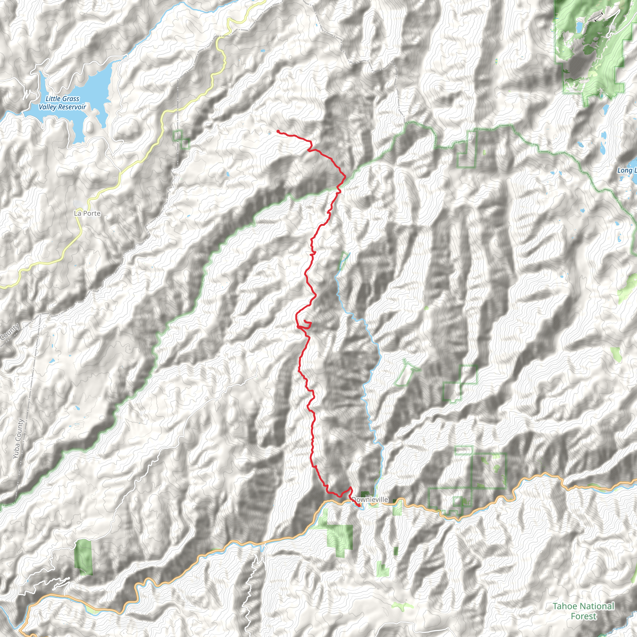
Saddleback Mountain via Poker Flat Road and Saddleback Road
Download
Preview
Add to list
More
29.9 km
~1 day 2 hrs
973 m
Point-to-Point
“Trek through history and nature on Saddleback Mountain's panoramic 18.6-mile journey with a 2953-foot ascent.”
Embarking on the Saddleback Mountain via Poker Flat Road and Saddleback Road trail, hikers will traverse approximately 30 kilometers (about 18.6 miles) with an elevation gain of around 900 meters (nearly 2953 feet). This point-to-point journey begins near Sierra County, California, and is rated as medium difficulty, offering a blend of challenging and rewarding experiences.
Getting to the Trailhead To reach the trailhead, if you're driving, navigate towards Sierra City, California. From there, you'll head towards Poker Flat Road, which is the nearest significant landmark to the starting point. For those relying on public transportation, options may be limited due to the remote nature of the area. It's advisable to check local transit resources for the latest schedules and routes that may get you closest to Sierra City, from where you might need to arrange a taxi or a shuttle service to the trailhead.
The Hike Itself The journey begins with a gentle incline as you make your way through mixed conifer forests, with the scent of pine and the soft crunch of needles underfoot. The first section of the trail is relatively smooth, allowing hikers to warm up before the more strenuous ascent begins.
As you progress, the incline becomes more pronounced, and the terrain shifts to a combination of rocky outcrops and meadows dotted with wildflowers, particularly in the spring and early summer months. Keep an eye out for local wildlife, including deer, black bears, and a variety of bird species. Remember to keep a safe distance from any wildlife and to store your food securely.
Historical Significance The region is steeped in history, with Saddleback Mountain and the surrounding areas having been part of the Gold Rush in the mid-19th century. As you hike, you'll be walking paths that prospectors once traversed in search of fortune. The landscape still bears the scars of mining activities, and you may come across old mine shafts (which should be avoided for safety) and remnants of settlements.
Navigating the Trail For navigation, HiiKER is a reliable tool to keep you on the right path. The app will help you track your progress and ensure you're following the trail as it winds towards the summit. As you approach the peak of Saddleback Mountain, the trail becomes steeper and more rugged. The final push to the summit will test your endurance, but the panoramic views at the top are a fitting reward, offering a breathtaking vista of the Sierra Nevada range.
Descent and Completion After taking in the views, the descent begins, which can be just as challenging as the climb. The trail can be loose and slippery in places, so a steady pace and good hiking boots are recommended. As you make your way back down, the landscape slowly transitions back to the lush greenery of the lower elevations.
Preparation and Safety Before setting out, ensure you have adequate water, food, and layers of clothing to adapt to changing weather conditions. The trail is remote, and cell service can be spotty, so inform someone of your plans and expected return time. It's also wise to carry a basic first aid kit, a map, and a compass as backups to your digital navigation tools.
Remember, the Saddleback Mountain trail is a backcountry experience that requires preparation, respect for the natural environment, and an understanding of your own limits. With the right planning and a sense of adventure, this trail offers a memorable experience in the heart of California's rugged wilderness.
What to expect?
Activity types
Comments and Reviews
User comments, reviews and discussions about the Saddleback Mountain via Poker Flat Road and Saddleback Road, California.
5.0
average rating out of 5
2 rating(s)
