
Download
3D Flyover
Add to list
More
41.2 km
~2 days
921 m
Loop
“Journey through diverse terrains and breathtaking vistas on this invigorating and historically rich trail loop.”
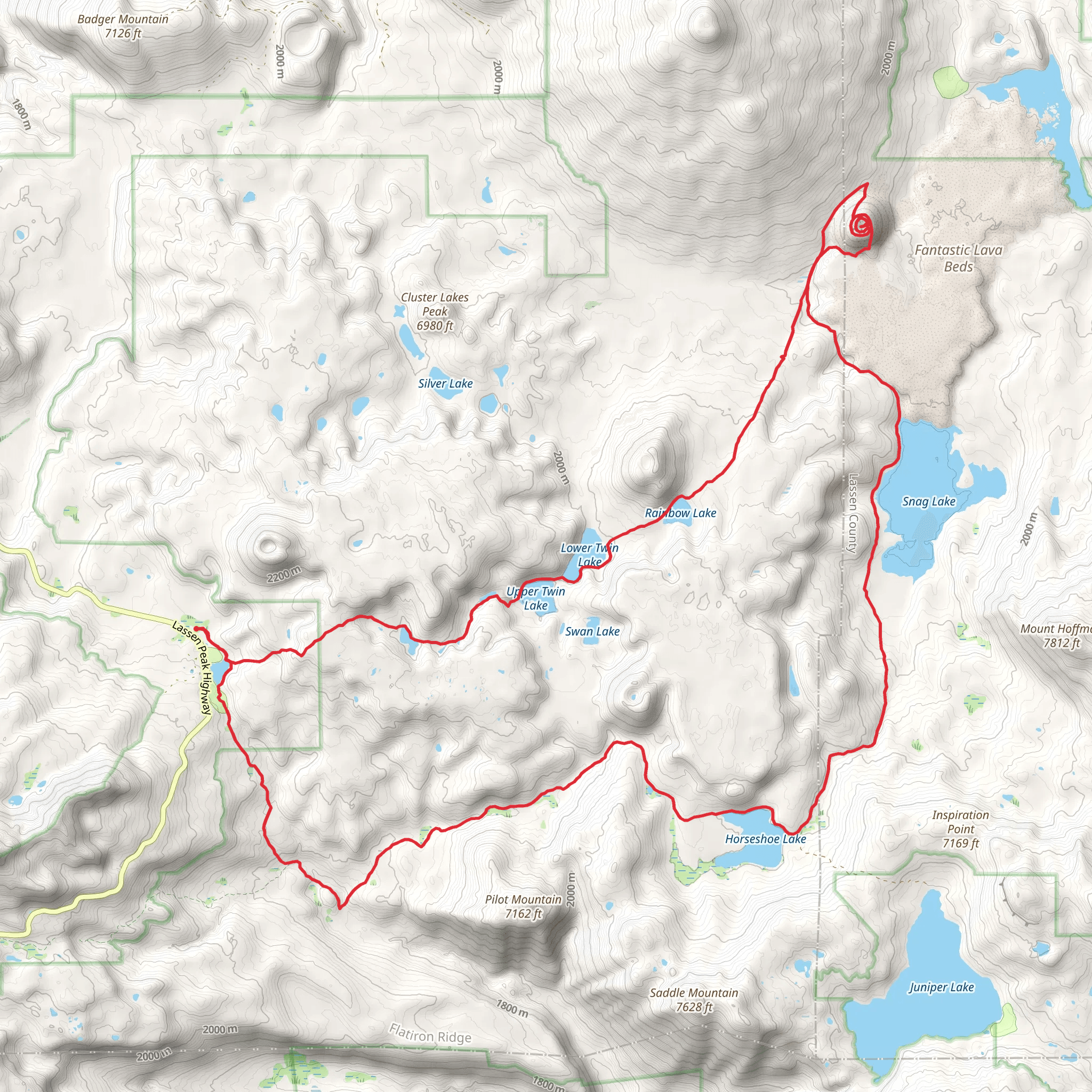
Nestled in the stunning landscapes of Shasta County, California, the Summit Lake, Horseshoe Lake, Snag Lake, and Cinder Cone Loop offers an invigorating journey through diverse terrains and breathtaking vistas. This 41 km (approximately 25.5 miles) loop trail, with an elevation gain of around 900 meters (about 2,950 feet), is a medium-difficulty adventure that promises both challenge and reward for those who embark on it.
Getting There
To reach the trailhead, travelers can drive to the Lassen Volcanic National Park, which is accessible via Highway 44 or Highway 36. The nearest major city is Redding, California, located about 80 miles (approximately 129 km) to the west. For those relying on public transport, the Redding Amtrak station is the closest rail service, and from there, a rental car or shuttle service can be arranged to reach the park.
Trail Highlights
Summit Lake
Starting near Summit Lake, hikers are greeted with serene waters reflecting the surrounding forested hills. This area is a perfect spot for a brief rest or a picnic before delving deeper into the trail. The lake is a popular camping site, offering both North and South campgrounds, which are ideal for those looking to extend their adventure over multiple days.
Horseshoe Lake
Continuing on, the trail leads to Horseshoe Lake, a smaller but equally picturesque body of water. The path around the lake is relatively flat, providing a gentle respite before the more challenging sections ahead. Keep an eye out for the diverse birdlife that frequents the area, including osprey and various waterfowl.
Snag Lake
As you approach Snag Lake, the trail begins to ascend, offering panoramic views of the surrounding volcanic landscape. This lake is known for its unique geological features, including the remnants of ancient lava flows that have shaped the terrain. The area is rich in history, with evidence of Native American habitation and use of the land for thousands of years.
Cinder Cone
The highlight of the loop is undoubtedly the Cinder Cone, a striking volcanic feature that rises prominently from the landscape. The climb to the top is steep but rewarding, with a gain of approximately 230 meters (750 feet) over a short distance. From the summit, hikers are treated to a 360-degree view of the Painted Dunes, Lassen Peak, and the surrounding wilderness. The Cinder Cone itself is a testament to the region's volcanic activity, having last erupted in the mid-17th century.
Navigation and Safety
Given the trail's length and varied terrain, it's crucial to be well-prepared. Hikers should carry a reliable navigation tool like HiiKER to ensure they stay on track, especially in areas where the trail may be less defined. Weather conditions can change rapidly, so packing layers and rain gear is advisable. Wildlife is abundant, including deer, black bears, and a variety of smaller mammals, so maintaining a respectful distance and securing food properly is essential.
Historical Significance
The Lassen Volcanic National Park, where this trail is located, is steeped in geological and cultural history. The park is one of the few places on Earth where all four types of volcanoes can be found: shield, plug dome, cinder cone, and stratovolcano. This diversity offers a unique opportunity to witness the forces that have shaped our planet. Additionally, the area holds cultural significance for the Native American tribes who have lived here for millennia, with many trails and landmarks bearing names that reflect their heritage.
Embarking on the Summit Lake, Horseshoe Lake, Snag Lake, and Cinder Cone Loop is not just a hike; it's a journey through time and nature, offering a glimpse into the dynamic processes that continue to shape this remarkable landscape.
AI Planner
Days planned around your pace, with somewhere to stay each night.
What to expect?
Activity types
Comments and Reviews
User comments, reviews and discussions about the Summit Lake, Horseshoe Lake, Snag Lake and Cinder Cone Loop, California.
average rating out of 5
0 rating(s)
