Download
Preview
Add to list
More
2.3 km
~43 min
166 m
Out and Back
“Embark on the historic Springhill Trail for a scenic and enlightening 2 km hike amidst California's nature.”
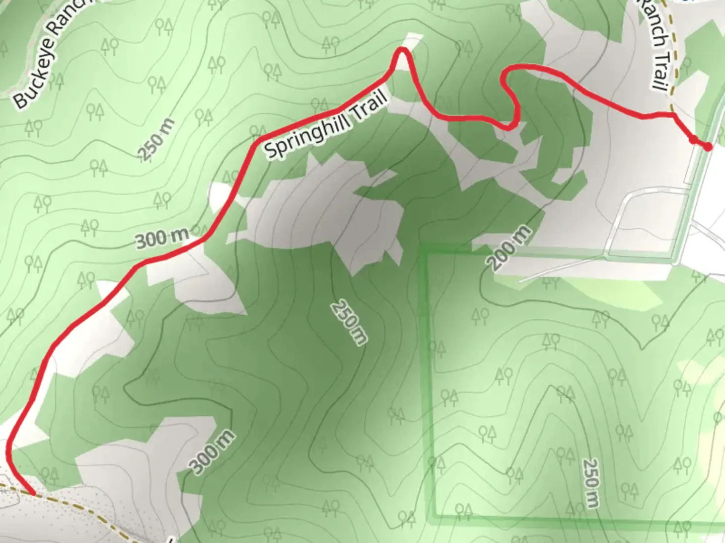
The Springhill Trail, nestled near Contra Costa County in California, offers a moderately challenging hike that spans approximately 2 km (about 1.24 miles) with an elevation gain of roughly 100 meters (328 feet). This out-and-back trail is a favorite among locals and visitors looking for a quick escape into nature.
Getting There
To reach the trailhead, if you're driving, navigate towards the Lafayette Reservoir Recreation Area, which is the nearest significant landmark. Parking is available here, though it may be limited on weekends and holidays when the trail sees more foot traffic. For those opting for public transport, check the local bus schedules as services may change seasonally, and plan to get off at a stop near the Lafayette Reservoir. From there, it's a short walk to the trailhead.
The Hike
As you embark on the Springhill Trail, you'll be greeted by a mix of oak woodlands and grassy hillsides. The trail is well-maintained, but it's advisable to download the trail map on HiiKER beforehand to ensure you stay on the right path. The initial section of the trail is relatively flat, allowing hikers to warm up before the ascent begins.
Flora and Fauna
As you progress, keep an eye out for the diverse plant life, including California poppies and purple lupines that add splashes of color in the spring. The area is also home to wildlife such as deer, squirrels, and various bird species, so birdwatchers will want to have their binoculars at the ready.
Historical Significance
The region around Springhill Trail is steeped in history. Contra Costa County played a significant role during the Gold Rush era and the development of the San Francisco Bay Area. While hiking, ponder the fact that you're walking near routes once traversed by indigenous peoples, early settlers, and prospectors.
Navigating the Ascent
The trail's incline becomes more pronounced as you approach the halfway mark. Here, the path may become rockier, so wearing proper hiking boots is recommended. The climb is steady, and as you gain elevation, you'll be rewarded with increasingly expansive views of the surrounding hills and the reservoir.
The Turnaround Point
Upon reaching the 1 km (0.62 miles) mark, you'll find a suitable spot to rest and enjoy the scenery before making your way back down the same path. The descent will be quicker, but maintain a careful pace as the trail can be slippery, especially if there's been recent rain.
Preparation Tips
Before setting out, ensure you have enough water, as there are no refill stations along the trail. Sun protection is also crucial, as certain stretches offer little shade. Lastly, always check the weather forecast and trail conditions, as they can change rapidly.
Remember, the Springhill Trail is a wonderful opportunity to enjoy a brief but invigorating hike that offers a glimpse into California's natural beauty and historical past.

What to expect?
Activity types
Comments and Reviews
User comments, reviews and discussions about the Springhill Trail, California.
5.0
average rating out of 5
1 rating(s)