Download
Preview
Add to list
More
5.5 km
~1 hrs 23 min
171 m
Loop
“Embark on a scenic Ozark adventure, blending historical intrigue with the Ozarks' natural splendor on the Butterfield Trail.”
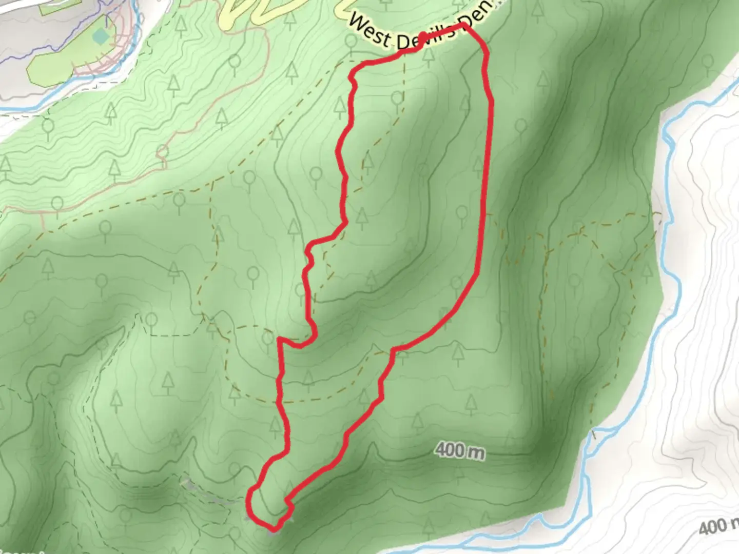
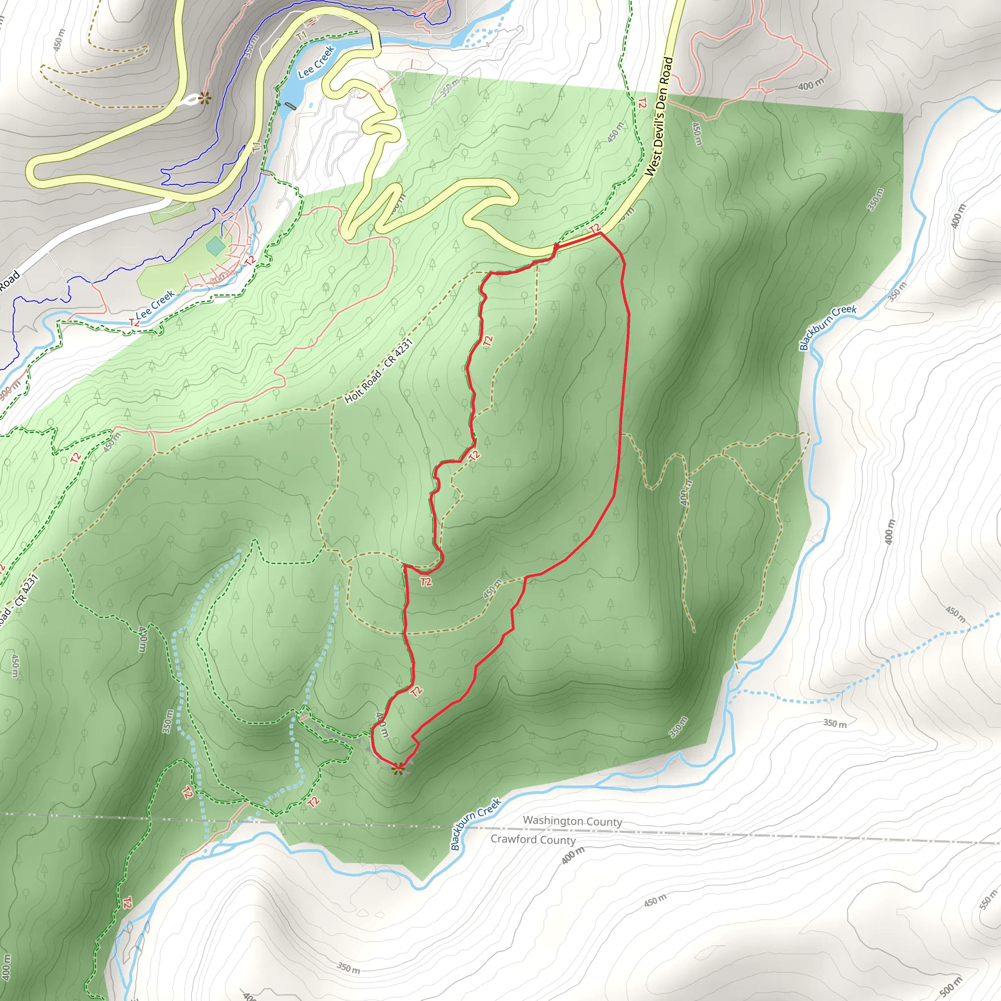
Nestled in the lush landscapes of Washington County, Arkansas, the Butterfield Hiking Trail and West Devil's Den Road Loop offers an immersive experience into the natural beauty and historical significance of the Ozarks. Spanning approximately 6 kilometers (about 3.7 miles) with an elevation gain of around 100 meters (328 feet), this loop trail is a medium-difficulty hike that caters to those with some experience on the trails.Getting There To reach the trailhead, hikers can drive to the Devil's Den State Park, located in the Lee Creek Valley. The park is accessible via Interstate 49, taking Exit 53 to AR-74 West, leading directly to the park. For those relying on public transportation, options are limited, and a car rental might be necessary to arrive at the starting point.Trail Experience The journey begins near the park's visitor center, where ample parking is available. As you embark on the trail, you'll be greeted by a canopy of hardwood forests, home to a diverse array of flora and fauna. Keep an eye out for white-tailed deer, armadillos, and a variety of bird species that inhabit this area.Historical Significance The Butterfield Hiking Trail is named after the historic Butterfield Overland Mail Route, which operated during the late 1850s. This mail and passenger stage service played a crucial role in connecting the eastern United States with California. As you hike, imagine the stagecoaches that once traversed these rugged landscapes, and consider stopping at the interpretive panels along the trail to learn more about the area's past.Navigating the Trail The loop is well-marked, but it's always wise to carry a reliable navigation tool like HiiKER to ensure you stay on the right path. The trail will lead you through varying terrain, including rocky outcrops and serene creek crossings. The elevation changes are moderate, with the most significant ascent occurring in the first half of the hike.Landmarks and Scenery Approximately 2 kilometers (1.2 miles) in, you'll encounter the impressive rock formations and bluffs that the Ozarks are famous for. These geological features offer a stunning backdrop for photos and a moment to appreciate the ancient landscapes.As you continue, the trail meanders alongside Lee Creek, providing opportunities to cool off in the clear waters during warmer months. Be mindful of the creek's water levels, as they can rise significantly after heavy rains.Flora and Fauna The trail is a haven for wildflower enthusiasts, especially in the spring when the forest floor is carpeted with trilliums, bloodroot, and wild violets. The changing seasons bring a kaleidoscope of colors, from the vibrant greens of spring to the fiery hues of autumn.Preparation and Safety Before setting out, ensure you have adequate water, snacks, and a first-aid kit. The weather in Arkansas can be unpredictable, so dress in layers and be prepared for sudden changes in temperature and precipitation. It's also advisable to wear sturdy hiking boots, as the terrain can be uneven and rocky in places.Conclusion The Butterfield Hiking Trail and West Devil's Den Road Loop is a journey through time, nature, and the undisturbed beauty of the Ozarks. Whether you're a history buff, nature lover, or simply seeking a peaceful hike, this trail offers a little something for everyone. Remember to leave no trace and preserve the pristine condition of this remarkable area for future generations to enjoy.
What to expect?
Activity types
Comments and Reviews
User comments, reviews and discussions about the Butterfield Hiking Trail and West Devil's Den Road Loop, Arkansas.
4.5
average rating out of 5
80 rating(s)
