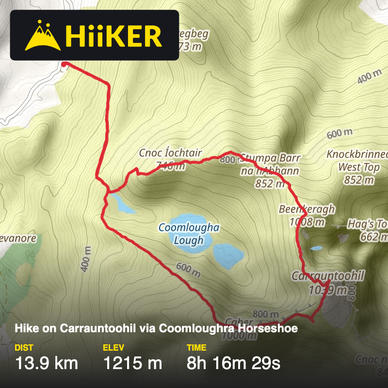
Hike on Carrauntoohil via Coomloughra Horseshoe
Maum ED, County Kerry, Kenmare Municipal District, Ireland
October 29, 2025
Download
3D Flyover
More
Trail length
13.9 km
Time
~8h 16m 29s
Elevation Gain
1215 m
Hike Type
Loop
Brilliant routes even though it rained three times and visibility off Carrauntoohil was very poor. Went down too far before taking the bearing to Caher. Knew I was wrong, knew where I had gone and was able to correct to the right path. Alex faced his fears with the Breekeragh Ridge - great job.
Comments and Reviews
User comments, reviews and discussions about this recording.
—
average rating out of 5
0 ratings