MAP COVERAGE
Toitu Te Whenua Land Information New Zealand and the New Zealand Government, the NZ government’s lead agency for property and location information, Crown property and managing overseas investment – working across land, sea, data and regulatory areas.
VIEW MAP
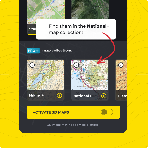
Not only do you get Land Information New Zealand (LINZ) with HiiKER PRO+, but ALL of our curated collections of the worlds essential hiking maps from both national and independent sources. Plus a bunch of great tools too!
LEARN MORE