Download
Preview
Add to list
More
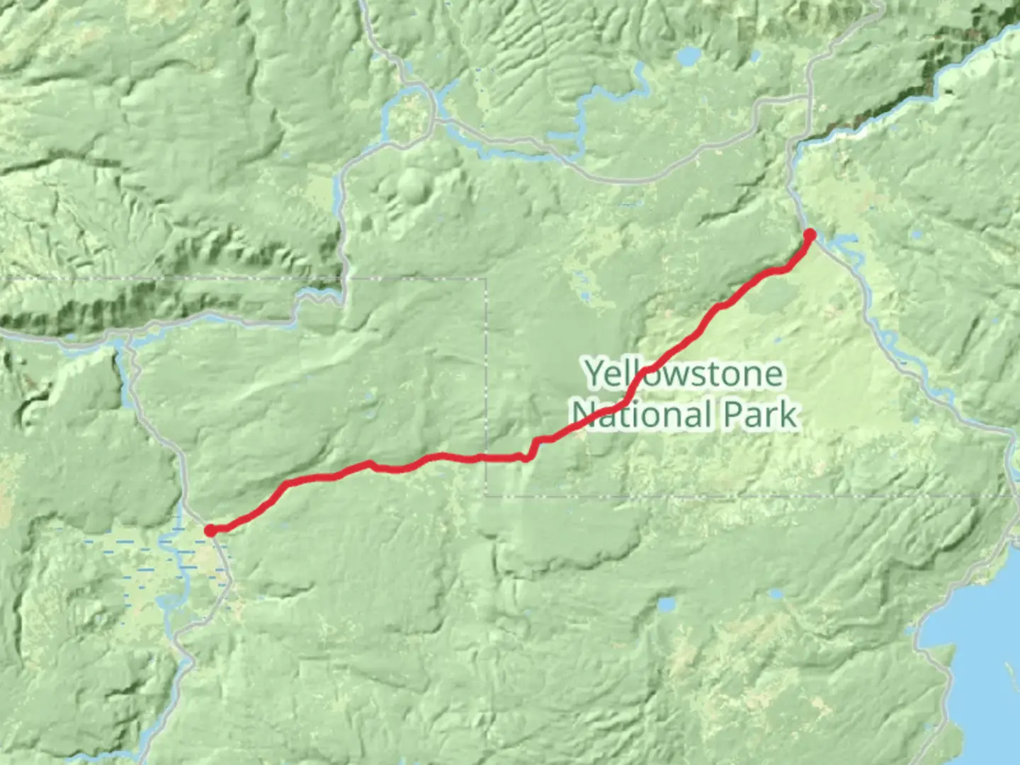
32.5 km
~7 hrs 27 min
574 m
Point-to-Point
“Explore the scenic and historic Mary Mountain Nez Perce Trail, a 20.5-mile moderate hike through diverse landscapes.”
Starting near Teton County, Wyoming, the Mary Mountain Nez Perce Trail stretches approximately 33 kilometers (20.5 miles) with an elevation gain of around 500 meters (1,640 feet). This point-to-point trail is rated as medium difficulty, making it suitable for moderately experienced hikers.
Getting There
To reach the trailhead, you can drive or use public transport. If driving, head towards the nearest significant landmark, which is the town of Jackson, Wyoming. From Jackson, take US-191 N/US-26 E/US-89 N towards Yellowstone National Park. The trailhead is located near the southern entrance of the park. For those using public transport, buses run from Jackson to the southern entrance of Yellowstone, where you can then arrange for a shuttle or taxi to the trailhead.
Trail Overview
The Mary Mountain Nez Perce Trail offers a rich blend of natural beauty and historical significance. The trail traverses through diverse landscapes, including meadows, forests, and geothermal areas. As you hike, you'll encounter a variety of flora and fauna, making it a paradise for nature enthusiasts.
Significant Landmarks and Wildlife
- Meadows and Forests: The trail begins with a gentle ascent through lush meadows and dense forests. Keep an eye out for wildflowers in the spring and summer months.
- Geothermal Areas: Around the 10-kilometer (6.2-mile) mark, you'll come across geothermal features such as hot springs and fumaroles. These areas are fascinating but can be dangerous, so stay on the marked paths.
- Wildlife: The trail is home to a variety of wildlife, including bison, elk, and occasionally bears. It's crucial to carry bear spray and know how to use it. Always maintain a safe distance from wildlife and never approach or feed them.
Historical Significance
The trail follows a route used by the Nez Perce tribe during their flight from the U.S. Army in 1877. This historical context adds a layer of depth to your hike, as you walk in the footsteps of those who traversed these lands over a century ago. Interpretive signs along the trail provide more information about this significant event.
Navigation and Safety
Given the trail's length and the potential for changing weather conditions, it's essential to be well-prepared. Use the HiiKER app for accurate navigation and real-time updates on trail conditions. Ensure you have a detailed map, a compass, and a GPS device as backup.
Elevation and Terrain
The trail's elevation gain of 500 meters (1,640 feet) is spread out over its length, making for a steady but manageable climb. The highest point is around 2,400 meters (7,874 feet) above sea level. The terrain varies from well-trodden paths to rocky sections, so sturdy hiking boots are recommended.
Water and Supplies
There are few reliable water sources along the trail, so carry enough water for the entire hike. A water filtration system can be useful if you plan to refill from natural sources. Pack enough food and snacks to sustain your energy levels, and always carry a first-aid kit.
Weather Considerations
Weather in this region can be unpredictable. Summers can be warm, but temperatures drop significantly at higher elevations and during the night. Winters are harsh and not recommended for hiking. Always check the weather forecast before setting out and be prepared for sudden changes.
By following these guidelines and being well-prepared, you can fully enjoy the natural beauty and historical significance of the Mary Mountain Nez Perce Trail.

What to expect?
Activity types
Comments and Reviews
User comments, reviews and discussions about the Mary Mountain Nez Perce Trail, Wyoming.
4.46
average rating out of 5
69 rating(s)