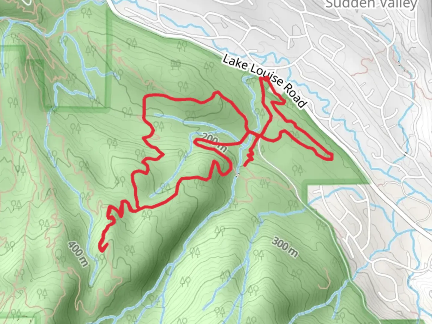
Rufus Creek, Waterfall, Baneberry and Leila June Loop Trail
Download
Preview
Add to list
More
7.2 km
~2 hrs 4 min
384 m
Loop
“Embark on the Rufus Creek Loop Trail for a 7 km journey of waterfalls, wildlife, and panoramic mountain views.”
Starting near Whatcom County, Washington, the Rufus Creek, Waterfall, Baneberry, and Leila June Loop Trail offers a captivating 7 km (approximately 4.3 miles) journey with an elevation gain of around 300 meters (984 feet). This loop trail is rated as medium difficulty, making it suitable for moderately experienced hikers.
Getting There
To reach the trailhead, you can drive or use public transportation. If driving, head towards Whatcom County and look for parking near the trailhead, which is close to the intersection of Mount Baker Highway and Canyon Creek Road. For those using public transport, the nearest significant landmark is the Glacier Public Service Center. From there, you may need to arrange a taxi or rideshare to the trailhead.
Trail Navigation
For navigation, it is highly recommended to use the HiiKER app, which provides detailed maps and real-time updates. This will help you stay on track and make the most of your hiking experience.
Trail Highlights
The trail begins with a gentle ascent through a dense forest of Douglas fir and western red cedar. About 1 km (0.6 miles) in, you'll encounter Rufus Creek, a serene spot perfect for a short break. The sound of the flowing water and the lush greenery create a tranquil atmosphere.
Waterfall and Scenic Views
Continuing along the trail, at around the 2 km (1.2 miles) mark, you'll reach a stunning waterfall. This is one of the highlights of the hike, where you can take in the sight and sound of cascading water. The area around the waterfall is often damp and slippery, so proceed with caution.
Baneberry Section
As you move forward, the trail takes you through the Baneberry section, named after the native baneberry plants that grow abundantly here. This part of the trail is relatively flat and offers a chance to observe local wildlife, including deer and various bird species. Keep an eye out for the distinctive red berries of the baneberry plant, but remember they are toxic if ingested.
Leila June Loop
The final section of the trail, known as the Leila June Loop, involves a moderate climb. This part of the trail offers panoramic views of the surrounding mountains and valleys. The elevation gain here is about 150 meters (492 feet) over 1.5 km (0.9 miles), making it the most challenging part of the hike. However, the effort is well worth it for the breathtaking vistas.
Historical Significance
The region around Whatcom County has a rich history, with indigenous tribes such as the Nooksack and Lummi having inhabited the area for thousands of years. The trail itself passes through lands that were historically used for hunting and gathering. Respect the natural and cultural heritage by staying on the designated paths and leaving no trace.
Final Stretch
As you complete the loop, the trail descends gently back towards the starting point. This final stretch is a great opportunity to reflect on the diverse landscapes and natural beauty you've experienced. The entire hike typically takes around 3 to 4 hours, depending on your pace and the time spent at various landmarks.
Prepare adequately with water, snacks, and appropriate footwear, and always check weather conditions before setting out. Happy hiking!

What to expect?
Activity types
Comments and Reviews
User comments, reviews and discussions about the Rufus Creek, Waterfall, Baneberry and Leila June Loop Trail, Washington.
4.5
average rating out of 5
10 rating(s)