Download
Preview
Add to list
More
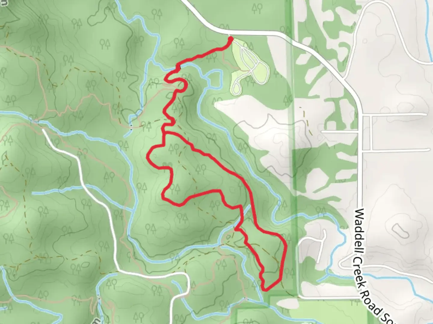
5.5 km
~1 hrs 24 min
190 m
Loop
“The Equine Loop is a scenic, medium-difficulty 5 km trail featuring diverse landscapes and rich history.”
Starting near Thurston County, Washington, the Equine Loop is a delightful 5 km (approximately 3.1 miles) loop trail with an elevation gain of around 100 meters (328 feet). This trail is rated as medium difficulty, making it suitable for moderately experienced hikers looking for a rewarding outdoor experience.
Getting There
To reach the trailhead, you can drive or use public transport. If driving, head towards the nearest significant landmark, the Mima Mounds Natural Area Preserve. From there, follow the signs to the trailhead. For those using public transport, the nearest bus stop is at Littlerock Road SW & 110th Ave SW, from where you can take a short taxi ride or a bike to the trailhead.
Trail Navigation
For navigation, it is highly recommended to use the HiiKER app, which provides detailed maps and real-time updates. The trail is well-marked, but having a reliable navigation tool can enhance your hiking experience.
Trail Highlights
The Equine Loop offers a variety of landscapes and natural features. Starting from the trailhead, the first kilometer (0.6 miles) takes you through a dense forest of Douglas fir and western red cedar. This section is relatively flat, making it a good warm-up for the more challenging parts ahead.
Flora and Fauna
As you progress, the trail begins to ascend gently. Around the 2 km (1.2 miles) mark, you'll encounter a meadow that bursts into a riot of colors during the spring and summer months, thanks to the wildflowers like lupines and Indian paintbrush. Keep an eye out for local wildlife, including black-tailed deer and various bird species such as the Steller's jay and the pileated woodpecker.
Historical Significance
The region around Thurston County has a rich history. The trail itself passes near areas that were historically significant to the indigenous Nisqually people. Interpretive signs along the trail provide insights into their way of life and the natural resources they relied upon.
Midpoint and Elevation Gain
At approximately the 3 km (1.9 miles) mark, you'll reach the highest point of the trail, offering panoramic views of the surrounding landscape. This is a great spot to take a break and enjoy the scenery. The elevation gain here is about 100 meters (328 feet), which is gradual but noticeable.
Descending and Completing the Loop
The descent begins after this high point, leading you back through another section of forest. This part of the trail can be a bit steeper, so watch your footing, especially if the ground is wet. The final kilometer (0.6 miles) brings you back to the trailhead, completing the loop.
Practical Tips
- Wear sturdy hiking boots, as the trail can be uneven in places.
- Bring water and snacks, especially if you plan to take breaks and enjoy the scenery.
- Check the weather forecast before heading out, as conditions can change rapidly.
- Use the HiiKER app for real-time navigation and updates.
The Equine Loop offers a balanced mix of natural beauty, moderate physical challenge, and historical context, making it a rewarding hike for those who venture onto its paths.

What to expect?
Activity types
Comments and Reviews
User comments, reviews and discussions about the Equine Loop, Washington.
4.57
average rating out of 5
14 rating(s)