Download
Preview
Add to list
More
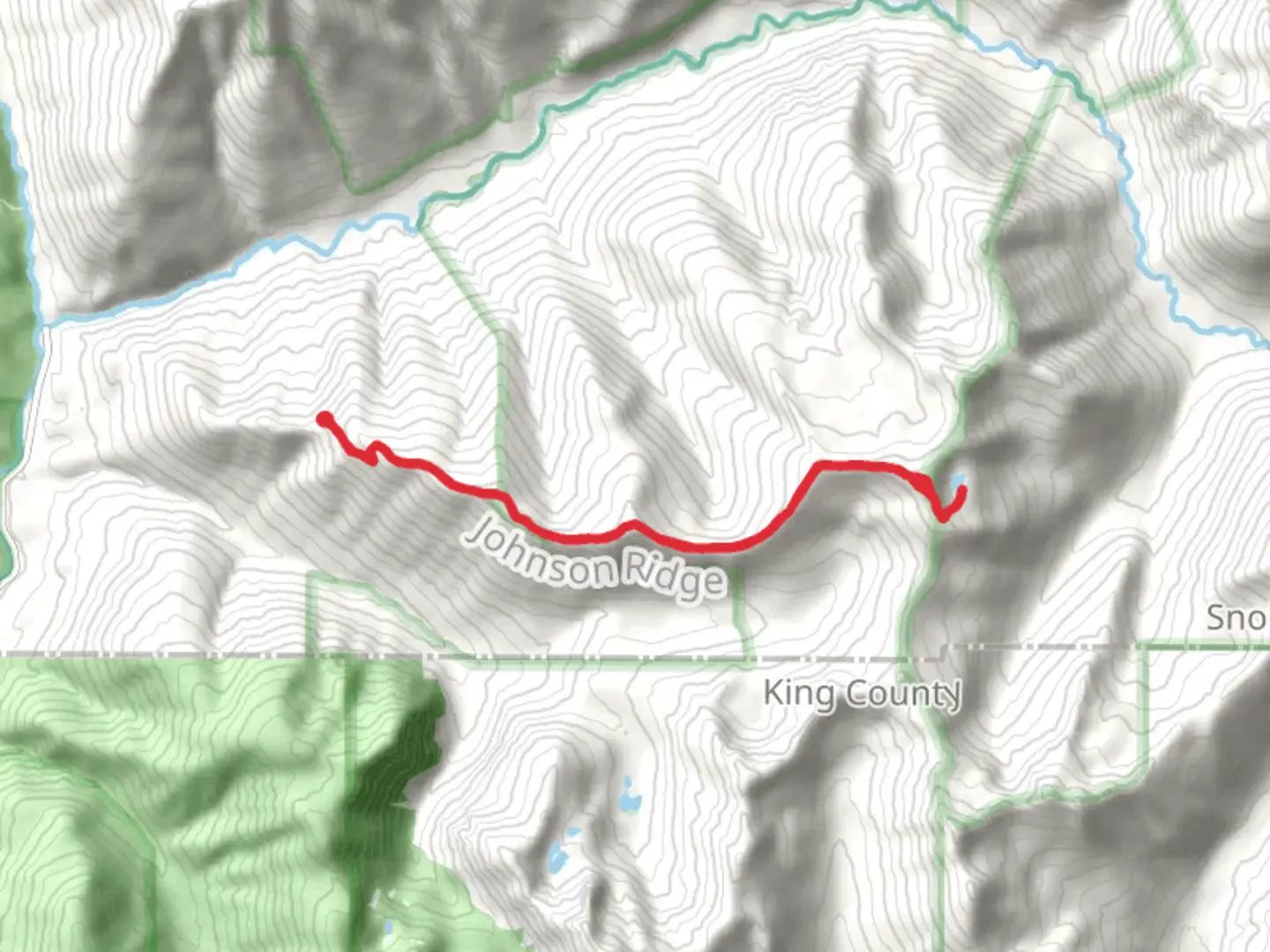
13.3 km
~4 hrs 21 min
1021 m
Loop
“Embark on a scenic, moderately challenging 13 km loop trail through lush forests and alpine meadows, capped with panoramic mountain views.”
Starting your adventure near Snohomish County, Washington, this 13 km (8 miles) loop trail offers a moderate challenge with an elevation gain of approximately 1000 meters (3280 feet). The trailhead is accessible by car, with parking available near the Beckler River Campground. For those using public transport, the nearest significant landmark is the town of Skykomish, from where you can arrange a taxi or rideshare to the trailhead.
Initial Ascent and Joan Lake
The hike begins with a steady ascent through dense forest, where you'll be surrounded by towering Douglas firs and western hemlocks. After about 3 km (1.9 miles) and an elevation gain of 300 meters (984 feet), you'll reach Joan Lake. This serene alpine lake is a perfect spot for a short break. The clear waters reflect the surrounding peaks, making it a picturesque location for photography. Keep an eye out for local wildlife such as deer and various bird species, including the occasional bald eagle.
Scorpion Mountain
Continuing from Joan Lake, the trail becomes steeper as you make your way towards Scorpion Mountain. This section covers approximately 4 km (2.5 miles) and involves an elevation gain of 500 meters (1640 feet). The trail here is rocky and can be slippery, especially after rain, so good hiking boots are essential. As you ascend, the forest gives way to alpine meadows filled with wildflowers during the summer months. Upon reaching the summit of Scorpion Mountain, you'll be rewarded with panoramic views of the Cascade Range. On clear days, you can see as far as Mount Rainier and Mount Baker.
Sunrise Mountain and Descent
From Scorpion Mountain, the trail continues towards Sunrise Mountain, which is about 2 km (1.2 miles) away with a minor elevation gain of 200 meters (656 feet). This section is less strenuous and offers more opportunities to enjoy the surrounding scenery. Sunrise Mountain provides another excellent vantage point, with sweeping views of the valleys below and the peaks beyond.
The descent begins from Sunrise Mountain, looping back towards the trailhead. This final 4 km (2.5 miles) stretch is mostly downhill, but be cautious as the path can be narrow and uneven in places. The descent takes you through more alpine meadows and eventually back into the forest, where you might spot small mammals like chipmunks and squirrels.
Navigation and Safety
Given the varied terrain and potential for changing weather conditions, it's advisable to use a reliable navigation tool like HiiKER to keep track of your progress and ensure you stay on the correct path. The trail is generally well-marked, but some sections can be confusing, especially in foggy conditions.
Historical Significance
The region around Snohomish County has a rich history, with the trail passing through areas that were historically used by Native American tribes for hunting and gathering. The Cascade Range itself has been a significant natural barrier and resource for centuries, shaping the lives and cultures of the people who lived here.
Getting There
To reach the trailhead by car, head towards the Beckler River Campground, which is well-signposted from the main roads. If you're using public transport, the nearest town is Skykomish, located along Highway 2. From Skykomish, you can arrange for a taxi or rideshare to take you the remaining distance to the trailhead. Ensure you check the latest schedules and availability of transport options before you set out.

What to expect?
Activity types
Comments and Reviews
User comments, reviews and discussions about the Joan Lake, Scorpion Mountain and Sunrise Mountain, Washington.
4.0
average rating out of 5
2 rating(s)