Download
Preview
Add to list
More
8.7 km
~2 hrs 37 min
534 m
Loop
“Embark on the Lava Canyon Trail for breathtaking waterfalls, unique geology, and a moderately challenging adventure.”
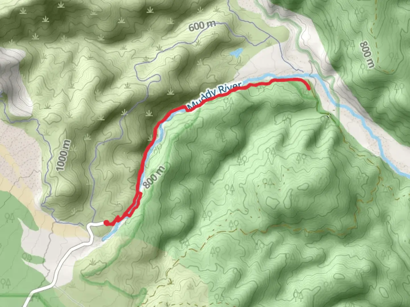
Starting your adventure near Skamania County, Washington, the Lava Canyon Trail and Muddy River loop offers a captivating journey through a landscape shaped by volcanic activity. This 9 km (approximately 5.6 miles) loop trail features an elevation gain of around 500 meters (1,640 feet), making it a moderately challenging hike suitable for those with some experience.
Getting There
To reach the trailhead, you can drive to the Lava Canyon Trailhead, located off Forest Road 83. If you're using public transport, the nearest major city is Portland, Oregon. From Portland, you can take a bus to Cougar, Washington, and then arrange for a local taxi or rideshare to the trailhead. The exact coordinates for the trailhead are near the Lava Canyon Interpretive Site, which is well-signposted.
Trail Highlights
As you embark on the trail, you'll immediately notice the unique geological features that define this area. The trail begins with a descent into the canyon, where you'll encounter the first of many waterfalls. The initial section is relatively easy, but as you progress, the terrain becomes more rugged.
Waterfalls and Bridges
Approximately 1.5 km (0.9 miles) into the hike, you'll come across the first suspension bridge. This bridge offers stunning views of the cascading waterfalls below. Be cautious here, as the bridge can sway and may be slippery when wet. Continuing along the trail, you'll encounter several more waterfalls, each more impressive than the last. The largest waterfall, located about 3 km (1.9 miles) in, is a perfect spot for a break and some photos.
Geological Formations
The trail is renowned for its fascinating geological formations, including lava tubes and basalt columns. These features are remnants of the 1980 eruption of Mount St. Helens, which dramatically altered the landscape. The lava flows created a unique environment that supports a variety of plant and animal life.
Flora and Fauna
The lush vegetation along the trail includes ferns, mosses, and a variety of wildflowers, especially vibrant in the spring and early summer. Keep an eye out for local wildlife such as deer, elk, and various bird species. The Muddy River, which you'll follow for a portion of the trail, is home to several fish species, adding to the area's biodiversity.
Safety and Navigation
Given the trail's moderate difficulty, it's essential to come prepared. Wear sturdy hiking boots, bring plenty of water, and consider using trekking poles for added stability. The trail can be narrow and steep in sections, so caution is advised, especially near the waterfalls and on the suspension bridges.
For navigation, the HiiKER app is highly recommended. It provides detailed maps and real-time GPS tracking, ensuring you stay on the correct path. Cell service can be spotty in this remote area, so downloading the trail map in advance is a good idea.
Historical Significance
The Lava Canyon area holds significant historical importance due to its transformation following the Mount St. Helens eruption. The eruption not only reshaped the landscape but also provided scientists with valuable insights into volcanic activity and its ecological impacts. Interpretive signs along the trail offer educational information about the eruption and its aftermath, enriching your hiking experience.
Final Stretch
As you near the end of the loop, the trail ascends back towards the trailhead. This final section can be strenuous, but the panoramic views of the canyon and surrounding forest make it worthwhile. The entire loop takes approximately 4-5 hours to complete, depending on your pace and the number of stops you make to take in the scenery.
This hike offers a unique blend of natural beauty, geological wonders, and historical significance, making it a must-visit for any outdoor enthusiast.

What to expect?
Activity types
Comments and Reviews
User comments, reviews and discussions about the Lava Canyon Trail and Muddy River, Washington.
4.45
average rating out of 5
11 rating(s)