Download
3D Preview
Add to list
More
16.1 km
~4 hrs 19 min
658 m
Out and Back
“Embark on the invigorating Cutthroat Pass hike for stunning vistas, diverse landscapes, and historical significance.”
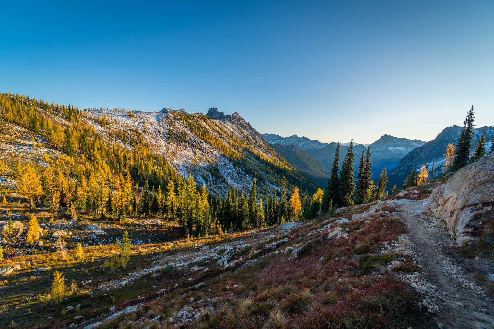
Starting your journey near Skagit County, Washington, the Cutthroat Pass via Pacific Crest Trail offers an invigorating 16 km (10 miles) out-and-back adventure with an elevation gain of approximately 700 meters (2,300 feet). This trail is rated as medium difficulty, making it accessible for most hikers with a moderate level of fitness.
Getting There
To reach the trailhead, you can drive to the nearest significant landmark, which is the Rainy Pass Trailhead on Highway 20. If you're using public transport, the closest major town is Marblemount, Washington. From Marblemount, you can arrange a shuttle or taxi service to the trailhead, as public transport options are limited in this remote area.
Trail Overview
The trail begins at the Rainy Pass Trailhead, located at an elevation of about 1,480 meters (4,860 feet). The initial section of the trail is relatively gentle, winding through lush forests of Douglas fir and western hemlock. As you progress, the trail begins to ascend more steeply, offering glimpses of the surrounding North Cascades peaks.
Significant Landmarks and Nature
Around 3 km (1.9 miles) into the hike, you'll encounter a series of switchbacks that lead you through alpine meadows adorned with wildflowers during the summer months. Keep an eye out for the vibrant colors of lupine, Indian paintbrush, and columbine. This section also provides excellent opportunities for spotting wildlife such as marmots, pikas, and occasionally, black bears.
At approximately 6 km (3.7 miles), you'll reach a viewpoint that offers stunning vistas of the North Cascades. This is a great spot to take a break and soak in the panoramic views of jagged peaks and deep valleys.
Historical Significance
The Pacific Crest Trail, which you are hiking a section of, is a historic long-distance trail that stretches from Mexico to Canada. This particular segment has been used for centuries by Native American tribes for trade and travel. The area around Cutthroat Pass was also explored by early European settlers and fur traders in the 19th century.
Final Ascent to Cutthroat Pass
The final push to Cutthroat Pass involves a steeper climb, gaining about 300 meters (1,000 feet) in elevation over the last 2 km (1.2 miles). As you approach the pass, the terrain becomes more rugged, and the vegetation transitions to hardy alpine species. The pass itself sits at an elevation of approximately 2,180 meters (7,150 feet) and offers breathtaking views of the surrounding peaks and valleys.
Navigation and Safety
Given the remote nature of this trail, it's crucial to be well-prepared. Make sure to download the trail map from HiiKER for offline use, as cell service is unreliable in this area. Carry sufficient water, snacks, and layers of clothing to adapt to changing weather conditions. Trekking poles can be helpful for the steeper sections, and always be aware of your surroundings to avoid wildlife encounters.
This trail offers a rewarding experience with its diverse landscapes, rich history, and stunning vistas, making it a must-do for any hiking enthusiast exploring the North Cascades.

What to expect?
Activity types
Comments and Reviews
User comments, reviews and discussions about the Cutthroat Pass via Pacific Crest Trail, Washington.
4.53
average rating out of 5
19 rating(s)