Download
Preview
Add to list
More
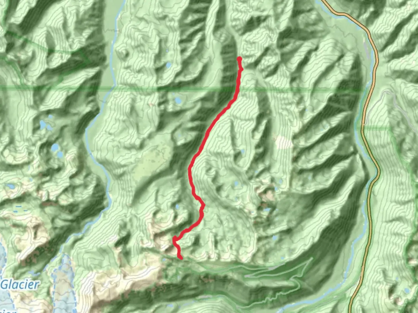
27.4 km
~7 hrs 41 min
1320 m
Out and Back
“The Huckleberry Creek Trail offers a challenging 27-kilometer hike with stunning views and rich historical significance.”
Starting near Pierce County, Washington, the Huckleberry Creek Trail - Long is an out-and-back trail that stretches approximately 27 kilometers (around 17 miles) with an elevation gain of about 1300 meters (4265 feet). This trail is rated as medium difficulty, making it suitable for moderately experienced hikers.
Getting There
To reach the trailhead, you can drive or use public transportation. If driving, head towards the vicinity of Mount Rainier National Park, specifically near the Carbon River Entrance. The nearest significant landmark is the Carbon River Ranger Station. For those using public transport, the closest major city is Seattle. From Seattle, you can take a bus or train to Tacoma, and then a local bus towards the Carbon River area. Be sure to check the latest schedules and routes on local transit websites.
Trail Overview
The trail begins in a lush, forested area characterized by towering Douglas firs and western hemlocks. The initial section is relatively flat, allowing you to ease into the hike. As you progress, the trail starts to ascend gradually, offering glimpses of Huckleberry Creek, which runs parallel to the path for a significant portion of the hike.
Key Landmarks and Sections
First 5 Kilometers (3.1 Miles)
The first 5 kilometers (3.1 miles) of the trail are relatively gentle, with an elevation gain of about 200 meters (656 feet). This section is rich in flora, including ferns, mosses, and wildflowers during the spring and summer months. Keep an eye out for deer and various bird species that frequent this area.
Midway Point: 13.5 Kilometers (8.4 Miles)
At around the 13.5-kilometer (8.4-mile) mark, you'll reach a more challenging section with steeper inclines. The elevation gain here is more pronounced, adding another 500 meters (1640 feet) over the next few kilometers. This part of the trail offers stunning views of the surrounding valleys and, on clear days, you can catch sight of Mount Rainier in the distance. This is a good spot to take a break and refuel.
Final Stretch: 20-27 Kilometers (12.4-17 Miles)
The last 7 kilometers (4.3 miles) of the trail are the most strenuous, with an elevation gain of about 600 meters (1968 feet). The terrain becomes rockier, and the trail narrows in some sections. As you approach the turnaround point, you'll be rewarded with panoramic views of the Cascade Range. This area is also known for its alpine meadows, which are particularly beautiful in late summer when they are in full bloom.
Historical Significance
The region around Huckleberry Creek has a rich history. It was originally inhabited by the Puyallup and Nisqually tribes, who used the area for hunting and gathering. In the late 19th and early 20th centuries, the trail was part of a network used by early settlers and loggers. Remnants of old logging camps can still be found along the trail, offering a glimpse into the area's past.
Wildlife and Nature
The trail is home to a variety of wildlife, including black bears, elk, and mountain goats. It's essential to carry bear spray and know how to use it. The diverse ecosystem also supports numerous bird species, making it a great spot for birdwatching. The creek itself is a habitat for various fish species, including trout.
Navigation and Safety
Given the trail's length and elevation gain, it's crucial to be well-prepared. Use the HiiKER app for accurate navigation and real-time updates on trail conditions. Ensure you have adequate water, food, and appropriate clothing for changing weather conditions. Cell service is limited, so inform someone of your plans before heading out.
This trail offers a rewarding experience for those willing to take on its challenges, with breathtaking views and a rich tapestry of natural and historical elements.

What to expect?
Activity types
Comments and Reviews
User comments, reviews and discussions about the Huckleberry Creek Trail - Long, Washington.
4.56
average rating out of 5
9 rating(s)