Download
Preview
Add to list
More
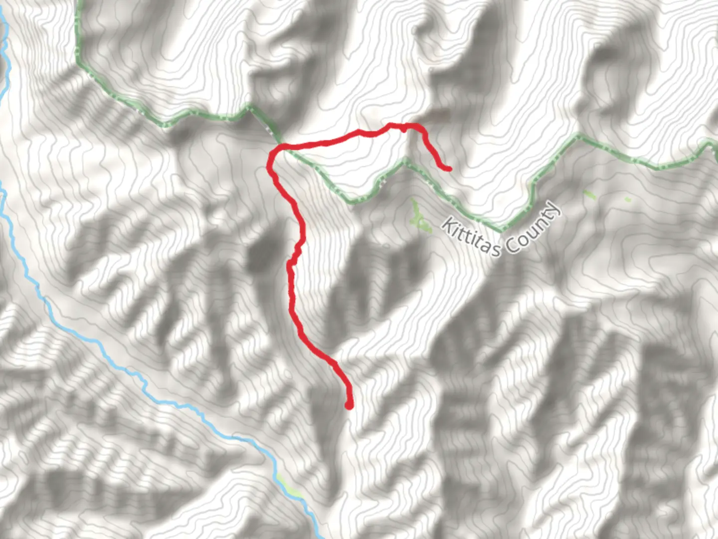
16.1 km
~5 hrs 9 min
1163 m
Out and Back
“Experience the rugged beauty and historical intrigue of the Pacific Northwest on this 16-km challenging hike.”
Starting your adventure near Kittitas County, Washington, the Hardscrabble Creek and Beverly Turnpike Trail offers a moderately challenging out-and-back hike spanning approximately 16 kilometers (10 miles) with an elevation gain of around 1100 meters (3600 feet). This trail is perfect for those looking to experience the rugged beauty of the Pacific Northwest.
Getting There
To reach the trailhead, you can drive or use public transportation. If driving, head towards the town of Cle Elum, Washington. From there, take the I-90 East and exit at WA-970 North. Continue on WA-970 until you reach Teanaway Road, then follow it to the trailhead near the Beverly Campground. For those using public transport, the nearest major bus stop is in Cle Elum, from where you can arrange a taxi or rideshare to the trailhead.
Trail Overview
The trail begins near the Beverly Campground, a convenient starting point with parking facilities. As you set off, the initial section of the trail meanders through dense forest, offering a cool and shaded environment. The first 3 kilometers (1.9 miles) are relatively gentle, with a gradual ascent of about 200 meters (650 feet), making it an excellent warm-up.
Significant Landmarks and Nature
Around the 4-kilometer (2.5-mile) mark, you'll encounter Hardscrabble Creek. This is a great spot to take a short break and enjoy the serene sounds of the flowing water. The trail then starts to climb more steeply, gaining approximately 300 meters (985 feet) over the next 2 kilometers (1.2 miles). Keep an eye out for the diverse flora, including Douglas firs, western hemlocks, and various wildflowers, especially in the spring and early summer.
Historical Significance
As you continue, you'll reach the Beverly Turnpike, a historic route used during the early 20th century for transporting goods. This section of the trail is particularly fascinating for history buffs, as remnants of old turnpike structures can still be seen. The trail here is rocky and uneven, so sturdy hiking boots are recommended.
Wildlife
The area is home to a variety of wildlife. Deer and elk are commonly spotted, and if you're lucky, you might even see a black bear or a mountain goat. Birdwatchers will also enjoy the diverse avian population, including eagles and hawks.
Final Ascent
The final push to the highest point of the trail involves a steep ascent of about 600 meters (1970 feet) over the last 4 kilometers (2.5 miles). This section is the most challenging, with switchbacks and rocky terrain. However, the effort is well worth it as you are rewarded with panoramic views of the surrounding mountains and valleys.
Navigation
Given the trail's complexity, it's advisable to use a reliable navigation tool like HiiKER to ensure you stay on track. The app provides detailed maps and real-time updates, which can be invaluable, especially in the more remote sections of the trail.
Return Journey
After reaching the peak, the return journey follows the same path back to the trailhead. The descent offers a different perspective and allows you to appreciate the trail's natural beauty from a new angle.
This trail offers a mix of natural beauty, historical intrigue, and physical challenge, making it a rewarding experience for any hiker.

What to expect?
Activity types
Comments and Reviews
User comments, reviews and discussions about the Hardscrabble Creek and Beverly Turnpike Trail, Washington.
4.63
average rating out of 5
8 rating(s)