Download
Preview
Add to list
More
13.2 km
~3 hrs 52 min
738 m
Out and Back
“Embark on a serene yet invigorating historical journey through Boulder De Roux's forested and rocky Washington terrain.”
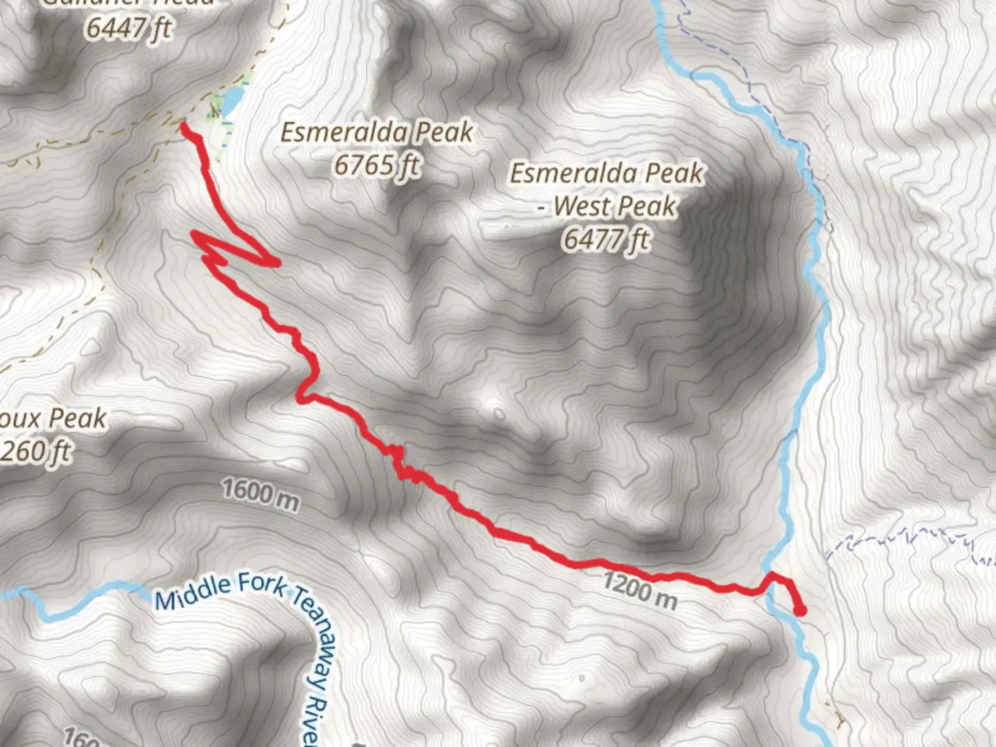
The Boulder De Roux Trail, nestled in the heart of Kittitas County, Washington, offers a moderately challenging hike that spans approximately 13 kilometers (about 8 miles) round trip with an elevation gain of roughly 700 meters (around 2300 feet). This out-and-back trail is a favorite among hikers who seek both the tranquility of dense forested areas and the excitement of rocky terrain.
Getting to the Trailhead
To reach the trailhead, if you're driving, you'll want to head towards the Teanaway Community Forest, which is the nearest significant landmark. From Cle Elum, take Highway 970 to Teanaway Road, and continue for about 13 kilometers (8 miles) until you reach the West Fork Teanaway Road. Follow this road for another 11 kilometers (7 miles), and you'll find the parking area for the Boulder De Roux Trail. Public transport options are limited in this region, so driving or carpooling is recommended.
The Hike Itself
As you embark on your hike, the first section of the trail meanders through a lush forest, where the canopy of conifers provides shade and a serene atmosphere. The undergrowth is rich with ferns and wildflowers, especially in the spring and early summer months. Keep an eye out for wildlife such as deer, elk, and various bird species that call this habitat home.
After approximately 3 kilometers (nearly 2 miles), the trail begins to ascend more steeply, offering hikers a bit of a challenge as they navigate the switchbacks. The terrain here becomes rockier, and the forest opens up to reveal stunning views of the surrounding peaks and valleys.
Historical Significance and Landmarks
The Boulder De Roux area is steeped in history, with the region having been a part of the mining and logging industries in the past. As you hike, you may come across remnants of these activities, such as old mine shafts (which should be viewed from a safe distance) and logged-out areas that are now in various stages of regrowth.
One of the trail's significant landmarks is the De Roux Campground, located near the trailhead. This site serves as a reminder of the human impact on these lands and provides a place for reflection on the balance between conservation and use.
Navigating the Trail
For navigation, HiiKER is an excellent tool to use on this trail. It will help you keep track of your progress and ensure you stay on the correct path, as some sections can be less clearly marked than others. Be sure to download the trail map on your device before you set out, as cell service can be spotty in the mountains.
Preparation and Safety
Given the trail's medium difficulty rating, it's essential to come prepared with adequate water, snacks, and layers of clothing to adjust for changing weather conditions. The elevation gain can be taxing, so pace yourself and take breaks as needed. Always let someone know your hiking plans and expected return time.
Remember to practice Leave No Trace principles to preserve the beauty and integrity of the trail for future hikers. This includes packing out all trash, staying on designated paths, and respecting wildlife and other hikers.
With its combination of natural beauty, historical interest, and a good workout, the Boulder De Roux Trail is a rewarding experience for hikers looking to explore the central Cascades of Washington State.

What to expect?
Activity types
Comments and Reviews
User comments, reviews and discussions about the Boulder De Roux Trail - Short, Washington.
4.5
average rating out of 5
6 rating(s)