Download
Preview
Add to list
More
16.0 km
~4 hrs 23 min
717 m
Out and Back
“Embark on a scenic 16 km hike through lush forests, historical sites, and rewarding summit views near King County.”
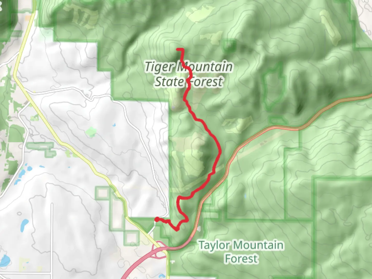
Starting your adventure near King County, Washington, the Tiger Middle Summit via Tiger Mountain Trail offers a rewarding 16 km (10 miles) out-and-back hike with an elevation gain of approximately 700 meters (2,300 feet). This trail is rated as medium difficulty, making it suitable for moderately experienced hikers.### Getting There To reach the trailhead, you can drive or use public transportation. If driving, head towards the Issaquah Alps and park at the High Point Trailhead, located near the intersection of SE 79th Street and High Point Way. For those using public transport, take a bus to Issaquah Transit Center and then a short taxi or rideshare to the trailhead.### Trail Overview The trail begins with a gentle ascent through lush, dense forest, characterized by towering Douglas firs and western hemlocks. The first 3 km (1.9 miles) are relatively easy, with a gradual elevation gain of about 150 meters (500 feet). This section is perfect for warming up your legs and getting accustomed to the terrain.### Significant Landmarks and Nature Around the 4 km (2.5 miles) mark, you'll encounter a small, picturesque waterfall. This is a great spot to take a short break and enjoy the soothing sounds of cascading water. Continuing on, the trail becomes steeper, gaining another 200 meters (650 feet) over the next 2 km (1.2 miles). Keep an eye out for wildlife such as black-tailed deer and various bird species, including the Pacific wren and Steller's jay.### Historical Significance As you hike, you'll be traversing land that has historical significance. The area was once heavily logged in the early 20th century, and remnants of old logging equipment can still be seen along the trail. This region was also a significant area for the local Native American tribes, who used the trails for hunting and gathering.### Reaching the Summit The final push to the summit is the most challenging part of the hike, with a steep ascent of about 350 meters (1,150 feet) over the last 3 km (1.9 miles). The trail narrows and becomes rockier, requiring careful footing. Upon reaching the Tiger Middle Summit, you'll be rewarded with panoramic views of the surrounding Cascade Range and, on clear days, even a glimpse of Mount Rainier.### Navigation and Safety For navigation, it's highly recommended to use the HiiKER app, which provides detailed maps and real-time GPS tracking. The trail is well-marked, but having a reliable navigation tool ensures you stay on the right path. Always carry enough water, snacks, and a first-aid kit. Weather can change rapidly, so bring layers and be prepared for rain.### Return Journey The descent follows the same path back to the trailhead. While descending, take your time to enjoy the scenery you might have missed on the way up. The total round trip is approximately 16 km (10 miles), making for a fulfilling day hike.This trail offers a mix of natural beauty, historical context, and a moderate challenge, making it a must-visit for hikers in the King County area.

What to expect?
Activity types
Comments and Reviews
User comments, reviews and discussions about the Tiger Middle Summit via Tiger Mountain Trail, Washington.
4.67
average rating out of 5
15 rating(s)