Shy Bear Trail, Wilderness Cliffs Trail and Whittaker Wilderness Peak Trail
Download
Preview
Add to list
More
9.7 km
~2 hrs 43 min
472 m
Loop
“Explore a scenic 10-kilometer loop through lush forests and viewpoints, blending nature, wildlife, and history.”
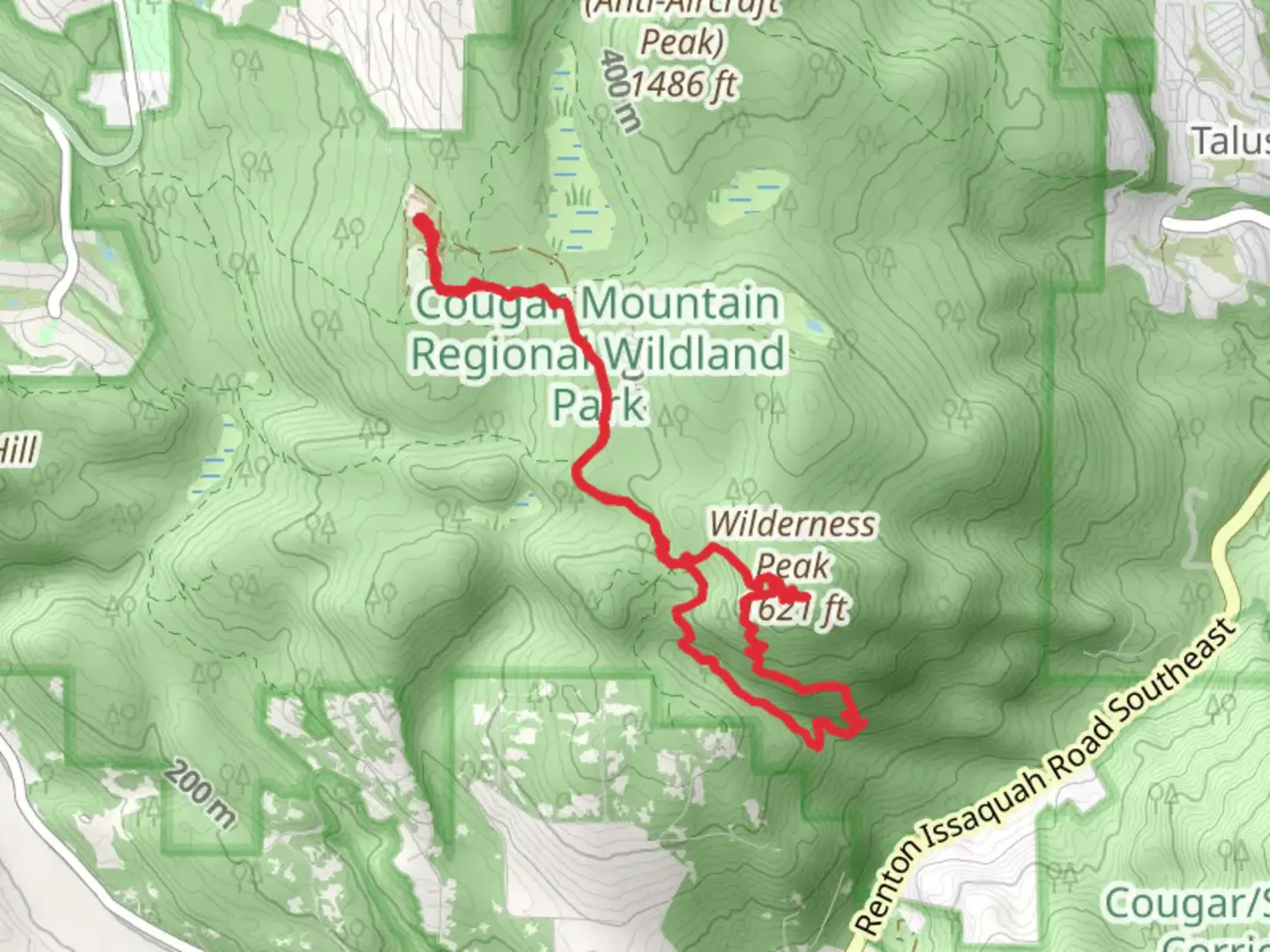
Starting your adventure near King County, Washington, this loop trail combines the Shy Bear Trail, Wilderness Cliffs Trail, and Whittaker Wilderness Peak Trail, covering approximately 10 kilometers (6.2 miles) with an elevation gain of around 400 meters (1,312 feet). This medium-difficulty hike offers a diverse experience through lush forests, scenic viewpoints, and notable landmarks.### Getting There To reach the trailhead, you can drive or use public transportation. If driving, head towards the Cougar Mountain Regional Wildland Park, with the nearest significant landmark being the Red Town Trailhead. For those using public transport, take a bus to the Issaquah Transit Center and then a short taxi or rideshare to the trailhead.### Trail Overview The loop begins at the Red Town Trailhead, where you can find ample parking and restroom facilities. From here, follow the signs for the Shy Bear Trail. This initial section is relatively gentle, winding through dense forests of Douglas fir and western red cedar. Keep an eye out for the occasional deer or black bear, especially in the early morning or late afternoon.### Shy Bear Trail Approximately 2 kilometers (1.2 miles) into the hike, you'll encounter the Shy Bear Marsh. This wetland area is a haven for birdwatchers, with species such as woodpeckers, owls, and various songbirds frequently spotted. The trail here is well-maintained but can be muddy after rain, so waterproof boots are advisable.### Wilderness Cliffs Trail Continuing onto the Wilderness Cliffs Trail, the path becomes steeper, gaining about 200 meters (656 feet) in elevation over the next 3 kilometers (1.9 miles). This section offers stunning views of the surrounding valleys and, on clear days, the distant peaks of the Cascade Range. The trail is rocky in places, so watch your footing and consider using trekking poles for added stability.### Whittaker Wilderness Peak Trail As you transition to the Whittaker Wilderness Peak Trail, you'll reach the highest point of the hike at Wilderness Peak, approximately 5 kilometers (3.1 miles) from the start. The summit provides a perfect spot for a break, with panoramic views and a few benches to rest on. This area is named after Jim Whittaker, the first American to summit Mount Everest, adding a touch of historical significance to your journey.### Descending Back The descent begins gently, with the trail winding through more forested areas. About 7 kilometers (4.3 miles) in, you'll pass by the De Leo Wall, a notable rock formation popular with local climbers. The final stretch of the trail loops back towards the Red Town Trailhead, completing your 10-kilometer (6.2-mile) adventure.### Navigation and Safety For navigation, the HiiKER app is highly recommended, offering detailed maps and real-time GPS tracking to ensure you stay on course. Always carry sufficient water, snacks, and a first aid kit. Weather can change rapidly, so layers and rain gear are essential.This loop trail offers a rich blend of natural beauty, wildlife, and historical context, making it a rewarding experience for hikers of all levels.

What to expect?
Activity types
Comments and Reviews
User comments, reviews and discussions about the Shy Bear Trail, Wilderness Cliffs Trail and Whittaker Wilderness Peak Trail, Washington.
4.43
average rating out of 5
14 rating(s)